TopoQuest Logo
Do you find TopoQuest useful?
Help keep TopoQuest running and adding new maps/features by donating!
Bitcoin:  19c7KJd3qBynnjoSw5npx9KScwjBe4ifkT
Litecoin:  LXs6TkuXGGXo1vDsWCkWVdjQX94eUKd6ui
Home View Maps Find Maps Find Places Resources & Links


Fritz Canyon, Arizona Topographic Map

USGS Map Title: Fritz Canyon, AZ
USGS Map MRC: 33109C2
DRG (GeoTIFF) Download: o33109c2.tif


Neighboring USGS Topographic Map Quads:


  Rose Peak, AZ  
33109D3
 

  Dutch Blue Creek, AZ  
33109D2
 

  Alma Mesa, AZ  
33109D1
 

  Pipestem Mountain, AZ  
33109C3
 

  Fritz Canyon, AZ  
33109C2
 

  Maple Peak, AZ  
33109C1
 

  Mitchell Peak, AZ  
33109B3
 

  Dix Creek, AZ  
33109B2
 

  Harden Cienega, NM  
33109B1


Map MRC Location:

N34°
W110°
N34°
W109°
H8 H7 H6 H5 H4 H3 H2 H1
G8 G7 G6 G5 G4 G3 G2 G1
F8 F7 F6 F5 F4 F3 F2 F1
E8 E7 E6 E5 E4 E3 E2 E1
D8 D7 D6 D5 D4 D3 D2 D1
C8 C7 C6 C5 C4 C3 C2 C1
B8 B7 B6 B5 B4 B3 B2 B1
A8 A7 A6 A5 A4 A3 A2 A1
N33°
W110°
N33°
W109°

Fritz Canyon, AZ USGS 1:24K Topographic Map Preview:
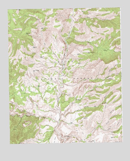
Fritz Canyon, AZ USGS Topographic Map
Click on map above to begin viewing in our Map Viewer.

This topographic map contains these locations and features:
Feature Name Type Latitude Longitude GNIS ID View Map
Alder CorralLocaleN33.3564°W109.2115°1853551View Map
Alder CreekStreamN33.3231°W109.1915°25570View Map
Alder SpringSpringN33.3570°W109.2106°25579View Map
Asma CorralLocaleN33.3603°W109.1623°42277View Map
Baseline CorralLocaleN33.3662°W109.1792°1853742View Map
Bear CreekStreamN33.2773°W109.2265°26079View Map
Big Horn SpringSpringN33.2784°W109.1822°42249View Map
Big Saddle TankReservoirN33.2576°W109.1660°42253View Map
Black Coffee SpringSpringN33.3138°W109.1277°42273View Map
Black Jack TankReservoirN33.2915°W109.1709°42178View Map
Buckhorn Canyon TankReservoirN33.3216°W109.1932°42234View Map
Buckhorn TankReservoirN33.3393°W109.2225°26923View Map
Burns SpringSpringN33.3741°W109.2142°42187View Map
Cienega Corral CabinLocaleN33.2651°W109.1517°42252View Map
Cienega CreekStreamN33.2531°W109.1884°27633View Map
Cienega Creek Number Two CorralLocaleN33.2659°W109.1501°42261View Map
Cienega SpringSpringN33.2677°W109.1499°42258View Map
Clear CreekStreamN33.2776°W109.1940°27698View Map
Clear Creek Ridge TankReservoirN33.3175°W109.2229°27702View Map
Cow SpringSpringN33.3087°W109.1531°42180View Map
Divide SpringSpringN33.2722°W109.1385°42268View Map
Dry Lake TankReservoirN33.3681°W109.2340°39971View Map
Dry Prong CanyonValleyN33.2648°W109.1495°28643View Map
Dry Prong SeepSpringN33.2618°W109.1400°42260View Map
Fish SpringSpringN33.3075°W109.1387°42264View Map
Fritz CanyonValleyN33.3053°W109.1912°29210View Map
Fritz RanchLocaleN33.3226°W109.1898°29211View Map
Fritz SpringSpringN33.2882°W109.1847°42248View Map
Garage TankReservoirN33.3056°W109.2054°29249View Map
Harry CanyonValleyN33.3092°W109.1540°42245View Map
Harry CanyonValleyN33.2920°W109.1845°42246View Map
Head of Wild Bunch SpringSpringN33.3044°W109.1398°42265View Map
Hobo Number Four TanksReservoirN33.3744°W109.1418°42274View Map
Hobo SpringSpringN33.3740°W109.1603°42188View Map
Holding Cienega SpringSpringN33.2554°W109.1838°30055View Map
Horse CanyonValleyN33.3492°W109.1823°30133View Map
Horse Canyon CabinLocaleN33.3381°W109.1509°42279View Map
Horse Canyon CorralLocaleN33.3387°W109.1512°42278View Map
Horse Canyon Ridge SpringSpringN33.3272°W109.1392°42270View Map
Horse Canyon Ridge TankReservoirN33.3335°W109.1622°30136View Map
Jeep TankReservoirN33.2820°W109.1760°42250View Map
Joe Fritz CorralLocaleN33.2909°W109.1823°42179View Map
Joe Fritz Pasture TankReservoirN33.2923°W109.1828°40007View Map
Joe Fritz TankReservoirN33.2856°W109.1904°42247View Map
Juan Miller CreekStreamN33.2678°W109.1451°30629View Map
Jump Up TankReservoirN33.3322°W109.1739°30643View Map
Lemonade SpringSpringN33.3082°W109.1393°30944View Map
Little Blue CreekStreamN33.3745°W109.1770°31035View Map
Lower Clear Creek CorralLocaleN33.3014°W109.2381°42191View Map
Lower TankReservoirN33.3073°W109.1440°42244View Map
Lower Wild Bunch CorralLocaleN33.3001°W109.1567°42175View Map
Manning CorralLocaleN33.3081°W109.1884°42238View Map
Manning TankReservoirN33.3237°W109.1731°31485View Map
Maple CanyonValleyN33.3628°W109.1765°31496View Map
Maple Number One TankReservoirN33.3700°W109.1382°42275View Map
Maple SpringSpringN33.3634°W109.1629°42276View Map
Mud SpringSpringN33.2831°W109.1538°32101View Map
Mud Springs CanyonValleyN33.2742°W109.1937°32133View Map
Mud Springs CorralLocaleN33.2837°W109.1537°42240View Map
No TankReservoirN33.2537°W109.2181°40045View Map
Number One TankReservoirN33.2552°W109.2138°42255View Map
Onery SpringSpringN33.2697°W109.1885°42257View Map
Open CanyonValleyN33.3364°W109.1426°41542View Map
Pasture Wells CorralLocaleN33.2673°W109.2092°42256View Map
Pat MesaSummitN33.2523°W109.1940°32718View Map
Pat MountainSummitN33.2503°W109.2409°32719View Map
Pigeon CreekStreamN33.2687°W109.1956°32893View Map
Pinon Mountain CorralLocaleN33.3553°W109.2365°42186View Map
Piņon Mountain TankReservoirN33.3519°W109.2302°33003View Map
Pocket SpringSpringN33.2942°W109.1504°42177View Map
Porky CanyonValleyN33.3384°W109.1492°41543View Map
Pungent SpringSpringN33.2628°W109.2428°42289View Map
Rattlesnake SpringSpringN33.3299°W109.2151°33404View Map
Roan Cow CanyonValleyN33.2715°W109.1392°33668View Map
Roan Cow TankReservoirN33.2831°W109.1300°42267View Map
Rock Tank CanyonValleyN33.3117°W109.1398°33748View Map
Rock Tank SpringSpringN33.3090°W109.1429°42263View Map
Sandrock CorralLocaleN33.3034°W109.2006°42239View Map
Sen Canyon TankReservoirN33.2937°W109.1264°42266View Map
Sour SpringSpringN33.2680°W109.2402°42189View Map
Spring CanyonValleyN33.2653°W109.1506°34723View Map
Stacy RanchLocaleN33.2684°W109.1820°34789View Map
Suicide CanyonValleyN33.2606°W109.1412°34925View Map
Suicide SpringSpringN33.2620°W109.1471°42262View Map
Suicide TankReservoirN33.2639°W109.1272°42448View Map
Sunflower SaddleGapN33.2542°W109.1384°34958View Map
Sunflower Saddle TankReservoirN33.2535°W109.1378°42259View Map
Sweet SpringSpringN33.2755°W109.2453°42190View Map
Tea Bag Springs Number OneSpringN33.3194°W109.1337°42271View Map
Tea Bag Springs Number ThreeSpringN33.3162°W109.1381°42272View Map
Tea Bag Springs Number TwoSpringN33.3181°W109.1365°44781View Map
The SpringSpringN33.2548°W109.1885°42254View Map
Upper Cienega CorralLocaleN33.2812°W109.1434°42241View Map
Upper Cienega SpringSpringN33.2863°W109.1417°35678View Map
Upper Mud SpringSpringN33.2898°W109.1447°42242View Map
Upper Salt Ground TankReservoirN33.2514°W109.1563°35709View Map
Upper SpringSpringN33.3117°W109.1400°42237View Map
White Basin TankReservoirN33.2661°W109.1683°40133View Map
White Bluff TankReservoirN33.2728°W109.1679°36063View Map
White Saddle TankReservoirN33.2927°W109.1759°42251View Map
Wild Bear SpringSpringN33.3352°W109.1359°42269View Map
Wild Bunch CanyonValleyN33.2762°W109.1903°36155View Map
Wild Bunch CorralLocaleN33.3017°W109.1545°42176View Map
Wild Bunch SpringSpringN33.3023°W109.1510°42243View Map
Wild Bunch TankReservoirN33.2900°W109.1725°36156View Map
Winter Camp TankReservoirN33.3552°W109.2360°40136View Map
Yellowstone TankReservoirN33.3031°W109.2182°36475View Map

Note: Coordinates in the location and feature list above are referenced to NAD83 datum.


Copyright (C) 2008-2024 Ryan Niemi / Sunset Dynamics ... All Rights Reserved