TopoQuest Logo
Do you find TopoQuest useful?
Help keep TopoQuest running and adding new maps/features by donating!
Bitcoin:  19c7KJd3qBynnjoSw5npx9KScwjBe4ifkT
Litecoin:  LXs6TkuXGGXo1vDsWCkWVdjQX94eUKd6ui
Home View Maps Find Maps Find Places Resources & Links


Fruita, Colorado Topographic Map

USGS Map Title: Fruita, CO
USGS Map MRC: 39108B6
DRG (GeoTIFF) Download: o39108b6.tif


Neighboring USGS Topographic Map Quads:


  Highline Lake, CO  
39108C7
 

  Ruby Lee Reservoir, CO  
39108C6
 

  Corcoran Peak, CO  
39108C5
 

  Mack, CO  
39108B7
 

  Fruita, CO  
39108B6
 

  Corcoran Point, CO  
39108B5
 

  Battleship Rock, CO  
39108A7
 

  Colorado National Monument, CO  
39108A6
 

  Grand Junction, CO  
39108A5


Map MRC Location:

N40°
W109°
N40°
W108°
H8 H7 H6 H5 H4 H3 H2 H1
G8 G7 G6 G5 G4 G3 G2 G1
F8 F7 F6 F5 F4 F3 F2 F1
E8 E7 E6 E5 E4 E3 E2 E1
D8 D7 D6 D5 D4 D3 D2 D1
C8 C7 C6 C5 C4 C3 C2 C1
B8 B7 B6 B5 B4 B3 B2 B1
A8 A7 A6 A5 A4 A3 A2 A1
N39°
W109°
N39°
W108°

Fruita, CO USGS 1:24K Topographic Map Preview:
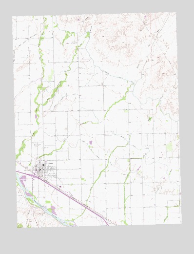
Fruita, CO USGS Topographic Map
Click on map above to begin viewing in our Map Viewer.

This topographic map contains these locations and features:
Feature Name Type Latitude Longitude GNIS ID View Map
Adobe CreekStreamN39.1283°W108.7082°174300View Map
Allen PitMineN39.1564°W108.7179°1684051View Map
City of FruitaCivilN39.1539°W108.7284°2410553View Map
Colorado State Patrol Troop 4A FruitaBuildingN39.1513°W108.7399°2757328View Map
East Branch Big Salt WashStreamN39.1964°W108.7332°174290View Map
Elmwood CemeteryCemeteryN39.1739°W108.7345°174393View Map
Enterprise Community CenterLocaleN39.2186°W108.7018°174394View Map
Family Health West HospitalHospitalN39.1637°W108.7366°2695612View Map
FruitaPopulated PlaceN39.1589°W108.7290°204660View Map
Fruita Number Two MineMineN39.1619°W108.7320°1684053View Map
Fruita Police DepartmentBuildingN39.1573°W108.7339°2757283View Map
Fruita Post OfficePost OfficeN39.1592°W108.7344°2750896View Map
Fruita Ready Mix PitMineN39.1564°W108.7179°1684052View Map
Independent Ranchmens DitchCanalN39.1297°W108.6784°202237View Map
Kodels CanyonValleyN39.1383°W108.7366°174387View Map
KSTR-AM (Grand Junction)TowerN39.1264°W108.6376°204020View Map
Little Salt WashStreamN39.1547°W108.7484°174282View Map
Lower Valley Fire Protection District Station 1BuildingN39.1604°W108.7332°2666835View Map
Main Line Grand Valley CanalCanalN39.1416°W108.6304°202239View Map
RhonePopulated PlaceN39.1266°W108.6784°202238View Map
Sacred Heart CemeteryCemeteryN39.1721°W108.7296°174392View Map
Star Community CenterLocaleN39.1783°W108.6826°174391View Map

Note: Coordinates in the location and feature list above are referenced to NAD83 datum.


Copyright (C) 2008-2024 Ryan Niemi / Sunset Dynamics ... All Rights Reserved