TopoQuest Logo
Do you find TopoQuest useful?
Help keep TopoQuest running and adding new maps/features by donating!
Bitcoin:  19c7KJd3qBynnjoSw5npx9KScwjBe4ifkT
Litecoin:  LXs6TkuXGGXo1vDsWCkWVdjQX94eUKd6ui
Home View Maps Find Maps Find Places Resources & Links


Fruita, Utah Topographic Map

USGS Map Title: Fruita, UT
USGS Map MRC: 38111C2
DRG (GeoTIFF) Download: o38111c2.tif


Neighboring USGS Topographic Map Quads:


  Cathedral Mountain, UT  
38111D3
 

  Fruita NW, UT  
38111D2
 

  Caine Springs, UT  
38111D1
 

  Twin Rocks, UT  
38111C3
 

  Fruita, UT  
38111C2
 

  Caineville, UT  
38111C1
 

  Grover, UT  
38111B3
 

  Golden Throne, UT  
38111B2
 

  Notom, UT  
38111B1


Map MRC Location:

N39°
W112°
N39°
W111°
H8 H7 H6 H5 H4 H3 H2 H1
G8 G7 G6 G5 G4 G3 G2 G1
F8 F7 F6 F5 F4 F3 F2 F1
E8 E7 E6 E5 E4 E3 E2 E1
D8 D7 D6 D5 D4 D3 D2 D1
C8 C7 C6 C5 C4 C3 C2 C1
B8 B7 B6 B5 B4 B3 B2 B1
A8 A7 A6 A5 A4 A3 A2 A1
N38°
W112°
N38°
W111°

Fruita, UT USGS 1:24K Topographic Map Preview:
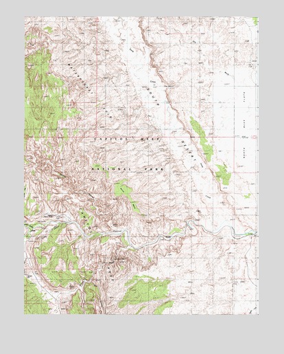
Fruita, UT USGS Topographic Map
Click on map above to begin viewing in our Map Viewer.

This topographic map contains these locations and features:
Feature Name Type Latitude Longitude GNIS ID View Map
Aldrich CemeteryCemeteryN38.2877°W111.1416°2769412View Map
Bear CanyonValleyN38.2639°W111.2147°1438451View Map
Capitol ReefRidgeN38.3158°W111.2363°1439474View Map
Cassidys ArchArchN38.2619°W111.2254°1435259View Map
Cohab CanyonValleyN38.2886°W111.2306°1426785View Map
Cuts CanyonValleyN38.2745°W111.2494°1441535View Map
Danish HillSummitN38.2660°W111.2486°1427207View Map
Deep CreekStreamN38.2864°W111.1446°1440353View Map
Dry WashStreamN38.3686°W111.1674°1427590View Map
FruitaPopulated PlaceN38.2855°W111.2468°1441249View Map
Fruita CampgroundLocaleN38.2828°W111.2485°1435560View Map
Grand WashValleyN38.2789°W111.1949°1441404View Map
Hickman Natural BridgeArchN38.2914°W111.2346°1454441View Map
Horse MesaSummitN38.3048°W111.2015°1428852View Map
Longleaf FlatFlatN38.2975°W111.2482°1442941View Map
Nels Johnson BridgeArchN38.2906°W111.2314°2729591View Map
Notch WaterSpringN38.3439°W111.1752°1430885View Map
School House Historical SiteLocaleN38.2858°W111.2460°1436328View Map
Spring CanyonValleyN38.2854°W111.1971°1455976View Map
Sulphur CreekStreamN38.2864°W111.2452°1446222View Map
The NarrowsGapN38.2733°W111.2013°1433377View Map
The NotchGapN38.3458°W111.1735°1433388View Map

Note: Coordinates in the location and feature list above are referenced to NAD83 datum.


Copyright (C) 2008-2025 Ryan Niemi / Sunset Dynamics ... All Rights Reserved