TopoQuest Logo
Do you find TopoQuest useful?
Help keep TopoQuest running and adding new maps/features by donating!
Bitcoin:  19c7KJd3qBynnjoSw5npx9KScwjBe4ifkT
Litecoin:  LXs6TkuXGGXo1vDsWCkWVdjQX94eUKd6ui
Home View Maps Find Maps Find Places Resources & Links


Fulford, Colorado Topographic Map

USGS Map Title: Fulford, CO
USGS Map MRC: 39106E6
DRG (GeoTIFF) Download: o39106e6.tif


Neighboring USGS Topographic Map Quads:


  Eagle, CO  
39106F7
 

  Wolcott, CO  
39106F6
 

  Edwards, CO  
39106F5
 

  The Seven Hermits, CO  
39106E7
 

  Fulford, CO  
39106E6
 

  Grouse Mountain, CO  
39106E5
 

  Red Creek, CO  
39106D7
 

  Crooked Creek Pass, CO  
39106D6
 

  Mount Jackson, CO  
39106D5


Map MRC Location:

N40°
W107°
N40°
W106°
H8 H7 H6 H5 H4 H3 H2 H1
G8 G7 G6 G5 G4 G3 G2 G1
F8 F7 F6 F5 F4 F3 F2 F1
E8 E7 E6 E5 E4 E3 E2 E1
D8 D7 D6 D5 D4 D3 D2 D1
C8 C7 C6 C5 C4 C3 C2 C1
B8 B7 B6 B5 B4 B3 B2 B1
A8 A7 A6 A5 A4 A3 A2 A1
N39°
W107°
N39°
W106°

Fulford, CO USGS 1:24K Topographic Map Preview:
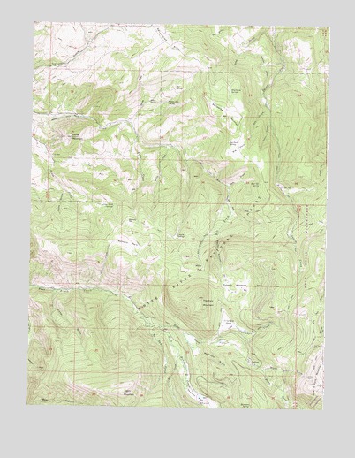
Fulford, CO USGS Topographic Map
Click on map above to begin viewing in our Map Viewer.

This topographic map contains these locations and features:
Feature Name Type Latitude Longitude GNIS ID View Map
Adam MountainSummitN39.5047°W106.7092°176032View Map
At Last MineMineN39.5058°W106.6406°1684185View Map
Bear Cat SpringSpringN39.5732°W106.6535°176045View Map
Bellyache MountainSummitN39.5908°W106.6648°176064View Map
Bemis DitchCanalN39.5922°W106.7423°202351View Map
Big ParkFlatN39.5853°W106.6639°176062View Map
Big Park SpringSpringN39.5865°W106.6667°176059View Map
Box SpringSpringN39.6045°W106.6897°176072View Map
Bumpity ParkFlatN39.5608°W106.7067°176048View Map
Devils CanyonValleyN39.5567°W106.6709°176066View Map
Dry GulchValleyN39.5985°W106.6511°176069View Map
Dubach MeadowsFlatN39.5403°W106.6631°176038View Map
Elbow ParkFlatN39.5658°W106.6661°176047View Map
Elk ParkFlatN39.5714°W106.6398°176046View Map
Fisher GulchValleyN39.5375°W106.7385°176031View Map
FulfordPopulated PlaceN39.5150°W106.6564°176042View Map
Fulford Census Designated PlaceCensusN39.5166°W106.6575°2583237View Map
Graham DitchCanalN39.6097°W106.6506°176074View Map
Granite SpringsSpringN39.5563°W106.6881°176050View Map
Graveyard FlatsFlatN39.5217°W106.6681°176036View Map
Happy Jack SpringSpringN39.5995°W106.6929°176060View Map
Hat CreekStreamN39.5178°W106.6867°176078View Map
Horse MountainSummitN39.5878°W106.7334°176058View Map
Jacks GulchValleyN39.5721°W106.7372°176056View Map
Johnson MineMineN39.5105°W106.6317°176040View Map
Kelly CreekStreamN39.5853°W106.6942°176054View Map
Lady Belle MineMineN39.5819°W106.7411°176057View Map
Lake Creek TrailTrailN39.5611°W106.6298°202355View Map
Lettuce Patch SpringsSpringN39.5655°W106.7149°176055View Map
McGinley GulchValleyN39.5176°W106.6777°176043View Map
Metheny ParkFlatN39.5533°W106.7081°176051View Map
New York Mountain TrailTrailN39.5333°W106.6273°202354View Map
Newcomer SpringSpringN39.5011°W106.6560°176041View Map
No Name CreekStreamN39.5272°W106.6992°176077View Map
Nolan CreekStreamN39.5264°W106.6942°176076View Map
North Dakota MineMineN39.5811°W106.7298°1684187View Map
Pipe CreekStreamN39.5380°W106.7228°176052View Map
Poison GulchValleyN39.5928°W106.6496°176068View Map
Polar Star MineMineN39.5208°W106.6300°176039View Map
Porphyry MountainSummitN39.5358°W106.6786°176033View Map
Red GulchValleyN39.5723°W106.6673°176044View Map
Salt CreekStreamN39.6125°W106.6375°176024View Map
Salt Creek TrailTrailN39.5667°W106.6686°176067View Map
Stag Gulch SpringSpringN39.6035°W106.6667°176063View Map
Taylor CreekStreamN39.5880°W106.7056°176053View Map
Triangle CreekStreamN39.5211°W106.6789°176037View Map
Triangle ParkFlatN39.5275°W106.6670°176034View Map
Triangle ReservoirReservoirN39.5255°W106.6675°176035View Map
White DrawValleyN39.5938°W106.7074°176073View Map
White Quail GulchValleyN39.5123°W106.6508°176065View Map
White SpringSpringN39.5997°W106.7034°176061View Map
Whittaker PointSummitN39.5692°W106.7186°2512539View Map
Willow ParkFlatN39.5455°W106.6784°176049View Map
Yeoman ParkFlatN39.5028°W106.6756°202356View Map
Yeoman Park CampgroundLocaleN39.5017°W106.6770°197227View Map

Note: Coordinates in the location and feature list above are referenced to NAD83 datum.


Copyright (C) 2008-2024 Ryan Niemi / Sunset Dynamics ... All Rights Reserved