TopoQuest Logo
Do you find TopoQuest useful?
Help keep TopoQuest running and adding new maps/features by donating!
Bitcoin:  19c7KJd3qBynnjoSw5npx9KScwjBe4ifkT
Litecoin:  LXs6TkuXGGXo1vDsWCkWVdjQX94eUKd6ui
Home View Maps Find Maps Find Places Resources & Links


Ashland, Kansas Topographic Map

USGS Map Title: Ashland, KS
USGS Map MRC: 37099B7
DRG (GeoTIFF) Download: o37099b7.tif


Neighboring USGS Topographic Map Quads:


  Bloom SW, KS  
37099C8
 

  Bloom SE, KS  
37099C7
 

  Mount Jesus, KS  
37099C6
 

  Ashland NW, KS  
37099B8
 

  Ashland, KS  
37099B7
 

  Sitka, KS  
37099B6
 

  Englewood, KS  
37099A8
 

  Ashland SE, KS  
37099A7
 

  Sitka SW, KS  
37099A6


Map MRC Location:

N38°
W100°
N38°
W99°
H8 H7 H6 H5 H4 H3 H2 H1
G8 G7 G6 G5 G4 G3 G2 G1
F8 F7 F6 F5 F4 F3 F2 F1
E8 E7 E6 E5 E4 E3 E2 E1
D8 D7 D6 D5 D4 D3 D2 D1
C8 C7 C6 C5 C4 C3 C2 C1
B8 B7 B6 B5 B4 B3 B2 B1
A8 A7 A6 A5 A4 A3 A2 A1
N37°
W100°
N37°
W99°

Ashland, KS USGS 1:24K Topographic Map Preview:
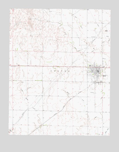
Ashland, KS USGS Topographic Map
Click on map above to begin viewing in our Map Viewer.

This topographic map contains these locations and features:
Feature Name Type Latitude Longitude GNIS ID View Map
AshlandPopulated PlaceN37.1886°W99.7657°470769View Map
Ashland City HallBuildingN37.1894°W99.7660°2693314View Map
Ashland Community CenterBuildingN37.1883°W99.7654°2692967View Map
Ashland Country ClubLocaleN37.1979°W99.7734°485381View Map
Ashland Elementary SchoolSchoolN37.1899°W99.7676°2427191View Map
Ashland Health CenterHospitalN37.1891°W99.7726°2499081View Map
Ashland Junior High SchoolSchoolN37.1937°W99.7754°2427227View Map
Ashland Junior Senior High SchoolSchoolN37.1942°W99.7754°481115View Map
Ashland LibraryBuildingN37.1904°W99.7654°2694686View Map
Ashland Municipal Power PlantLocaleN37.1943°W99.7630°2692465View Map
Ashland Oil FieldOilfieldN37.2106°W99.7851°470766View Map
Ashland Post OfficePost OfficeN37.1890°W99.7655°2693611View Map
Ashland Rural Fire DepartmentBuildingN37.1894°W99.7662°2111108View Map
Ashland United Methodist ChurchChurchN37.1933°W99.7654°2689347View Map
Ashland Wastewater Treatment FacilityLocaleN37.1740°W99.7549°2691916View Map
Casino CreekStreamN37.2072°W99.7623°470772View Map
City of AshlandCivilN37.1868°W99.7697°2393999View Map
Clark CountyCivilN37.2355°W99.8203°484982View Map
Clark County CourthouseBuildingN37.1869°W99.7676°2625106View Map
Clark County FairgroundsLocaleN37.1866°W99.7764°479829View Map
Clark County Health DepartmentBuildingN37.1869°W99.7676°2694992View Map
Clark County JailBuildingN37.1872°W99.7682°2504295View Map
Clark County Sheriff's OfficeBuildingN37.1872°W99.7680°2503981View Map
East Branch Bear CreekStreamN37.1884°W99.7601°470768View Map
Farmers Co - Operative Grain Elevator Number 2LocaleN37.1774°W99.7661°2695316View Map
First Baptist ChurchChurchN37.1898°W99.7662°2688950View Map
First Christian ChurchChurchN37.1913°W99.7677°2688984View Map
First Church of GodChurchN37.1923°W99.7681°2689592View Map
First Presbyterian ChurchChurchN37.1909°W99.7681°2689012View Map
Harold Krier FieldAirportN37.1669°W99.7711°470770View Map
Lighthouse Assembly of God ChurchChurchN37.1862°W99.7654°2689103View Map
Mount CasinoSummitN37.2292°W99.7582°470765View Map
Pioneer - Krier MuseumBuildingN37.1931°W99.7707°2694245View Map
Redhole CreekStreamN37.1370°W99.7710°470771View Map
Saint Joseph's Catholic ChurchChurchN37.1910°W99.7641°2689186View Map
Township of CenterCivilN37.1478°W99.8155°470813View Map
West Branch Bear CreekStreamN37.1884°W99.7601°470767View Map

Note: Coordinates in the location and feature list above are referenced to NAD83 datum.


Copyright (C) 2008-2024 Ryan Niemi / Sunset Dynamics ... All Rights Reserved