TopoQuest Logo
Do you find TopoQuest useful?
Help keep TopoQuest running and adding new maps/features by donating!
Bitcoin:  19c7KJd3qBynnjoSw5npx9KScwjBe4ifkT
Litecoin:  LXs6TkuXGGXo1vDsWCkWVdjQX94eUKd6ui
Home View Maps Find Maps Find Places Resources & Links


Furnace Creek, California Topographic Map

USGS Map Title: Furnace Creek, CA
USGS Map MRC: 36116D7
DRG (GeoTIFF) Download: o36116d7.tif


Neighboring USGS Topographic Map Quads:


  Beatty Junction, CA  
36116E8
 

  Nevares Peak, CA  
36116E7
 

  Lees Camp, CA  
36116E6
 

  West of Furnace Creek, CA  
36116D8
 

  Furnace Creek, CA  
36116D7
 

  Echo Canyon, CA  
36116D6
 

  Devils Speedway, CA  
36116C8
 

  Devils Golf Course, CA  
36116C7
 

  Ryan, CA  
36116C6


Map MRC Location:

N37°
W117°
N37°
W116°
H8 H7 H6 H5 H4 H3 H2 H1
G8 G7 G6 G5 G4 G3 G2 G1
F8 F7 F6 F5 F4 F3 F2 F1
E8 E7 E6 E5 E4 E3 E2 E1
D8 D7 D6 D5 D4 D3 D2 D1
C8 C7 C6 C5 C4 C3 C2 C1
B8 B7 B6 B5 B4 B3 B2 B1
A8 A7 A6 A5 A4 A3 A2 A1
N36°
W117°
N36°
W116°

Furnace Creek, CA USGS 1:24K Topographic Map Preview:
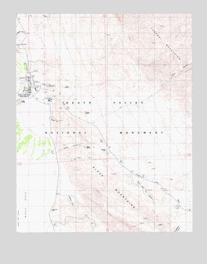
Furnace Creek, CA USGS Topographic Map
Click on map above to begin viewing in our Map Viewer.

This topographic map contains these locations and features:
Feature Name Type Latitude Longitude GNIS ID View Map
Breakfast CanyonValleyN36.4400°W116.8513°239666View Map
Corkscrew CanyonValleyN36.3783°W116.7600°240917View Map
Cow CreekStreamN36.4997°W116.8695°241027View Map
Death ValleyLocaleN36.4555°W116.8676°252190View Map
Death Valley National Park Fire and RescueBuildingN36.4563°W116.8661°2623916View Map
Death Valley National Park Visitor CenterBuildingN36.4619°W116.8667°1804723View Map
Death Valley Post OfficePost OfficeN36.4572°W116.8663°2789132View Map
Desolation CanyonValleyN36.3959°W116.8389°241445View Map
East Coleman PitMineN36.4713°W116.8462°1670635View Map
Echo CanyonValleyN36.4560°W116.7760°241817View Map
Furnace CreekPopulated PlaceN36.4580°W116.8709°1853390View Map
Furnace Creek CampgroundLocaleN36.4630°W116.8687°1667165View Map
Furnace Creek Census Designated PlaceCensusN36.4277°W116.8747°2408270View Map
Furnace Creek Golf CourseLocaleN36.4599°W116.8706°1804726View Map
Furnace Creek InnLocaleN36.4505°W116.8517°242553View Map
Furnace Creek RanchLocaleN36.4572°W116.8662°242554View Map
Furnace Creek Volunteer Fire DepartmentBuildingN36.4564°W116.8654°2623942View Map
Golden CanyonValleyN36.4214°W116.8465°242817View Map
Gower GulchValleyN36.4109°W116.8405°271380View Map
Harmony Borax WorksLocaleN36.4822°W116.8734°243231View Map
Indian VillagePopulated PlaceN36.4491°W116.8742°1656543View Map
Manly BeaconSummitN36.4236°W116.8260°1667176View Map
Mars HillSummitN36.3822°W116.8528°1667292View Map
Mushroom RockLocaleN36.3877°W116.8503°246398View Map
Salt SpringsSpringN36.4933°W116.8534°248765View Map
Sunset CampgroundLocaleN36.4611°W116.8634°1667188View Map
Texas SpringsSpringN36.4577°W116.8373°250361View Map
Texas Springs CampgroundLocaleN36.4594°W116.8523°250362View Map
Travertine SpringsSpringN36.4422°W116.8284°250603View Map
Twenty Mule Team CanyonValleyN36.4052°W116.7921°250729View Map
Zabriskie PointSummitN36.4202°W116.8122°1656663View Map

Note: Coordinates in the location and feature list above are referenced to NAD83 datum.


Copyright (C) 2008-2025 Ryan Niemi / Sunset Dynamics ... All Rights Reserved