TopoQuest Logo
Do you find TopoQuest useful?
Help keep TopoQuest running and adding new maps/features by donating!
Bitcoin:  19c7KJd3qBynnjoSw5npx9KScwjBe4ifkT
Litecoin:  LXs6TkuXGGXo1vDsWCkWVdjQX94eUKd6ui
Home View Maps Find Maps Find Places Resources & Links


Gageville, Ohio Topographic Map

USGS Map Title: Gageville, OH
USGS Map MRC: 41080G6
DRG (GeoTIFF) Download: o41080g6.tif


Neighboring USGS Topographic Map Quads:


  Ashtabula North, OH  
41080H7
 

  North Kingsville, OH  
41080H6
 

  Conneaut, OH  
41080H5
 

  Ashtabula South, OH  
41080G7
 

  Gageville, OH  
41080G6
 

  Pierpont, OH  
41080G5
 

  Jefferson, OH  
41080F7
 

  Dorset, OH  
41080F6
 

  Leon, OH  
41080F5


Map MRC Location:

N42°
W81°
N42°
W80°
H8 H7 H6 H5 H4 H3 H2 H1
G8 G7 G6 G5 G4 G3 G2 G1
F8 F7 F6 F5 F4 F3 F2 F1
E8 E7 E6 E5 E4 E3 E2 E1
D8 D7 D6 D5 D4 D3 D2 D1
C8 C7 C6 C5 C4 C3 C2 C1
B8 B7 B6 B5 B4 B3 B2 B1
A8 A7 A6 A5 A4 A3 A2 A1
N41°
W81°
N41°
W80°

Gageville, OH USGS 1:24K Topographic Map Preview:
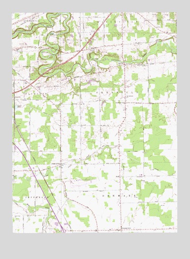
Gageville, OH USGS Topographic Map
Click on map above to begin viewing in our Map Viewer.

This topographic map contains these locations and features:
Feature Name Type Latitude Longitude GNIS ID View Map
Benetka Road BridgeBridgeN41.8487°W80.6890°1052975View Map
BulahPopulated PlaceN41.7820°W80.6684°1062413View Map
Bulah Calvary United Methodist ChurchChurchN41.7823°W80.6673°1062414View Map
Carson PondLakeN41.8215°W80.7468°1038843View Map
Coffee CreekStreamN41.8384°W80.7220°1039223View Map
Denmark CenterPopulated PlaceN41.7517°W80.6679°1062730View Map
GagevillePopulated PlaceN41.8456°W80.6656°1062775View Map
Gageville CemeteryCemeteryN41.8453°W80.6684°1731125View Map
Griggs CornersLocaleN41.7892°W80.7131°1041186View Map
Griggs Corners CemeteryCemeteryN41.7884°W80.7126°1731128View Map
Hidden Creek Dairy FarmLocaleN41.7847°W80.7122°2706736View Map
Maple View FarmLocaleN41.7897°W80.6972°2706783View Map
Northeast Ohio Regional AirportAirportN41.7800°W80.7014°1082468View Map
Olin-Dewey Road BridgeBridgeN41.8626°W80.7209°1052976View Map
Ollins CornersPopulated PlaceN41.7995°W80.6692°1065856View Map
PlymouthPopulated PlaceN41.8259°W80.7459°1062946View Map
Plymouth Pines Alpaca FarmLocaleN41.7981°W80.7289°2516127View Map
Saint Andrews Catholic ChurchChurchN41.8270°W80.6637°1062415View Map
Sheffield CenterPopulated PlaceN41.8237°W80.6642°1065312View Map
Sheffield Township Volunteer Fire DepartmentBuildingN41.8234°W80.6562°2549488View Map
Township of DenmarkCivilN41.7515°W80.6679°1085724View Map
Township of SheffieldCivilN41.8263°W80.6691°1085743View Map
Victor's LandingAirportN41.8419°W80.6438°1082771View Map

Note: Coordinates in the location and feature list above are referenced to NAD83 datum.


Copyright (C) 2008-2024 Ryan Niemi / Sunset Dynamics ... All Rights Reserved