TopoQuest Logo
Do you find TopoQuest useful?
Help keep TopoQuest running and adding new maps/features by donating!
Bitcoin:  19c7KJd3qBynnjoSw5npx9KScwjBe4ifkT
Litecoin:  LXs6TkuXGGXo1vDsWCkWVdjQX94eUKd6ui
Home View Maps Find Maps Find Places Resources & Links


Ashland NE, Montana Topographic Map

USGS Map Title: Ashland NE, MT
USGS Map MRC: 45106F3
DRG (GeoTIFF) Download: o45106f3.tif


Neighboring USGS Topographic Map Quads:


  Hammond Draw SW, MT  
45106G4
 

  Hammond Draw, MT  
45106G3
 

  Brandenberg, MT  
45106G2
 

  Garfield Peak, MT  
45106F4
 

  Ashland NE, MT  
45106F3
 

  Cook Creek Reservoir, MT  
45106F2
 

  Hollowwood Creek, MT  
45106E4
 

  Ashland, MT  
45106E3
 

  Willow Crossing, MT  
45106E2


Map MRC Location:

N46°
W107°
N46°
W106°
H8 H7 H6 H5 H4 H3 H2 H1
G8 G7 G6 G5 G4 G3 G2 G1
F8 F7 F6 F5 F4 F3 F2 F1
E8 E7 E6 E5 E4 E3 E2 E1
D8 D7 D6 D5 D4 D3 D2 D1
C8 C7 C6 C5 C4 C3 C2 C1
B8 B7 B6 B5 B4 B3 B2 B1
A8 A7 A6 A5 A4 A3 A2 A1
N45°
W107°
N45°
W106°

Ashland NE, MT USGS 1:24K Topographic Map Preview:
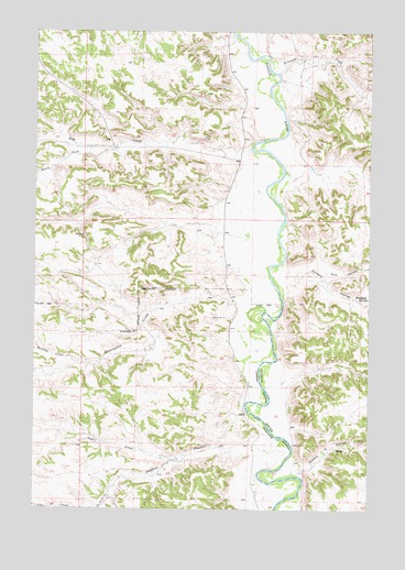
Ashland NE, MT USGS Topographic Map
Click on map above to begin viewing in our Map Viewer.

This topographic map contains these locations and features:
Feature Name Type Latitude Longitude GNIS ID View Map
01S43E25BDDA01 SpringSpringN45.7231°W106.3683°811425View Map
01S44E33ABD_01 WellWellN45.7122°W106.3017°811341View Map
02S44E04DDCB01 WellWellN45.6875°W106.2989°811129View Map
02S44E06BCBC01 SpringSpringN45.6964°W106.3570°811210View Map
02S44E12BCCA01 SpringSpringN45.6797°W106.2514°811061View Map
02S44E14CB__01 SpringSpringN45.6622°W106.2717°810915View Map
02S44E18CBBA01 WellWellN45.6636°W106.3561°810937View Map
02S44E27ADCC01 WellWellN45.6347°W106.2792°810713View Map
Bowers Ranch (historical)LocaleN45.6269°W106.2783°1716716View Map
Bringoff CreekStreamN45.7394°W106.2845°780417View Map
Burning CreekStreamN45.6644°W106.3625°780621View Map
Colbert CouleeValleyN45.6853°W106.2814°781484View Map
Double E CouleeValleyN45.6344°W106.2756°782498View Map
Lake CreekStreamN45.6392°W106.3214°785903View Map
Lay CreekStreamN45.7200°W106.2939°785997View Map
McDowell Post Office (historical)Post OfficeN45.6633°W106.2950°1716775View Map
Reservation CreekStreamN45.6767°W106.2886°789532View Map
Rice CouleeValleyN45.6864°W106.2667°789556View Map
South Brandenburg School (historical)SchoolN45.7161°W106.2978°1716739View Map
South Fork Lay CreekStreamN45.7197°W106.3483°790996View Map
Stebbins CreekStreamN45.6433°W106.2828°791474View Map
Wakefield SpringSpringN45.6801°W106.2512°792756View Map

Note: Coordinates in the location and feature list above are referenced to NAD83 datum.


Copyright (C) 2008-2025 Ryan Niemi / Sunset Dynamics ... All Rights Reserved