TopoQuest Logo
Do you find TopoQuest useful?
Help keep TopoQuest running and adding new maps/features by donating!
Bitcoin:  19c7KJd3qBynnjoSw5npx9KScwjBe4ifkT
Litecoin:  LXs6TkuXGGXo1vDsWCkWVdjQX94eUKd6ui
Home View Maps Find Maps Find Places Resources & Links


Garrison, Iowa Topographic Map

USGS Map Title: Garrison, IA
USGS Map MRC: 42092B2
DRG (GeoTIFF) Download: o42092b2.tif


Neighboring USGS Topographic Map Quads:


  Eagle Center, IA  
42092C3
 

  La Porte City, IA  
42092C2
 

  Brandon, IA  
42092C1
 

  Dysart, IA  
42092B3
 

  Garrison, IA  
42092B2
 

  Vinton, IA  
42092B1
 

  Elberon, IA  
42092A3
 

  Keystone North, IA  
42092A2
 

  Van Horne, IA  
42092A1


Map MRC Location:

N43°
W93°
N43°
W92°
H8 H7 H6 H5 H4 H3 H2 H1
G8 G7 G6 G5 G4 G3 G2 G1
F8 F7 F6 F5 F4 F3 F2 F1
E8 E7 E6 E5 E4 E3 E2 E1
D8 D7 D6 D5 D4 D3 D2 D1
C8 C7 C6 C5 C4 C3 C2 C1
B8 B7 B6 B5 B4 B3 B2 B1
A8 A7 A6 A5 A4 A3 A2 A1
N42°
W93°
N42°
W92°

Garrison, IA USGS 1:24K Topographic Map Preview:
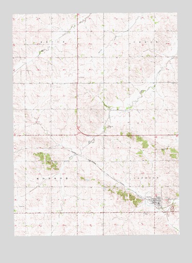
Garrison, IA USGS Topographic Map
Click on map above to begin viewing in our Map Viewer.

This topographic map contains these locations and features:
Feature Name Type Latitude Longitude GNIS ID View Map
Benton Station (historical)Populated PlaceN42.1453°W92.1446°465536View Map
Carlisle Grove CemeteryCemeteryN42.1730°W92.1388°455170View Map
City of GarrisonCivilN42.1440°W92.1432°2394860View Map
Daggett Post Office (historical)Post OfficeN42.1375°W92.1418°2000204View Map
Fairview CemeteryCemeteryN42.2139°W92.2008°456492View Map
Fellowship Brethren ChurchChurchN42.1456°W92.1471°2000294View Map
GarrisonPopulated PlaceN42.1442°W92.1438°456854View Map
Garrison (historical)LocaleN42.1431°W92.1446°2000297View Map
Garrison CemeteryCemeteryN42.1369°W92.1485°456855View Map
Garrison City HallBuildingN42.1456°W92.1391°2000292View Map
Garrison Fire DepartmentBuildingN42.1468°W92.1431°2577263View Map
Garrison First ResponseBuildingN42.1468°W92.1431°2599801View Map
Garrison LibraryBuildingN42.1444°W92.1449°2000291View Map
Garrison Post OfficePost OfficeN42.1442°W92.1455°2000293View Map
Garrison QuarryMineN42.1361°W92.1303°2571228View Map
Garrison United Methodist ChurchChurchN42.1450°W92.1435°2000296View Map
Gillespie Post Office (historical)Post OfficeN42.2111°W92.1821°2000203View Map
Gnagy CemeteryCemeteryN42.1419°W92.2419°456938View Map
Pratt Creek CemeteryCemeteryN42.2103°W92.1304°2000354View Map
Pratt Creek ChurchChurchN42.2105°W92.1299°460434View Map
Saint Mark's Lutheran ChurchChurchN42.1444°W92.1396°2000295View Map
Township of MonroeCivilN42.1671°W92.2406°468391View Map
Urmy CemeteryCemeteryN42.1714°W92.2284°462505View Map
Woods Post Office (historical)Post OfficeN42.1678°W92.2335°2000202View Map

Note: Coordinates in the location and feature list above are referenced to NAD83 datum.


Copyright (C) 2008-2024 Ryan Niemi / Sunset Dynamics ... All Rights Reserved