TopoQuest Logo
Do you find TopoQuest useful?
Help keep TopoQuest running and adding new maps/features by donating!
Bitcoin:  19c7KJd3qBynnjoSw5npx9KScwjBe4ifkT
Litecoin:  LXs6TkuXGGXo1vDsWCkWVdjQX94eUKd6ui
Home View Maps Find Maps Find Places Resources & Links


Gass Peak SW, Nevada Topographic Map

USGS Map Title: Gass Peak SW, NV
USGS Map MRC: 36115C2
DRG (GeoTIFF) Download: o36115c2.tif


Neighboring USGS Topographic Map Quads:


  Corn Creek Springs, NV  
36115D3
 

  Gass Peak, NV  
36115D2
 

  Gass Peak NE, NV  
36115D1
 

  Tule Springs Lake, NV  
36115C3
 

  Gass Peak SW, NV  
36115C2
 

  Valley, NV  
36115C1
 

  Blue Diamond NE, NV  
36115B3
 

  Las Vegas NW, NV  
36115B2
 

  Las Vegas NE, NV  
36115B1


Map MRC Location:

N37°
W116°
N37°
W115°
H8 H7 H6 H5 H4 H3 H2 H1
G8 G7 G6 G5 G4 G3 G2 G1
F8 F7 F6 F5 F4 F3 F2 F1
E8 E7 E6 E5 E4 E3 E2 E1
D8 D7 D6 D5 D4 D3 D2 D1
C8 C7 C6 C5 C4 C3 C2 C1
B8 B7 B6 B5 B4 B3 B2 B1
A8 A7 A6 A5 A4 A3 A2 A1
N36°
W116°
N36°
W115°

Gass Peak SW, NV USGS 1:24K Topographic Map Preview:
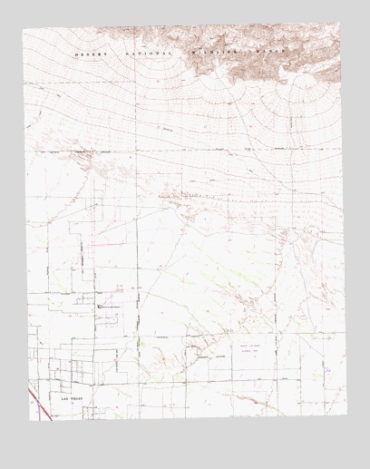
Gass Peak SW, NV USGS Topographic Map
Click on map above to begin viewing in our Map Viewer.

This topographic map contains these locations and features:
Feature Name Type Latitude Longitude GNIS ID View Map
Addeliar Guy Elementary SchoolSchoolN36.2513°W115.1952°2084190View Map
Anthony Saville Middle SchoolSchoolN36.3063°W115.2344°2085609View Map
Brian and Teri Cram Middle SchoolSchoolN36.2851°W115.1698°2086762View Map
Candil Hall Early Childhood Education CenterSchoolN36.2583°W115.2413°2087950View Map
Clifford O Findlay Middle SchoolSchoolN36.2679°W115.1455°2086763View Map
Crossroads Post OfficePost OfficeN36.2727°W115.2238°2473427View Map
Double I J RanchLocaleN36.2891°W115.2458°853578View Map
Eldorado ParkParkN36.2674°W115.1586°2473297View Map
Eldorado Village Shopping CenterLocaleN36.2611°W115.1537°2473545View Map
Ernest May Elementary SchoolSchoolN36.2551°W115.2327°857770View Map
Eva G Simmons Elementary SchoolSchoolN36.2684°W115.1747°2084973View Map
Eva Wolfe Elementary SchoolSchoolN36.2533°W115.1951°2085008View Map
Fredric W Watson Elementary SchoolSchoolN36.2662°W115.1454°2085000View Map
Gass Peak Mining DistrictCivilN36.3711°W115.1747°848422View Map
Gilcrease RanchLocaleN36.2872°W115.2408°855486View Map
Goynes ParkParkN36.2532°W115.1924°2473464View Map
Home of the Good ShepherdChurchN36.2858°W115.2228°841037View Map
Howard Heckethorn Elementary SchoolSchoolN36.3030°W115.2134°2084192View Map
Joseph M Neal Elementary SchoolSchoolN36.2718°W115.2394°2084792View Map
June Bug MineMineN36.3694°W115.1725°841439View Map
Kay Carl Elementary SchoolSchoolN36.2657°W115.2200°2083980View Map
Kinder Prep AcademySchoolN36.2648°W115.2424°2088489View Map
Lamb of God Lutheran ChurchChurchN36.2742°W115.2248°2473565View Map
Lamb of God Lutheran SchoolSchoolN36.2735°W115.2226°2088495View Map
Lee Antonello Elementary SchoolSchoolN36.2684°W115.1577°2083965View Map
Lied Middle SchoolSchoolN36.2693°W115.2151°2085592View Map
Living Gospel Baptist ChurchChurchN36.2742°W115.2471°2473574View Map
Mojave High SchoolSchoolN36.2560°W115.1378°2086468View Map
North Las Vegas Community Police FacilityBuildingN36.2537°W115.1901°2760160View Map
North Las Vegas Fire Department Station 54BuildingN36.2597°W115.1536°2472744View Map
North Las Vegas Fire Department Station 55BuildingN36.2639°W115.1895°2472745View Map
North Las Vegas Fire Department Station 56BuildingN36.2907°W115.1861°2472746View Map
North Las Vegas Regional ParkParkN36.2719°W115.1614°849401View Map
Parsons Peace Academy of Ministry and Performing ArtsSchoolN36.2623°W115.1657°2088513View Map
Regional ParkParkN36.3110°W115.2178°2473381View Map
Saint Judes School-Good ShepherdSchoolN36.2864°W115.2231°856976View Map
Seastrand Community ParkParkN36.2770°W115.1618°2473472View Map
Shadow Ridge High SchoolSchoolN36.3189°W115.2103°2086470View Map
Sonrise Community ChurchChurchN36.2594°W115.2250°2473169View Map
Steve Cozine Elementary SchoolSchoolN36.2567°W115.1769°2083984View Map
Theron H and Naomi D Goynes Elementary SchoolSchoolN36.2815°W115.1847°2084189View Map

Note: Coordinates in the location and feature list above are referenced to NAD83 datum.


Copyright (C) 2008-2025 Ryan Niemi / Sunset Dynamics ... All Rights Reserved