TopoQuest Logo
Do you find TopoQuest useful?
Help keep TopoQuest running and adding new maps/features by donating!
Bitcoin:  19c7KJd3qBynnjoSw5npx9KScwjBe4ifkT
Litecoin:  LXs6TkuXGGXo1vDsWCkWVdjQX94eUKd6ui
Home View Maps Find Maps Find Places Resources & Links


Gaston, Indiana Topographic Map

USGS Map Title: Gaston, IN
USGS Map MRC: 40085C5
DRG (GeoTIFF) Download: o40085c5.tif


Neighboring USGS Topographic Map Quads:


  Fairmount, IN  
40085D6
 

  Gas City, IN  
40085D5
 

  Hartford City West, IN  
40085D4
 

  Alexandria, IN  
40085C6
 

  Gaston, IN  
40085C5
 

  Wheeling, IN  
40085C4
 

  Anderson North, IN  
40085B6
 

  Gilman, IN  
40085B5
 

  Muncie West, IN  
40085B4


Map MRC Location:

N41°
W86°
N41°
W85°
H8 H7 H6 H5 H4 H3 H2 H1
G8 G7 G6 G5 G4 G3 G2 G1
F8 F7 F6 F5 F4 F3 F2 F1
E8 E7 E6 E5 E4 E3 E2 E1
D8 D7 D6 D5 D4 D3 D2 D1
C8 C7 C6 C5 C4 C3 C2 C1
B8 B7 B6 B5 B4 B3 B2 B1
A8 A7 A6 A5 A4 A3 A2 A1
N40°
W86°
N40°
W85°

Gaston, IN USGS 1:24K Topographic Map Preview:
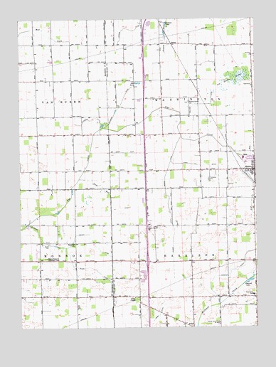
Gaston, IN USGS Topographic Map
Click on map above to begin viewing in our Map Viewer.

This topographic map contains these locations and features:
Feature Name Type Latitude Longitude GNIS ID View Map
Beech Grove ChurchChurchN40.2912°W85.5575°430729View Map
BethelPopulated PlaceN40.2500°W85.5339°430880View Map
Bethel Home Place for BoysSchoolN40.2520°W85.5200°430954View Map
Collins DitchCanalN40.3406°W85.5300°432795View Map
Emerald LakeLakeN40.2688°W85.5035°434153View Map
Epworth ChurchChurchN40.2842°W85.5966°434226View Map
GastonPopulated PlaceN40.3139°W85.5005°434988View Map
Gaston Police DepartmentBuildingN40.3145°W85.5009°2758149View Map
Gaston Volunteer Fire DepartmentBuildingN40.3143°W85.5009°2625663View Map
Jackson LakeLakeN40.3729°W85.5471°436893View Map
JanneyPopulated PlaceN40.3650°W85.5439°436939View Map
Jim LakeReservoirN40.3491°W85.5622°452453View Map
Kings ChapelChurchN40.2623°W85.5650°437332View Map
Miami Reserve Christian CampParkN40.2781°W85.6116°439070View Map
North Thurston DitchCanalN40.3342°W85.5875°440300View Map
Old Prairie SwampSwampN40.3506°W85.5122°440584View Map
Polecat CreekStreamN40.2917°W85.6214°441402View Map
Prairie Grove ChurchChurchN40.3417°W85.5353°441558View Map
Richard DitchCanalN40.3417°W85.5705°441949View Map
Sloan DitchCanalN40.2725°W85.5833°443616View Map
Steel DitchCanalN40.3153°W85.5291°444105View Map
Stem RunStreamN40.3106°W85.5933°444122View Map
Thompson CemeteryCemeteryN40.3104°W85.5247°444703View Map
Thurston DitchCanalN40.2712°W85.5150°444751View Map
Town of GastonCivilN40.3138°W85.5009°2396955View Map
Town RunStreamN40.3200°W85.5100°444835View Map
Township of HarrisonCivilN40.2628°W85.5097°453384View Map
Township of Van BurenCivilN40.3428°W85.6248°453949View Map
Township of WashingtonCivilN40.3428°W85.5109°453993View Map
Walker CemeteryCemeteryN40.2839°W85.6102°445374View Map
Wes-Del Middle SchoolSchoolN40.2625°W85.5022°446627View Map
Yeager Finley Manard DitchCanalN40.3037°W85.5469°446372View Map
Zion ChurchChurchN40.3525°W85.5641°446461View Map

Note: Coordinates in the location and feature list above are referenced to NAD83 datum.


Copyright (C) 2008-2024 Ryan Niemi / Sunset Dynamics ... All Rights Reserved