TopoQuest Logo
Do you find TopoQuest useful?
Help keep TopoQuest running and adding new maps/features by donating!
Bitcoin:  19c7KJd3qBynnjoSw5npx9KScwjBe4ifkT
Litecoin:  LXs6TkuXGGXo1vDsWCkWVdjQX94eUKd6ui
Home View Maps Find Maps Find Places Resources & Links


Gautier South, Mississippi Topographic Map

USGS Map Title: Gautier South, MS
USGS Map MRC: 30088C6
DRG (GeoTIFF) Download: o30088c6.tif


Neighboring USGS Topographic Map Quads:


  Ocean Springs, MS  
30088D7
 

  Gautier North, MS  
30088D6
 

  Pascagoula North, MS  
30088D5
 

  Deer Island, MS  
30088C7
 

  Gautier South, MS  
30088C6
 

  Pascagoula South, MS  
30088C5
 

  Dog Keys Pass, MS  
30088B7
 

  Horn Island West, MS  
30088B6
 

  Horn Island East, MS  
30088B5


Map MRC Location:

N31°
W89°
N31°
W88°
H8 H7 H6 H5 H4 H3 H2 H1
G8 G7 G6 G5 G4 G3 G2 G1
F8 F7 F6 F5 F4 F3 F2 F1
E8 E7 E6 E5 E4 E3 E2 E1
D8 D7 D6 D5 D4 D3 D2 D1
C8 C7 C6 C5 C4 C3 C2 C1
B8 B7 B6 B5 B4 B3 B2 B1
A8 A7 A6 A5 A4 A3 A2 A1
N30°
W89°
N30°
W88°

Gautier South, MS USGS 1:24K Topographic Map Preview:
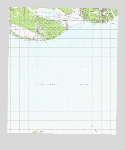
Gautier South, MS USGS Topographic Map
Click on map above to begin viewing in our Map Viewer.

This topographic map contains these locations and features:
Feature Name Type Latitude Longitude GNIS ID View Map
Bacot ParkParkN30.3749°W88.6456°688893View Map
Belle Fontaine PointCapeN30.3430°W88.7217°666789View Map
Bethel CemeteryCemeteryN30.3669°W88.6456°710400View Map
Bethel Church (historical)ChurchN30.3663°W88.6464°688906View Map
Camp LamotteLocaleN30.3649°W88.6317°667982View Map
Coast Meadows Mobile Home ParkPopulated PlaceN30.3717°W88.6510°2597048View Map
Fontainebleau Volunteer Fire Department South StationBuildingN30.3558°W88.6919°2332747View Map
Fountainbleau Volunteer Fire DepartmentBuildingN30.3612°W88.6991°2332847View Map
Gautier Fire Department South StationBuildingN30.3696°W88.6468°2667788View Map
Gautier Junior High SchoolSchoolN30.3694°W88.6414°689001View Map
Graveline BayBayN30.3699°W88.7028°670619View Map
Graveline BayouGutN30.3660°W88.6820°670620View Map
Graveline Bayou Boat RampLocaleN30.3630°W88.6946°2596154View Map
Gulf Park Estates Volunteer Fire Department Station 6BuildingN30.3614°W88.7199°2332846View Map
Middle GroundBarN30.2569°W88.6514°673528View Map
Saint Andrews Golf CourseLocaleN30.3669°W88.7222°689137View Map
Southside Baptist ChurchChurchN30.3716°W88.6470°689174View Map

Note: Coordinates in the location and feature list above are referenced to NAD83 datum.


Copyright (C) 2008-2024 Ryan Niemi / Sunset Dynamics ... All Rights Reserved