TopoQuest Logo
Do you find TopoQuest useful?
Help keep TopoQuest running and adding new maps/features by donating!
Bitcoin:  19c7KJd3qBynnjoSw5npx9KScwjBe4ifkT
Litecoin:  LXs6TkuXGGXo1vDsWCkWVdjQX94eUKd6ui
Home View Maps Find Maps Find Places Resources & Links


Geddart Lake, Montana Topographic Map

USGS Map Title: Geddart Lake, MT
USGS Map MRC: 48105C1
DRG (GeoTIFF) Download: o48105c1.tif


Neighboring USGS Topographic Map Quads:


  Hay Creek NW, MT  
48105D2
 

  Hay Creek, MT  
48105D1
 

  Biem School, MT  
48104D8
 

  Long Creek East, MT  
48105C2
 

  Geddart Lake, MT  
48105C1
 

  Smoke Creek SW, MT  
48104C8
 

  Badger Creek, MT  
48105B2
 

  Poplar NE, MT  
48105B1
 

  Brockton, MT  
48104B8


Map MRC Location:

N49°
W106°
N49°
W105°
H8 H7 H6 H5 H4 H3 H2 H1
G8 G7 G6 G5 G4 G3 G2 G1
F8 F7 F6 F5 F4 F3 F2 F1
E8 E7 E6 E5 E4 E3 E2 E1
D8 D7 D6 D5 D4 D3 D2 D1
C8 C7 C6 C5 C4 C3 C2 C1
B8 B7 B6 B5 B4 B3 B2 B1
A8 A7 A6 A5 A4 A3 A2 A1
N48°
W106°
N48°
W105°

Geddart Lake, MT USGS 1:24K Topographic Map Preview:
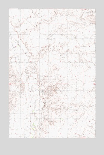
Geddart Lake, MT USGS Topographic Map
Click on map above to begin viewing in our Map Viewer.

This topographic map contains these locations and features:
Feature Name Type Latitude Longitude GNIS ID View Map
29N51E03BCDB01 WellWellN48.2964°W105.0794°1634691View Map
29N51E03CAAD01 WellWellN48.2942°W105.0725°1634687View Map
29N51E03CABA01 WellWellN48.2950°W105.0761°1634690View Map
29N51E08CC__01 WellWellN48.2770°W105.1239°1634570View Map
29N51E09ABBA01 WellWellN48.2870°W105.0916°1634636View Map
29N51E09ABBA02 WellWellN48.2870°W105.0916°1634637View Map
29N51E09ABBA03 WellWellN48.2870°W105.0916°1634638View Map
29N51E09ABBA04 WellWellN48.2870°W105.0916°1634639View Map
29N51E09CA__01 WellWellN48.2778°W105.0964°1634573View Map
29N51E10CADD01 WellWellN48.2775°W105.0736°1634572View Map
29N51E10CDAA01 WellWellN48.2767°W105.0736°1634567View Map
29N51E10CDAB01 WellWellN48.2770°W105.0747°1634568View Map
29N51E10CDBA01 WellWellN48.2770°W105.0755°1634569View Map
29N51E14ACCC01 WellWellN48.2667°W105.0500°1634510View Map
29N51E14BDDA01 WellWellN48.2681°W105.0511°1634529View Map
29N51E15CACA01 WellWellN48.2645°W105.0764°1634494View Map
29N51E15CCBD01 WellWellN48.2617°W105.0816°1634477View Map
29N51E16BDAA01 WellWellN48.2700°W105.0944°1634535View Map
29N51E16CBCC01 WellWellN48.2631°W105.1053°1634484View Map
29N51E16CCAA01 WellWellN48.2631°W105.0997°1634483View Map
29N51E16DACA01 WellWellN48.2639°W105.0864°1634489View Map
29N51E16DDDD01 WellWellN48.2600°W105.0841°1634465View Map
29N51E20ABBA01 WellWellN48.2589°W105.1139°1634456View Map
29N51E20ABBA02 WellWellN48.2586°W105.1141°1634453View Map
29N51E20DABB01 WellWellN48.2511°W105.1103°1634416View Map
29N51E21ABCB01 WellWellN48.2564°W105.0933°1634436View Map
29N51E21ABCC01 WellWellN48.2561°W105.0933°1634433View Map
29N51E21ABDA01 WellWellN48.2564°W105.0894°1634435View Map
29N51E21BBAA01 WellWellN48.2592°W105.0997°1634459View Map
30N51E10CCAD01 WellWellN48.3625°W105.0783°1635119View Map
30N51E13DCBC01 WellWellN48.3486°W105.0291°1635051View Map
30N51E28DCAA01 WellWellN48.3203°W105.1228°1634856View Map
Brockton DistrictCivilN48.3618°W105.0120°2419322View Map
Geddart LakeLakeN48.3304°W105.0439°800073View Map
Graninger DamDamN48.3384°W105.0722°796480View Map
Kerns School (historical)SchoolN48.2834°W105.0894°1669311View Map
Kirns CouleeValleyN48.3450°W105.1091°800072View Map
Kirns RanchLocaleN48.3467°W105.1103°773088View Map
Roosevelt CountyCivilN48.2945°W105.0165°1669428View Map
Slims CouleeValleyN48.2525°W105.0861°776644View Map

Note: Coordinates in the location and feature list above are referenced to NAD83 datum.


Copyright (C) 2008-2025 Ryan Niemi / Sunset Dynamics ... All Rights Reserved