TopoQuest Logo
Do you find TopoQuest useful?
Help keep TopoQuest running and adding new maps/features by donating!
Bitcoin:  19c7KJd3qBynnjoSw5npx9KScwjBe4ifkT
Litecoin:  LXs6TkuXGGXo1vDsWCkWVdjQX94eUKd6ui
Home View Maps Find Maps Find Places Resources & Links


Genoa, Illinois Topographic Map

USGS Map Title: Genoa, IL
USGS Map MRC: 42088A6
DRG (GeoTIFF) Download: o42088a6.tif


Neighboring USGS Topographic Map Quads:


  Belvidere South, IL  
42088B7
 

  Riley, IL  
42088B6
 

  Marengo South, IL  
42088B5
 

  Kirkland, IL  
42088A7
 

  Genoa, IL  
42088A6
 

  Hampshire, IL  
42088A5
 

  DeKalb, IL  
41088H7
 

  Sycamore, IL  
41088H6
 

  Maple Park, IL  
41088H5


Map MRC Location:

N43°
W89°
N43°
W88°
H8 H7 H6 H5 H4 H3 H2 H1
G8 G7 G6 G5 G4 G3 G2 G1
F8 F7 F6 F5 F4 F3 F2 F1
E8 E7 E6 E5 E4 E3 E2 E1
D8 D7 D6 D5 D4 D3 D2 D1
C8 C7 C6 C5 C4 C3 C2 C1
B8 B7 B6 B5 B4 B3 B2 B1
A8 A7 A6 A5 A4 A3 A2 A1
N42°
W89°
N42°
W88°

Genoa, IL USGS 1:24K Topographic Map Preview:
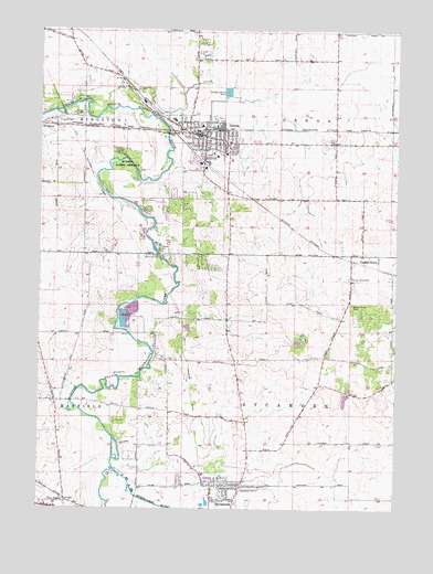
Genoa, IL USGS Topographic Map
Click on map above to begin viewing in our Map Viewer.

This topographic map contains these locations and features:
Feature Name Type Latitude Longitude GNIS ID View Map
Aero Lake Estates AirportAirportN42.0772°W88.6251°427311View Map
Anderson Airport (historical)AirportN42.0181°W88.7147°427864View Map
Base Line School (historical)SchoolN42.0661°W88.6318°1719033View Map
Charter GroveWoodsN42.0500°W88.6334°1807793View Map
Charter GrovePopulated PlaceN42.0664°W88.6315°421741View Map
Charter Grove CemeteryCemeteryN42.0606°W88.6415°421742View Map
Charter Grove School (historical)SchoolN42.0339°W88.6265°1719032View Map
City of GenoaCivilN42.0928°W88.6966°2394879View Map
Davenport Elementary SchoolSchoolN42.1000°W88.6937°1807797View Map
Deer CreekStreamN42.1050°W88.7265°421763View Map
Derby Line School (historical)SchoolN42.0814°W88.6740°1719034View Map
East Branch South Branch Kishwaukee RiverStreamN42.0106°W88.7237°421769View Map
Faith Tabernacle ChurchChurchN42.1011°W88.6968°1962326View Map
Faith United Methodist ChurchChurchN42.0928°W88.6895°1962327View Map
First Baptist Church of GenoaChurchN42.1000°W88.6920°1962328View Map
Five PointsPopulated PlaceN42.0025°W88.7404°422701View Map
Foursquare Gospel ChurchChurchN42.0947°W88.6929°1962329View Map
GenoaPopulated PlaceN42.0972°W88.6929°421818View Map
Genoa - Kingston AmbulanceBuildingN42.0981°W88.6936°2681825View Map
Genoa - Kingston Fire Protection District Station 1BuildingN42.0988°W88.6880°2682033View Map
Genoa - Kingston Fire Protection District Station 2BuildingN42.0982°W88.6917°2682541View Map
Genoa CemeteryCemeteryN42.0925°W88.6912°1807811View Map
Genoa Center School (historical)SchoolN42.0947°W88.6470°1720218View Map
Genoa Middle SchoolSchoolN42.0928°W88.6851°1807812View Map
Genoa Police DepartmentBuildingN42.1001°W88.6884°2757069View Map
Genoa Post OfficePost OfficeN42.0903°W88.6827°2788455View Map
Genoa-Kingston High SchoolSchoolN42.1014°W88.7037°1807813View Map
Henrietta (historical)LocaleN42.0959°W88.7368°1719028View Map
J Walter Becker Memorial ParkParkN42.0656°W88.7065°421870View Map
Kingston CemeteryCemeteryN42.1011°W88.7443°421886View Map
Moose Range Park (historical)AreaN42.0516°W88.6326°421947View Map
North Elementary SchoolSchoolN42.0092°W88.6923°1807830View Map
North Grove School (historical)SchoolN42.0203°W88.7045°1719037View Map
Oak Glen School (historical)SchoolN42.1100°W88.7206°1719029View Map
Olmstead School (historical)SchoolN42.1175°W88.6618°1719035View Map
Parke School (historical)SchoolN42.0497°W88.6848°1719030View Map
Person School (historical)SchoolN42.0225°W88.6770°1719031View Map
Pleasant Hill School (historical)SchoolN42.0547°W88.7331°1719036View Map
Richard C Watson Airport (historical)AirportN42.0822°W88.6956°427312View Map
Russell Forest PreserveForestN42.0909°W88.7206°422021View Map
Saint Catherine ChurchChurchN42.0922°W88.6881°1962330View Map
Sycamore Junior High SchoolSchoolN42.0020°W88.6823°1807858View Map
Township of GenoaCivilN42.1100°W88.6469°429047View Map
Township of SycamoreCivilN42.0237°W88.6584°429820View Map
Wetzel ParkParkN42.0070°W88.6843°1807871View Map
Willis Airport (historical)AirportN42.0306°W88.7018°427865View Map
WSQR-AM (Sycamore)TowerN42.0067°W88.6779°428100View Map

Note: Coordinates in the location and feature list above are referenced to NAD83 datum.


Copyright (C) 2008-2025 Ryan Niemi / Sunset Dynamics ... All Rights Reserved