TopoQuest Logo
Do you find TopoQuest useful?
Help keep TopoQuest running and adding new maps/features by donating!
Bitcoin:  19c7KJd3qBynnjoSw5npx9KScwjBe4ifkT
Litecoin:  LXs6TkuXGGXo1vDsWCkWVdjQX94eUKd6ui
Home View Maps Find Maps Find Places Resources & Links


Asti, California Topographic Map

USGS Map Title: Asti, CA
USGS Map MRC: 38122G8
DRG (GeoTIFF) Download: o38122g8.tif


Neighboring USGS Topographic Map Quads:


  Hopland, CA  
38123H1
 

  Highland Springs, CA  
38122H8
 

  Kelseyville, CA  
38122H7
 

  Cloverdale, CA  
38123G1
 

  Asti, CA  
38122G8
 

  The Geysers, CA  
38122G7
 

  Warm Springs Dam, CA  
38123F1
 

  Geyserville, CA  
38122F8
 

  Jimtown, CA  
38122F7


Map MRC Location:

N39°
W123°
N39°
W122°
H8 H7 H6 H5 H4 H3 H2 H1
G8 G7 G6 G5 G4 G3 G2 G1
F8 F7 F6 F5 F4 F3 F2 F1
E8 E7 E6 E5 E4 E3 E2 E1
D8 D7 D6 D5 D4 D3 D2 D1
C8 C7 C6 C5 C4 C3 C2 C1
B8 B7 B6 B5 B4 B3 B2 B1
A8 A7 A6 A5 A4 A3 A2 A1
N38°
W123°
N38°
W122°

Asti, CA USGS 1:24K Topographic Map Preview:
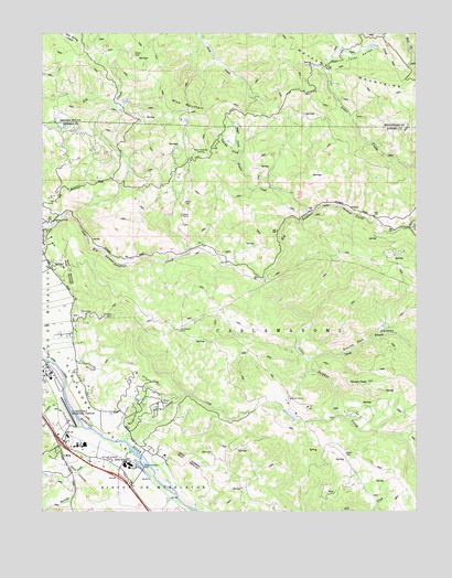
Asti, CA USGS Topographic Map
Click on map above to begin viewing in our Map Viewer.

This topographic map contains these locations and features:
Feature Name Type Latitude Longitude GNIS ID View Map
AstiPopulated PlaceN38.7630°W122.9731°1657958View Map
Asti Post Office (historical)Post OfficeN38.7630°W122.9736°1799133View Map
Barrelli CreekStreamN38.7691°W122.9800°218695View Map
Black RanchLocaleN38.7766°W122.9186°1724043View Map
Black WineryLocaleN38.7896°W122.9914°1724044View Map
Boggs CreekStreamN38.8441°W122.9344°219584View Map
Cascade CreekStreamN38.8438°W122.9336°220662View Map
Cascade Horn RanchLocaleN38.8480°W122.9403°1724045View Map
CaslamayomiCivilN38.7949°W122.9272°220674View Map
Cloverdale Municipal AirportAirportN38.7748°W122.9925°1653352View Map
Covered Wagon RanchLocaleN38.7791°W122.9672°1724046View Map
Crocker CreekStreamN38.7688°W122.9733°221835View Map
Crocker RanchLocaleN38.7810°W122.9636°1724047View Map
Demming RanchLocaleN38.7755°W122.9331°1724048View Map
Devils Den CanyonValleyN38.7896°W122.9119°222297View Map
Frasier CreekStreamN38.8282°W122.9114°223845View Map
H E RanchLocaleN38.8185°W122.9528°1724049View Map
Hardin (historical)Populated PlaceN38.8727°W122.8942°1724035View Map
Icaria CreekStreamN38.7763°W122.9942°225816View Map
Italian Swiss Colony WineryLocaleN38.7619°W122.9725°1799112View Map
Kissack RanchLocaleN38.8271°W122.8900°1724050View Map
Little Sulphur CreekStreamN38.8096°W122.9264°227384View Map
North Branch Little Sulphur CreekStreamN38.7899°W122.9119°229605View Map
Oak Ridge RanchLocaleN38.8452°W122.9942°1724051View Map
Our Lady of Carmel ChurchChurchN38.7624°W122.9778°1657237View Map
Pat Paulsen VineyardsLocaleN38.7644°W122.9600°1799121View Map
Pine MountainSummitN38.8557°W122.9533°1659394View Map
Pocket PeakSummitN38.7830°W122.8944°230840View Map
Pocket RanchLocaleN38.7757°W122.8997°1724053View Map
Ratto WineryLocaleN38.8421°W122.9889°1724054View Map
Read RanchLocaleN38.7766°W122.9814°1724055View Map
Red Bud RanchLocaleN38.8044°W122.9911°1724056View Map
Rincon De MusalaconCivilN38.7546°W122.9672°231605View Map
Roberts RanchLocaleN38.7641°W122.8994°1724057View Map
Squaw CreekStreamN38.8243°W122.8781°235310View Map
Sunset RanchLocaleN38.8524°W122.9219°1724037View Map
Washington SchoolSchoolN38.7599°W122.9678°237308View Map

Note: Coordinates in the location and feature list above are referenced to NAD83 datum.


Copyright (C) 2008-2024 Ryan Niemi / Sunset Dynamics ... All Rights Reserved