TopoQuest Logo
Do you find TopoQuest useful?
Help keep TopoQuest running and adding new maps/features by donating!
Bitcoin:  19c7KJd3qBynnjoSw5npx9KScwjBe4ifkT
Litecoin:  LXs6TkuXGGXo1vDsWCkWVdjQX94eUKd6ui
Home View Maps Find Maps Find Places Resources & Links


Gillette West, Wyoming Topographic Map

USGS Map Title: Gillette West, WY
USGS Map MRC: 44105C5
DRG (GeoTIFF) Download: o44105c5.tif


Neighboring USGS Topographic Map Quads:


  Oriva NW, WY  
44105D6
 

  Rawhide School, WY  
44105D5
 

  Moyer Springs, WY  
44105D4
 

  Oriva, WY  
44105C6
 

  Gillette West, WY  
44105C5
 

  Gillette East, WY  
44105C4
 

  Four Bar J Ranch, WY  
44105B6
 

  Appel Butte, WY  
44105B5
 

  The Gap, WY  
44105B4


Map MRC Location:

N45°
W106°
N45°
W105°
H8 H7 H6 H5 H4 H3 H2 H1
G8 G7 G6 G5 G4 G3 G2 G1
F8 F7 F6 F5 F4 F3 F2 F1
E8 E7 E6 E5 E4 E3 E2 E1
D8 D7 D6 D5 D4 D3 D2 D1
C8 C7 C6 C5 C4 C3 C2 C1
B8 B7 B6 B5 B4 B3 B2 B1
A8 A7 A6 A5 A4 A3 A2 A1
N44°
W106°
N44°
W105°

Gillette West, WY USGS 1:24K Topographic Map Preview:
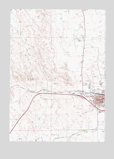
Gillette West, WY USGS Topographic Map
Click on map above to begin viewing in our Map Viewer.

This topographic map contains these locations and features:
Feature Name Type Latitude Longitude GNIS ID View Map
Barker MineMineN44.3128°W105.5397°1726397View Map
Burkhardt PitMineN44.2944°W105.5203°1726346View Map
Campbell County Emergency Medical ServicesBuildingN44.2900°W105.5171°2673659View Map
Campbell County Fire Department Station 1 HeadquartersBuildingN44.2942°W105.5131°2673447View Map
Campbell County Fire Department Station 4BuildingN44.2554°W105.5450°2673473View Map
Campbell County Fire Department Training CenterBuildingN44.2970°W105.5122°2673415View Map
Campbell County Memorial HospitalHospitalN44.2902°W105.5182°1794899View Map
Campbell County Sheriff's OfficeBuildingN44.2775°W105.5124°2752635View Map
City of GilletteCivilN44.2779°W105.5004°2410589View Map
Clyde Potter QuarryMineN44.2722°W105.5017°1726343View Map
GillettePopulated PlaceN44.2911°W105.5022°1609094View Map
Gillette - Campbell County Airport Fire DepartmentBuildingN44.3458°W105.5367°2673681View Map
Gillette Police DepartmentBuildingN44.2909°W105.5015°2752662View Map
Gillette Post OfficePost OfficeN44.2916°W105.5020°2766556View Map
Gillette-Campbell County AirportAirportN44.3491°W105.5367°1605603View Map
Gregersen DamDamN44.2550°W105.5539°1606388View Map
Gregersen ReservoirReservoirN44.2550°W105.5539°1606389View Map
Hines PitMineN44.2947°W105.5014°1726344View Map
Keils MineMineN44.2791°W105.5156°1726398View Map
Little DrawValleyN44.2519°W105.5906°1590789View Map
Oluf DrawValleyN44.2544°W105.5833°1592438View Map
Pioneer Manor Nursing and Convalescent HomeHospitalN44.2884°W105.5154°1794907View Map
Rix DamDamN44.3566°W105.6239°1607399View Map
Shepherd PitMineN44.2828°W105.5000°1726345View Map
Vines MineMineN44.2889°W105.5317°1726399View Map

Note: Coordinates in the location and feature list above are referenced to NAD83 datum.


Copyright (C) 2008-2025 Ryan Niemi / Sunset Dynamics ... All Rights Reserved