TopoQuest Logo
Do you find TopoQuest useful?
Help keep TopoQuest running and adding new maps/features by donating!
Bitcoin:  19c7KJd3qBynnjoSw5npx9KScwjBe4ifkT
Litecoin:  LXs6TkuXGGXo1vDsWCkWVdjQX94eUKd6ui
Home View Maps Find Maps Find Places Resources & Links


Gilletts Lake, Michigan Topographic Map

USGS Map Title: Gilletts Lake, MI
USGS Map MRC: 42084C3
DRG (GeoTIFF) Download: o42084c3.tif


Neighboring USGS Topographic Map Quads:


  Leslie, MI  
42084D4
 

  Pleasant Lake, MI  
42084D3
 

  Stockbridge, MI  
42084D2
 

  Jackson North, MI  
42084C4
 

  Gilletts Lake, MI  
42084C3
 

  Grass Lake, MI  
42084C2
 

  Jackson South, MI  
42084B4
 

  Michigan Center, MI  
42084B3
 

  Norvell, MI  
42084B2


Map MRC Location:

N43°
W85°
N43°
W84°
H8 H7 H6 H5 H4 H3 H2 H1
G8 G7 G6 G5 G4 G3 G2 G1
F8 F7 F6 F5 F4 F3 F2 F1
E8 E7 E6 E5 E4 E3 E2 E1
D8 D7 D6 D5 D4 D3 D2 D1
C8 C7 C6 C5 C4 C3 C2 C1
B8 B7 B6 B5 B4 B3 B2 B1
A8 A7 A6 A5 A4 A3 A2 A1
N42°
W85°
N42°
W84°

Gilletts Lake, MI USGS 1:24K Topographic Map Preview:
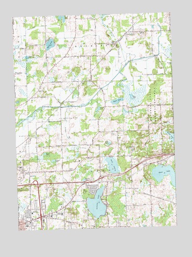
Gilletts Lake, MI USGS Topographic Map
Click on map above to begin viewing in our Map Viewer.

This topographic map contains these locations and features:
Feature Name Type Latitude Longitude GNIS ID View Map
Apostolic ChurchChurchN42.2845°W84.3702°620171View Map
Batteese CreekStreamN42.3414°W84.2913°620751View Map
Blackman Township Department of Public Safety Station 2BuildingN42.2603°W84.3653°2636099View Map
Brill LakeLakeN42.2867°W84.2992°621998View Map
Clement SchoolSchoolN42.2511°W84.3152°623445View Map
Coon Hill CemeteryCemeteryN42.3659°W84.3116°623778View Map
Cradit CemeteryCemeteryN42.2575°W84.3530°623946View Map
Eagle LakeLakeN42.3242°W84.2943°625082View Map
East Jackson High SchoolSchoolN42.2592°W84.3405°625197View Map
East Jackson Junior High SchoolSchoolN42.2545°W84.3655°625198View Map
East Jackson Memorial SchoolSchoolN42.2600°W84.3641°625199View Map
Eastgate Shopping CenterLocaleN42.2567°W84.3636°2632547View Map
Gilletts LakeLakeN42.2639°W84.3124°626828View Map
Goose LakeLakeN42.2825°W84.2527°626978View Map
Green Pasture CampLocaleN42.3053°W84.2533°627324View Map
Greenwood Acres CampgroundLocaleN42.2792°W84.2561°2633026View Map
Harmony ChurchChurchN42.2764°W84.3016°627812View Map
Harrington CemeteryCemeteryN42.3314°W84.3561°627826View Map
Henrietta StationLocaleN42.3634°W84.2861°628111View Map
Hideaway CampgroundsLocaleN42.2894°W84.2786°2633021View Map
Holiday Manor ParkPopulated PlaceN42.2783°W84.3153°2632151View Map
Interchange 142CrossingN42.2767°W84.3592°2630721View Map
Interchange 144CrossingN42.2775°W84.3214°2630719View Map
Interchange 145CrossingN42.2794°W84.3086°2630720View Map
Interchange 147CrossingN42.2925°W84.2603°2630718View Map
Jackson District Library-East BranchBuildingN42.2553°W84.3642°2632160View Map
Kingdom HallChurchN42.2661°W84.2711°2109274View Map
Kryst PondLakeN42.2944°W84.3524°629883View Map
Leoni Township Fire Department Station 2BuildingN42.2920°W84.3186°2636100View Map
Malay LakeLakeN42.3514°W84.3641°631346View Map
Maxon CemeteryCemeteryN42.2847°W84.3341°631758View Map
McArthur CemeteryCemeteryN42.2559°W84.3392°2633096View Map
Mud LakeLakeN42.3257°W84.2829°632914View Map
O'Leary PondLakeN42.2903°W84.3458°633789View Map
Orchard CreekStreamN42.3553°W84.2597°634085View Map
Pine Hollow Golf ClubLocaleN42.2814°W84.3144°2632154View Map
Robinson SchoolSchoolN42.2900°W84.3258°636061View Map
RootsPopulated PlaceN42.3356°W84.3222°1617826View Map
Roots Post Office (historical)Post OfficeN42.3356°W84.3222°2631466View Map
Roots Station (historical)LocaleN42.3356°W84.3225°2633074View Map
Saint Demetrius ChurchChurchN42.2834°W84.3677°636620View Map
Saint John LakeLakeN42.3198°W84.3093°636705View Map
Sherman LakeLakeN42.2786°W84.3225°637764View Map
Smith LakeLakeN42.2994°W84.3012°638158View Map
Sparrow Hawk Golf CourseLocaleN42.2806°W84.3742°2632153View Map
Sun Valley Mobile Home EstatesPopulated PlaceN42.2583°W84.3717°2632152View Map
Sycamore ChurchChurchN42.2581°W84.3494°1614509View Map
Township of LeoniCivilN42.2701°W84.3026°1626605View Map
Twin LakesLakeN42.3736°W84.3350°1615274View Map
Twin Lakes DrainCanalN42.3692°W84.3541°1615281View Map
White LakeLakeN42.3585°W84.3457°1616314View Map
Wildcat CreekStreamN42.3217°W84.3313°1616444View Map

Note: Coordinates in the location and feature list above are referenced to NAD83 datum.


Copyright (C) 2008-2024 Ryan Niemi / Sunset Dynamics ... All Rights Reserved