TopoQuest Logo
Do you find TopoQuest useful?
Help keep TopoQuest running and adding new maps/features by donating!
Bitcoin:  19c7KJd3qBynnjoSw5npx9KScwjBe4ifkT
Litecoin:  LXs6TkuXGGXo1vDsWCkWVdjQX94eUKd6ui
Home View Maps Find Maps Find Places Resources & Links


Girard Ridge, California Topographic Map

USGS Map Title: Girard Ridge, CA
USGS Map MRC: 41122B2
DRG (GeoTIFF) Download: o41122b2.tif


Neighboring USGS Topographic Map Quads:


  City of Mount Shasta, CA  
41122C3
 

  McCloud, CA  
41122C2
 

  Elk Spring, CA  
41122C1
 

  Dunsmuir, CA  
41122B3
 

  Girard Ridge, CA  
41122B2
 

  Lake McCloud, CA  
41122B1
 

  Tombstone Mountain, CA  
41122A3
 

  Yellowjacket Mountain, CA  
41122A2
 

  Shoeinhorse Mountain, CA  
41122A1


Map MRC Location:

N42°
W123°
N42°
W122°
H8 H7 H6 H5 H4 H3 H2 H1
G8 G7 G6 G5 G4 G3 G2 G1
F8 F7 F6 F5 F4 F3 F2 F1
E8 E7 E6 E5 E4 E3 E2 E1
D8 D7 D6 D5 D4 D3 D2 D1
C8 C7 C6 C5 C4 C3 C2 C1
B8 B7 B6 B5 B4 B3 B2 B1
A8 A7 A6 A5 A4 A3 A2 A1
N41°
W123°
N41°
W122°

Girard Ridge, CA USGS 1:24K Topographic Map Preview:
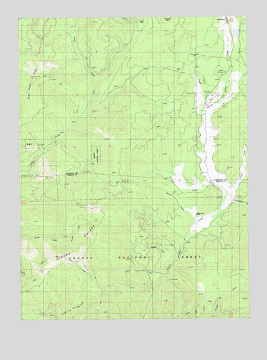
Girard Ridge, CA USGS Topographic Map
Click on map above to begin viewing in our Map Viewer.

This topographic map contains these locations and features:
Feature Name Type Latitude Longitude GNIS ID View Map
Cabin CreekStreamN41.1424°W122.1717°257799View Map
California Department of Forestry and Fire Protection McCloudBuildingN41.2332°W122.1359°2622029View Map
Connor CreekStreamN41.1768°W122.1403°258645View Map
Connor Ranch (historical)LocaleN41.1832°W122.1400°1682293View Map
Cooley Circle Seven Ranch Recreation SiteLocaleN41.2152°W122.1497°277028View Map
Cooley Circle Seven Ranch ResortLocaleN41.2096°W122.1500°277029View Map
Cottonwood CreekStreamN41.1749°W122.1403°258766View Map
Dairy CreekStreamN41.1807°W122.1472°259013View Map
Dan StevensFlatN41.2338°W122.1600°259034View Map
Girard RidgeRidgeN41.1496°W122.2295°260575View Map
McCloud Golf ClubLocaleN41.2390°W122.1364°1701879View Map
Pig CreekStreamN41.2099°W122.1531°264715View Map
Ponto ParkFlatN41.2482°W122.1828°264931View Map
Shasta National ForestForestN41.1325°W122.2002°255929View Map
Shingle CreekStreamN41.1504°W122.1706°266121View Map
Soda Creek RidgeRidgeN41.2110°W122.2472°267363View Map
Soda SpringsSpringN41.2279°W122.1414°267375View Map
Warmcastle Mobile Home ParkPopulated PlaceN41.2181°W122.1483°2515995View Map
Willow CreekStreamN41.1649°W122.1564°269145View Map
Willow Creek RanchLocaleN41.1685°W122.1561°269163View Map

Note: Coordinates in the location and feature list above are referenced to NAD83 datum.


Copyright (C) 2008-2025 Ryan Niemi / Sunset Dynamics ... All Rights Reserved