TopoQuest Logo
Do you find TopoQuest useful?
Help keep TopoQuest running and adding new maps/features by donating!
Bitcoin:  19c7KJd3qBynnjoSw5npx9KScwjBe4ifkT
Litecoin:  LXs6TkuXGGXo1vDsWCkWVdjQX94eUKd6ui
Home View Maps Find Maps Find Places Resources & Links


Goehner, Nebraska Topographic Map

USGS Map Title: Goehner, NE
USGS Map MRC: 40097G2
DRG (GeoTIFF) Download: o40097g2.tif


Neighboring USGS Topographic Map Quads:


  Utica, NE  
40097H3
 

  Staplehurst, NE  
40097H2
 

  Seward, NE  
40097H1
 

  Beaver Crossing, NE  
40097G3
 

  Goehner, NE  
40097G2
 

  Milford, NE  
40097G1
 

  Friend, NE  
40097F3
 

  Dorchester NW, NE  
40097F2
 

  Dorchester, NE  
40097F1


Map MRC Location:

N41°
W98°
N41°
W97°
H8 H7 H6 H5 H4 H3 H2 H1
G8 G7 G6 G5 G4 G3 G2 G1
F8 F7 F6 F5 F4 F3 F2 F1
E8 E7 E6 E5 E4 E3 E2 E1
D8 D7 D6 D5 D4 D3 D2 D1
C8 C7 C6 C5 C4 C3 C2 C1
B8 B7 B6 B5 B4 B3 B2 B1
A8 A7 A6 A5 A4 A3 A2 A1
N40°
W98°
N40°
W97°

Goehner, NE USGS 1:24K Topographic Map Preview:
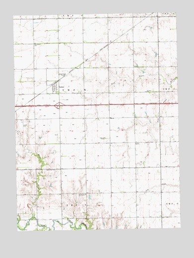
Goehner, NE USGS Topographic Map
Click on map above to begin viewing in our Map Viewer.

This topographic map contains these locations and features:
Feature Name Type Latitude Longitude GNIS ID View Map
Centerfield ReservoirReservoirN40.7997°W97.1656°1766930View Map
Ebers-Eberspacher DamDamN40.8000°W97.1653°1766929View Map
Election Precinct KCivilN40.8291°W97.1967°1929212View Map
GoehnerPopulated PlaceN40.8322°W97.2212°829554View Map
Goehner (historical)LocaleN40.8353°W97.2198°1881913View Map
Goehner Post OfficePost OfficeN40.8334°W97.2206°1881912View Map
Goehner Rest AreaLocaleN40.8228°W97.1712°1881977View Map
Goehner Volunteer Fire DepartmentBuildingN40.8328°W97.2213°2553416View Map
Interchange 373CrossingN40.8222°W97.2159°1881979View Map
KOLN-TV (Lincoln)TowerN40.8022°W97.1798°837452View Map
North Branch Crooked CreekStreamN40.8333°W97.1309°831661View Map
Old Salem CemeteryCemeteryN40.8297°W97.1492°831860View Map
Perry Mound CemeteryCemeteryN40.8578°W97.2345°832043View Map
Salem ChurchChurchN40.7997°W97.1581°833136View Map
Seward CountyCivilN40.8724°W97.1395°835901View Map
Seward County Historical Society MuseumBuildingN40.8333°W97.2195°1881853View Map
South Branch Crooked CreekStreamN40.8333°W97.1309°833547View Map
Star SchoolSchoolN40.8145°W97.1770°833783View Map
Tall Grass Prairie Historical MarkerParkN40.8228°W97.1712°1881978View Map
Township KCivilN40.8250°W97.1948°1881772View Map
Village of GoehnerCivilN40.8327°W97.2196°2398171View Map
Walnut CreekStreamN40.7570°W97.2384°834442View Map
Walnut Creek CemeteryCemeteryN40.7851°W97.2203°834449View Map
West Fairview ChurchChurchN40.7706°W97.1973°834589View Map
West Walnut CreekStreamN40.7992°W97.2425°834633View Map

Note: Coordinates in the location and feature list above are referenced to NAD83 datum.


Copyright (C) 2008-2025 Ryan Niemi / Sunset Dynamics ... All Rights Reserved