TopoQuest Logo
Do you find TopoQuest useful?
Help keep TopoQuest running and adding new maps/features by donating!
Bitcoin:  19c7KJd3qBynnjoSw5npx9KScwjBe4ifkT
Litecoin:  LXs6TkuXGGXo1vDsWCkWVdjQX94eUKd6ui
Home View Maps Find Maps Find Places Resources & Links


Gold Butte, Nevada Topographic Map

USGS Map Title: Gold Butte, NV
USGS Map MRC: 36114C2
DRG (GeoTIFF) Download: o36114c2.tif


Neighboring USGS Topographic Map Quads:


  Overton Beach, NV  
36114D3
 

  Devils Throat, NV  
36114D2
 

  Saint Thomas Gap, NV  
36114D1
 

  Lime Wash, NV  
36114C3
 

  Gold Butte, NV  
36114C2
 

  Azure Ridge, NV  
36114C1
 

  Garrett Butte, NV  
36114B3
 

  Jumbo Peak, NV  
36114B2
 

  Iceberg Canyon, NV  
36114B1


Map MRC Location:

N37°
W115°
N37°
W114°
H8 H7 H6 H5 H4 H3 H2 H1
G8 G7 G6 G5 G4 G3 G2 G1
F8 F7 F6 F5 F4 F3 F2 F1
E8 E7 E6 E5 E4 E3 E2 E1
D8 D7 D6 D5 D4 D3 D2 D1
C8 C7 C6 C5 C4 C3 C2 C1
B8 B7 B6 B5 B4 B3 B2 B1
A8 A7 A6 A5 A4 A3 A2 A1
N36°
W115°
N36°
W114°

Gold Butte, NV USGS 1:24K Topographic Map Preview:
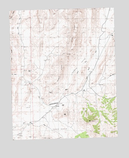
Gold Butte, NV USGS Topographic Map
Click on map above to begin viewing in our Map Viewer.

This topographic map contains these locations and features:
Feature Name Type Latitude Longitude GNIS ID View Map
Azure Ridge DrawValleyN36.2542°W114.1380°838544View Map
Azure Ridge MineMineN36.3180°W114.1261°838545View Map
Baylor (historical)LocaleN36.2667°W114.1458°851449View Map
Bills SpringSpringN36.2953°W114.1633°838787View Map
Black Jack MineMineN36.2933°W114.2016°854884View Map
Copper City (historical)Populated PlaceN36.3166°W114.2119°846669View Map
Garden SpringSpringN36.3019°W114.1464°840609View Map
Gold ButteSummitN36.2730°W114.1847°840678View Map
Gold Butte (historical)Populated PlaceN36.2803°W114.2005°856035View Map
Gold Butte MineMineN36.2747°W114.1922°840679View Map
Gold Butte Mining DistrictCivilN36.2833°W114.1925°855051View Map
Gold Butte Post Office (historical)Post OfficeN36.2803°W114.2005°864778View Map
Granite SpringSpringN36.2823°W114.1912°840755View Map
Hill Top MineMineN36.2744°W114.1844°854927View Map
Horse SpringSpringN36.3491°W114.1296°856273View Map
Immigrant CanyonValleyN36.3153°W114.1258°841228View Map
Indian Trail WashStreamN36.2505°W114.2030°854492View Map
Lincoln MineMineN36.3311°W114.1833°841646View Map
Mica PeakSummitN36.2658°W114.1561°842068View Map
Million HillsRangeN36.2850°W114.1266°842145View Map
Ole MineMineN36.2511°W114.2141°855315View Map
Paradise GapGapN36.2966°W114.1875°842718View Map
Paradise ValleyBasinN36.3183°W114.1675°842721View Map
Perkins SpringSpringN36.3161°W114.2271°842779View Map
Snowflake MineMineN36.2808°W114.1561°843802View Map
South Virgin MountainsRangeN36.2569°W114.1980°849599View Map
Summit PassGapN36.2753°W114.1261°844085View Map
Summit SpringSpringN36.2880°W114.1258°844086View Map
Tramp RidgeRidgeN36.3516°W114.1733°844400View Map
Valatier WashStreamN36.3344°W114.1480°844563View Map
Vermiculite MineMineN36.2855°W114.1586°844581View Map
Voight WellWellN36.2833°W114.1947°846668View Map
Willow SpringSpringN36.2989°W114.1514°851447View Map

Note: Coordinates in the location and feature list above are referenced to NAD83 datum.


Copyright (C) 2008-2025 Ryan Niemi / Sunset Dynamics ... All Rights Reserved