TopoQuest Logo
Do you find TopoQuest useful?
Help keep TopoQuest running and adding new maps/features by donating!
Bitcoin:  19c7KJd3qBynnjoSw5npx9KScwjBe4ifkT
Litecoin:  LXs6TkuXGGXo1vDsWCkWVdjQX94eUKd6ui
Home View Maps Find Maps Find Places Resources & Links


Goldbug Ridge, Idaho Topographic Map

USGS Map Title: Goldbug Ridge, ID
USGS Map MRC: 44113H8
DRG (GeoTIFF) Download: o44113h8.tif


Neighboring USGS Topographic Map Quads:


  Lake Mountain, ID  
45114A1
 

  Williams Lake, ID  
45113A8
 

  Sal Mountain, ID  
45113A7
 

  Degan Mountain, ID  
44114H1
 

  Goldbug Ridge, ID  
44113H8
 

  Poison Peak, ID  
44113H7
 

  Hat Creek, ID  
44114G1
 

  Allison Creek, ID  
44113G8
 

  Lem Peak, ID  
44113G7


Map MRC Location:

N45°
W114°
N45°
W113°
H8 H7 H6 H5 H4 H3 H2 H1
G8 G7 G6 G5 G4 G3 G2 G1
F8 F7 F6 F5 F4 F3 F2 F1
E8 E7 E6 E5 E4 E3 E2 E1
D8 D7 D6 D5 D4 D3 D2 D1
C8 C7 C6 C5 C4 C3 C2 C1
B8 B7 B6 B5 B4 B3 B2 B1
A8 A7 A6 A5 A4 A3 A2 A1
N44°
W114°
N44°
W113°

Goldbug Ridge, ID USGS 1:24K Topographic Map Preview:
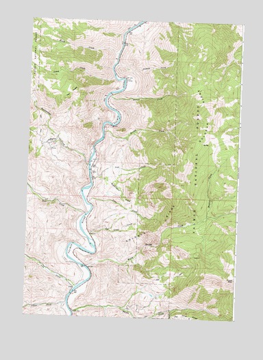
Goldbug Ridge, ID USGS Topographic Map
Click on map above to begin viewing in our Map Viewer.

This topographic map contains these locations and features:
Feature Name Type Latitude Longitude GNIS ID View Map
Birch CreekStreamN44.9858°W113.9487°377665View Map
Briney CreekStreamN44.9684°W113.9532°2785428View Map
Buck LakeStreamN44.9685°W113.9534°378234View Map
Cabin CreekStreamN44.8955°W113.9887°378644View Map
Camp CreekStreamN44.9763°W113.9506°378787View Map
Camp Creek Access AreaLocaleN44.9371°W113.9631°401248View Map
Deer CreekStreamN44.9180°W113.9653°380442View Map
Dummy CreekStreamN44.9771°W113.9409°380931View Map
Elk BendPopulated PlaceN44.8844°W113.9690°1828972View Map
Elk Bend Fire Protection District Station 1BuildingN44.9044°W113.9698°2619315View Map
Elk Bend Fire Protection District Station 2BuildingN44.9123°W113.9653°2619040View Map
Goldbug RidgeRidgeN44.9605°W113.8940°382402View Map
Iron CreekStreamN44.8871°W113.9701°383753View Map
Iron Creek CemeteryCemeteryN44.8872°W113.9714°2766758View Map
Lemhi CountyCivilN44.9432°W113.9333°399754View Map
Lime CreekStreamN44.9224°W113.9631°384657View Map
Lime Creek Access AreaLocaleN44.9230°W113.9642°401577View Map
Lost CreekStreamN44.9338°W113.9578°386137View Map
Meadow CreekStreamN44.9180°W113.8928°386686View Map
Phantom CreekStreamN44.8780°W113.9126°388391View Map
Poison CreekStreamN44.8769°W113.9717°388642View Map
Rattlesnake CreekStreamN44.9388°W113.9640°389148View Map
Rye Grass CreekStreamN44.9102°W113.9606°389757View Map
Second CreekStreamN44.9527°W113.9559°390080View Map
South Fork Poison CreekStreamN44.8752°W113.9351°390995View Map
Twin PeaksSummitN44.9669°W113.9795°397286View Map
Twin Peaks RanchLocaleN44.9491°W113.9884°392538View Map
Waddington CreekStreamN44.9324°W113.9623°392756View Map
Warm Spring CreekStreamN44.8958°W113.9634°392866View Map

Note: Coordinates in the location and feature list above are referenced to NAD83 datum.


Copyright (C) 2008-2025 Ryan Niemi / Sunset Dynamics ... All Rights Reserved