TopoQuest Logo
Do you find TopoQuest useful?
Help keep TopoQuest running and adding new maps/features by donating!
Bitcoin:  19c7KJd3qBynnjoSw5npx9KScwjBe4ifkT
Litecoin:  LXs6TkuXGGXo1vDsWCkWVdjQX94eUKd6ui
Home View Maps Find Maps Find Places Resources & Links


Golva, North Dakota Topographic Map

USGS Map Title: Golva, ND
USGS Map MRC: 46103F8
DRG (GeoTIFF) Download: o46103f8.tif


Neighboring USGS Topographic Map Quads:


  Duck Creek, MT  
46104G1
 

  Thelan, ND  
46103G8
 

  Sentinel Butte SE, ND  
46103G7
 

  Carlyle, MT  
46104F1
 

  Golva, ND  
46103F8
 

  Alpha, ND  
46103F7
 

  Ollie, MT  
46104E1
 

  Williams Lake, ND  
46103E8
 

  Three V Crossing, ND  
46103E7


Map MRC Location:

N47°
W104°
N47°
W103°
H8 H7 H6 H5 H4 H3 H2 H1
G8 G7 G6 G5 G4 G3 G2 G1
F8 F7 F6 F5 F4 F3 F2 F1
E8 E7 E6 E5 E4 E3 E2 E1
D8 D7 D6 D5 D4 D3 D2 D1
C8 C7 C6 C5 C4 C3 C2 C1
B8 B7 B6 B5 B4 B3 B2 B1
A8 A7 A6 A5 A4 A3 A2 A1
N46°
W104°
N46°
W103°

Golva, ND USGS 1:24K Topographic Map Preview:
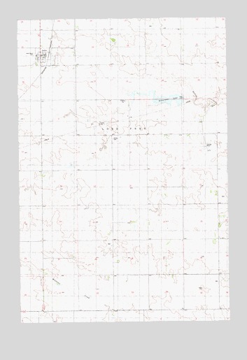
Golva, ND USGS Topographic Map
Click on map above to begin viewing in our Map Viewer.

This topographic map contains these locations and features:
Feature Name Type Latitude Longitude GNIS ID View Map
Bosserman LakeLakeN46.7164°W103.9095°1035591View Map
Burkey CemeteryCemeteryN46.7008°W103.9421°1034042View Map
City of GolvaCivilN46.7347°W103.9831°1036060View Map
Finneman Private Field (historical)AirportN46.7000°W103.9005°1035266View Map
GolvaPopulated PlaceN46.7342°W103.9863°1034887View Map
Golva Elementary SchoolSchoolN46.7351°W103.9857°2747786View Map
Golva Post OfficePost OfficeN46.7353°W103.9845°2742019View Map
Golva Rural Fire StationBuildingN46.7353°W103.9834°2637696View Map
Saint Marys CemeteryCemeteryN46.7359°W103.9905°1034041View Map
Township of Lone TreeCivilN46.7166°W103.9530°1037205View Map

Note: Coordinates in the location and feature list above are referenced to NAD83 datum.


Copyright (C) 2008-2025 Ryan Niemi / Sunset Dynamics ... All Rights Reserved