TopoQuest Logo
Do you find TopoQuest useful?
Help keep TopoQuest running and adding new maps/features by donating!
Bitcoin:  19c7KJd3qBynnjoSw5npx9KScwjBe4ifkT
Litecoin:  LXs6TkuXGGXo1vDsWCkWVdjQX94eUKd6ui
Home View Maps Find Maps Find Places Resources & Links


Gomez Peak, Texas Topographic Map

USGS Map Title: Gomez Peak, TX
USGS Map MRC: 31104A1
DRG (GeoTIFF) Download: o31104a1.tif


Neighboring USGS Topographic Map Quads:


  Iron Mountain, TX  
31104B2
 

  San Martine, TX  
31104B1
 

  Gozar, TX  
31103B8
 

  Kent, TX  
31104A2
 

  Gomez Peak, TX  
31104A1
 

  Sotol Hill, TX  
31103A8
 

  Echo Canyon, TX  
30104H2
 

  Buckhorn Mountain, TX  
30104H1
 

  Antelope Flat, TX  
30103H8


Map MRC Location:

N32°
W105°
N32°
W104°
H8 H7 H6 H5 H4 H3 H2 H1
G8 G7 G6 G5 G4 G3 G2 G1
F8 F7 F6 F5 F4 F3 F2 F1
E8 E7 E6 E5 E4 E3 E2 E1
D8 D7 D6 D5 D4 D3 D2 D1
C8 C7 C6 C5 C4 C3 C2 C1
B8 B7 B6 B5 B4 B3 B2 B1
A8 A7 A6 A5 A4 A3 A2 A1
N31°
W105°
N31°
W104°

Gomez Peak, TX USGS 1:24K Topographic Map Preview:
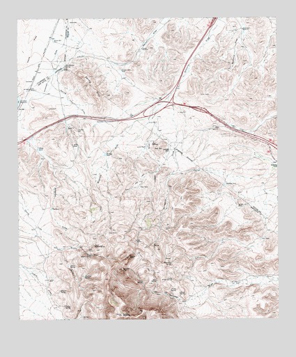
Gomez Peak, TX USGS Topographic Map
Click on map above to begin viewing in our Map Viewer.

This topographic map contains these locations and features:
Feature Name Type Latitude Longitude GNIS ID View Map
Antelope TankReservoirN31.0563°W104.0257°1351163View Map
Arbor WindmillLocaleN31.0796°W104.0285°1351233View Map
Bankhead WindmillLocaleN31.1201°W104.0169°1351481View Map
Brushy DrawValleyN31.0296°W104.1057°1353062View Map
Canyon Mill TankReservoirN31.1034°W104.0754°1353777View Map
Canyon WindmillLocaleN31.1124°W104.0655°1353787View Map
Cherry SpringSpringN31.0055°W104.1031°1354371View Map
Clay TankReservoirN31.0552°W104.0668°1354595View Map
Cold SpringSpringN31.0331°W104.0687°1354748View Map
Cowan DrawValleyN31.0891°W104.0574°1355222View Map
Cowan HomesteadLocaleN31.0735°W104.0607°1355223View Map
Cowden RanchLocaleN31.0168°W104.1107°1355232View Map
Cox TankReservoirN31.0457°W104.1096°1355260View Map
Deer CampLocaleN31.0290°W104.0913°1355841View Map
Gold HillSummitN31.0376°W104.0546°1358115View Map
Gomez PeakSummitN31.0260°W104.0719°1358141View Map
Hackberry SpringSpringN31.0233°W104.0521°1358592View Map
Highway TankReservoirN31.0640°W104.0004°1359229View Map
House SpringSpringN31.0110°W104.0481°1359713View Map
Indian SpringSpringN31.0223°W104.1006°1359986View Map
Indian SpringsSpringN31.0251°W104.1088°1998473View Map
Lake WindmillLocaleN31.0957°W104.1191°1360871View Map
LevinsonPopulated PlaceN31.0990°W104.1180°1380079View Map
Levinson Reservoir DamDamN31.0918°W104.1238°1858098View Map
Little TankReservoirN31.0720°W104.0641°1361486View Map
Little Willow SpringSpringN31.0168°W104.0518°1361504View Map
Little Willow SpringsSpringN31.0251°W104.0588°1998476View Map
Lower Hidden SpringSpringN31.0310°W104.0888°1361919View Map
Middle TankReservoirN31.0468°W104.0196°1362758View Map
Mud SpringSpringN31.0162°W104.0594°1363418View Map
New TankReservoirN31.0334°W104.0085°1363789View Map
Newman PeakSummitN31.0213°W104.0749°1363852View Map
Pine SpringSpringN31.0160°W104.0657°1365308View Map
Red HillSummitN31.0699°W104.0566°1366157View Map
Red Hill TankReservoirN31.0710°W104.0531°1366163View Map
Rock TankReservoirN31.0726°W104.0967°1366711View Map
San Martine SpringSpringN31.1051°W104.1023°1367530View Map
Scroggins DrawValleyN31.0925°W104.0526°1367903View Map
Spring HillsSummitN31.0962°W104.0888°1369013View Map
Spring Hills DrawValleyN31.1035°W104.1080°1369014View Map
Stocks RanchLocaleN31.1040°W104.1032°1369224View Map
Stocks Well Number OneWellN31.1157°W104.1080°1369225View Map
Stratton WellWellN31.0787°W104.0960°1369267View Map
Upper Hidden SpringSpringN31.0271°W104.0902°1370514View Map
Wallace TankReservoirN31.0684°W104.0834°1370791View Map
Walnut SpringSpringN31.0120°W104.1052°1370825View Map
White TankReservoirN31.0710°W104.1157°1371424View Map
Willow SpringSpringN31.0125°W104.0522°1371670View Map
Woodrow SpringSpringN31.0182°W104.0932°1371927View Map
Woulfter MountainSummitN31.0021°W104.0757°1371966View Map
Woulfter RanchLocaleN31.0154°W104.0213°1371967View Map

Note: Coordinates in the location and feature list above are referenced to NAD83 datum.


Copyright (C) 2008-2024 Ryan Niemi / Sunset Dynamics ... All Rights Reserved