TopoQuest Logo
Do you find TopoQuest useful?
Help keep TopoQuest running and adding new maps/features by donating!
Bitcoin:  19c7KJd3qBynnjoSw5npx9KScwjBe4ifkT
Litecoin:  LXs6TkuXGGXo1vDsWCkWVdjQX94eUKd6ui
Home View Maps Find Maps Find Places Resources & Links


Atlanta, Louisiana Topographic Map

USGS Map Title: Atlanta, LA
USGS Map MRC: 31092G6
DRG (GeoTIFF) Download: o31092g6.tif


Neighboring USGS Topographic Map Quads:


  Calvin, LA  
31092H7
 

  Winnfield West, LA  
31092H6
 

  Winnfield East, LA  
31092H5
 

  Coochie Brake, LA  
31092G7
 

  Atlanta, LA  
31092G6
 

  Packton, LA  
31092G5
 

  Verda, LA  
31092F7
 

  Savage Creek, LA  
31092F6
 

  Williana, LA  
31092F5


Map MRC Location:

N32°
W93°
N32°
W92°
H8 H7 H6 H5 H4 H3 H2 H1
G8 G7 G6 G5 G4 G3 G2 G1
F8 F7 F6 F5 F4 F3 F2 F1
E8 E7 E6 E5 E4 E3 E2 E1
D8 D7 D6 D5 D4 D3 D2 D1
C8 C7 C6 C5 C4 C3 C2 C1
B8 B7 B6 B5 B4 B3 B2 B1
A8 A7 A6 A5 A4 A3 A2 A1
N31°
W93°
N31°
W92°

Atlanta, LA USGS 1:24K Topographic Map Preview:
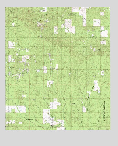
Atlanta, LA USGS Topographic Map
Click on map above to begin viewing in our Map Viewer.

This topographic map contains these locations and features:
Feature Name Type Latitude Longitude GNIS ID View Map
Alonzo (historical)Populated PlaceN31.8641°W92.7052°549116View Map
Antioch CemeteryCemeteryN31.7776°W92.6866°546975View Map
AtlantaPopulated PlaceN31.8052°W92.7382°553323View Map
Atlanta Gas FieldOilfieldN31.8352°W92.7127°549117View Map
Atlanta Post OfficePost OfficeN31.8063°W92.7370°1630999View Map
ATLANTA SCHOOLSchoolN31.8067°W92.7330°549118View Map
Beal CrossingPopulated PlaceN31.7541°W92.6932°547030View Map
Bell CreekStreamN31.7524°W92.6485°553582View Map
Bulger CreekStreamN31.7813°W92.7421°547147View Map
Cedar Creek SchoolSchoolN31.8421°W92.6385°547200View Map
Cow CreekStreamN31.8196°W92.7432°547254View Map
Cruie CreekStreamN31.7554°W92.6832°547270View Map
Five ForksPopulated PlaceN31.8116°W92.6960°547362View Map
Five Forks Gas FieldOilfieldN31.8238°W92.6696°549137View Map
Hill BayouStreamN31.7535°W92.7057°547464View Map
Iatt Creek Oil FieldOilfieldN31.7510°W92.6821°549148View Map
Lawrence BranchStreamN31.7877°W92.6582°547567View Map
Macedonia ChurchChurchN31.8043°W92.6449°547639View Map
Marlin BranchStreamN31.7721°W92.6813°547650View Map
Ninth Ward School (historical)StreamN31.7546°W92.6963°547778View Map
Old Mill PondLakeN31.8140°W92.7451°555543View Map
Prairie Home (historical)Populated PlaceN31.8116°W92.6335°549173View Map
Ratton CreekStreamN31.7546°W92.6485°547886View Map
Redland CreekStreamN31.8018°W92.7471°555780View Map
Rhoe CreekStreamN31.7538°W92.6799°555796View Map
SardisPopulated PlaceN31.8449°W92.7074°541801View Map
Sardis ChurchChurchN31.8446°W92.7077°547970View Map
Sardis Lookout TowerTowerN31.8435°W92.7079°558821View Map
Sulphur CreekStreamN31.8546°W92.6285°548050View Map
Sulphur Creek Gas FieldOilfieldN31.8460°W92.6924°549183View Map
Swindelly CemeteryCemeteryN31.8528°W92.7054°548060View Map
Village of AtlantaCivilN31.8064°W92.7383°2407412View Map
Ward SixCivilN31.7954°W92.7385°545292View Map
WhitfordPopulated PlaceN31.8327°W92.7252°549188View Map
Worsham CrossingPopulated PlaceN31.7607°W92.7240°548161View Map

Note: Coordinates in the location and feature list above are referenced to NAD83 datum.


Copyright (C) 2008-2025 Ryan Niemi / Sunset Dynamics ... All Rights Reserved