TopoQuest Logo
Do you find TopoQuest useful?
Help keep TopoQuest running and adding new maps/features by donating!
Bitcoin:  19c7KJd3qBynnjoSw5npx9KScwjBe4ifkT
Litecoin:  LXs6TkuXGGXo1vDsWCkWVdjQX94eUKd6ui
Home View Maps Find Maps Find Places Resources & Links


Goodwill, South Dakota Topographic Map

USGS Map Title: Goodwill, SD
USGS Map MRC: 45097E1
DRG (GeoTIFF) Download: o45097e1.tif


Neighboring USGS Topographic Map Quads:


  Whitestone Lake, SD  
45097F2
 

  Sisseton, SD  
45097F1
 

  Peever NW, SD  
45096F8
 

  Drywood Lakes, SD  
45097E2
 

  Goodwill, SD  
45097E1
 

  Peever, SD  
45096E8
 

  Enemy Swim Lake East, SD  
45097D2
 

  Summit NE, SD  
45097D1
 

  Wilmot NW, SD  
45096D8


Map MRC Location:

N46°
W98°
N46°
W97°
H8 H7 H6 H5 H4 H3 H2 H1
G8 G7 G6 G5 G4 G3 G2 G1
F8 F7 F6 F5 F4 F3 F2 F1
E8 E7 E6 E5 E4 E3 E2 E1
D8 D7 D6 D5 D4 D3 D2 D1
C8 C7 C6 C5 C4 C3 C2 C1
B8 B7 B6 B5 B4 B3 B2 B1
A8 A7 A6 A5 A4 A3 A2 A1
N45°
W98°
N45°
W97°

Goodwill, SD USGS 1:24K Topographic Map Preview:
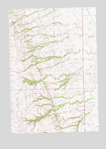
Goodwill, SD USGS Topographic Map
Click on map above to begin viewing in our Map Viewer.

This topographic map contains these locations and features:
Feature Name Type Latitude Longitude GNIS ID View Map
Agency Village Census Designated PlaceCensusN45.5808°W97.0831°2584542View Map
GoodwillPopulated PlaceN45.5669°W97.0701°1255285View Map
Goodwill CemeteryCemeteryN45.6250°W97.0620°1255287View Map
Goodwill Census Designated PlaceCensusN45.5673°W97.0612°2584555View Map
Goodwill ChurchChurchN45.5700°W97.0731°1255288View Map
Goodwill Mission Church (historical)ChurchN45.5652°W97.0770°1263943View Map
Goodwill Number 2 CemeteryCemeteryN45.5925°W97.0619°1255286View Map
Goodwill Post Office (historical)Post OfficeN45.5705°W97.0792°1267142View Map
Goodwill Presbyterian CemeteryCemeteryN45.5693°W97.0727°2779326View Map
Government Indian School (historical)SchoolN45.5625°W97.0634°1263971View Map
Indian Mission School (historical)SchoolN45.5658°W97.0634°1263972View Map
Lohre (historical)LocaleN45.5502°W97.1223°1263942View Map
Old Agency DistrictCivilN45.5598°W97.0722°2419041View Map
Old Sisseton Indian AgencyLocaleN45.5497°W97.0534°1256869View Map
Renville Family CemeteryCemeteryN45.5278°W97.0646°2779324View Map
Saint Mary's Episcopal CemeteryCemeteryN45.5487°W97.0577°2779331View Map
Saint Marys ChurchChurchN45.5480°W97.0615°1263895View Map
School Number 1 (historical)SchoolN45.6175°W97.0762°1263946View Map
School Number 1 (historical)SchoolN45.5452°W97.0587°1263970View Map
School Number 2 (historical)SchoolN45.5816°W97.1245°1263944View Map
School Number 2 (historical)SchoolN45.5866°W97.0715°1263945View Map
Sisseton - Wahpeton Sioux Tribal Police DepartmentBuildingN45.5671°W97.0702°2755457View Map
Sisseton Wahpeton CollegeSchoolN45.5635°W97.0608°1829120View Map
Tiospa Zina Elementary SchoolSchoolN45.5602°W97.0779°2729685View Map
Tiospa Zina High SchoolSchoolN45.5602°W97.0779°2729686View Map
Tiospa Zina Middle SchoolSchoolN45.5602°W97.0779°2729687View Map
Tiospa Zina Primary SchoolSchoolN45.5602°W97.0779°2729688View Map
Township of AgencyCivilN45.5147°W97.0410°1268566View Map
Township of GoodwillCivilN45.6018°W97.0408°1268563View Map

Note: Coordinates in the location and feature list above are referenced to NAD83 datum.


Copyright (C) 2008-2025 Ryan Niemi / Sunset Dynamics ... All Rights Reserved