TopoQuest Logo
Do you find TopoQuest useful?
Help keep TopoQuest running and adding new maps/features by donating!
Bitcoin:  19c7KJd3qBynnjoSw5npx9KScwjBe4ifkT
Litecoin:  LXs6TkuXGGXo1vDsWCkWVdjQX94eUKd6ui
Home View Maps Find Maps Find Places Resources & Links


Goose Egg Butte, Oregon Topographic Map

USGS Map Title: Goose Egg Butte, OR
USGS Map MRC: 43119B6
DRG (GeoTIFF) Download: o43119b6.tif


Neighboring USGS Topographic Map Quads:


  Wagontire Mountain East, OR  
43119C7
 

  Alec Butte, OR  
43119C6
 

  Lake on the Trail, OR  
43119C5
 

  Little Juniper Mountain, OR  
43119B7
 

  Goose Egg Butte, OR  
43119B6
 

  Wilson Butte, OR  
43119B5
 

  Cox Canyon, OR  
43119A7
 

  Dry Valley Rim, OR  
43119A6
 

  Rawhide Canyon, OR  
43119A5


Map MRC Location:

N44°
W120°
N44°
W119°
H8 H7 H6 H5 H4 H3 H2 H1
G8 G7 G6 G5 G4 G3 G2 G1
F8 F7 F6 F5 F4 F3 F2 F1
E8 E7 E6 E5 E4 E3 E2 E1
D8 D7 D6 D5 D4 D3 D2 D1
C8 C7 C6 C5 C4 C3 C2 C1
B8 B7 B6 B5 B4 B3 B2 B1
A8 A7 A6 A5 A4 A3 A2 A1
N43°
W120°
N43°
W119°

Goose Egg Butte, OR USGS 1:24K Topographic Map Preview:
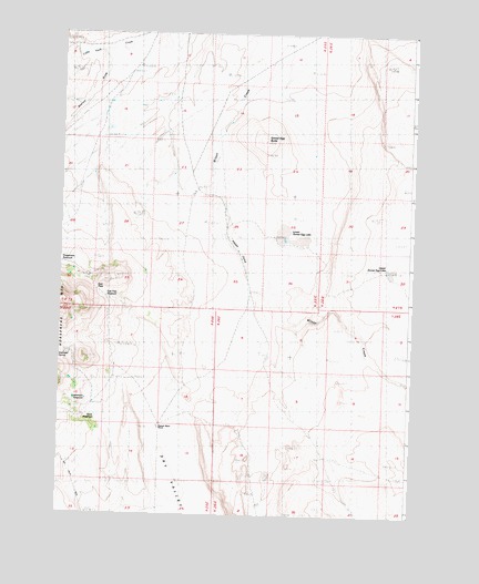
Goose Egg Butte, OR USGS Topographic Map
Click on map above to begin viewing in our Map Viewer.

This topographic map contains these locations and features:
Feature Name Type Latitude Longitude GNIS ID View Map
Brink ReservoirReservoirN43.1506°W119.7368°1134111View Map
China Cap MineMineN43.1860°W119.7400°1162102View Map
East PassGapN43.1840°W119.7383°1134115View Map
East Pass ReservoirReservoirN43.1814°W119.7338°1134114View Map
Goose Egg ButteSummitN43.2221°W119.6780°1134118View Map
Goose Egg ReservoirReservoirN43.2187°W119.6340°1638224View Map
Hannah Myers RanchLocaleN43.1479°W119.7144°1134110View Map
Happy CampValleyN43.1971°W119.6919°1134109View Map
Horsehead MountainSummitN43.1657°W119.7408°1136396View Map
Horsehead SpringSpringN43.1664°W119.7488°1134112View Map
Leehmann ReservoirReservoirN43.1548°W119.7403°1134113View Map
Little Tank CanyonValleyN43.2457°W119.7455°1157672View Map
Lonely ReservoirReservoirN43.1792°W119.7275°1157671View Map
Lower Goose Egg LakeFlatN43.1971°W119.6705°1134117View Map
Prospectors ReservoirReservoirN43.1900°W119.7499°1134116View Map
Quarry ReservoirReservoirN43.1879°W119.7433°1638225View Map
Stormy DrawStreamN43.2457°W119.7372°1134119View Map
Upper Goose Egg LakeLakeN43.1887°W119.6331°1133138View Map

Note: Coordinates in the location and feature list above are referenced to NAD83 datum.


Copyright (C) 2008-2025 Ryan Niemi / Sunset Dynamics ... All Rights Reserved