TopoQuest Logo
Do you find TopoQuest useful?
Help keep TopoQuest running and adding new maps/features by donating!
Bitcoin:  19c7KJd3qBynnjoSw5npx9KScwjBe4ifkT
Litecoin:  LXs6TkuXGGXo1vDsWCkWVdjQX94eUKd6ui
Home View Maps Find Maps Find Places Resources & Links


Goose Prairie, Washington Topographic Map

USGS Map Title: Goose Prairie, WA
USGS Map MRC: 46121H3
DRG (GeoTIFF) Download: o46121h3.tif


Neighboring USGS Topographic Map Quads:


  Noble Knob, WA  
47121A4
 

  Raven Roost, WA  
47121A3
 

  Mount Clifty, WA  
47121A2
 

  Norse Peak, WA  
46121H4
 

  Goose Prairie, WA  
46121H3
 

  Old Scab Mountain, WA  
46121H2
 

  Cougar Lake, WA  
46121G4
 

  Bumping Lake, WA  
46121G3
 

  Timberwolf Mountain, WA  
46121G2


Map MRC Location:

N47°
W122°
N47°
W121°
H8 H7 H6 H5 H4 H3 H2 H1
G8 G7 G6 G5 G4 G3 G2 G1
F8 F7 F6 F5 F4 F3 F2 F1
E8 E7 E6 E5 E4 E3 E2 E1
D8 D7 D6 D5 D4 D3 D2 D1
C8 C7 C6 C5 C4 C3 C2 C1
B8 B7 B6 B5 B4 B3 B2 B1
A8 A7 A6 A5 A4 A3 A2 A1
N46°
W122°
N46°
W121°

Goose Prairie, WA USGS 1:24K Topographic Map Preview:
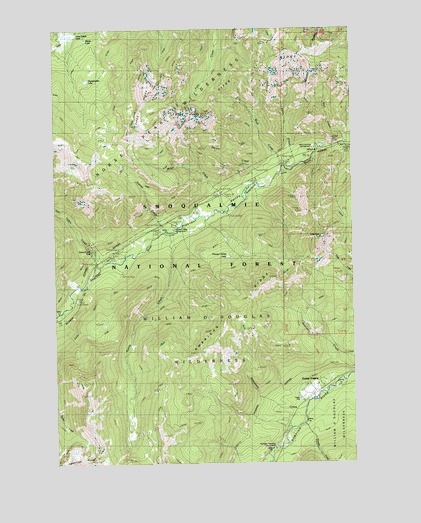
Goose Prairie, WA USGS Topographic Map
Click on map above to begin viewing in our Map Viewer.

This topographic map contains these locations and features:
Feature Name Type Latitude Longitude GNIS ID View Map
American RidgeRidgeN46.9395°W121.2650°1515852View Map
American Ridge TrailTrailN46.9332°W121.2704°1515853View Map
Bumping Crossing CampgroundLocaleN46.8793°W121.2834°1533029View Map
Camp FifeLocaleN46.8929°W121.2740°1517277View Map
Crow Creek LakeLakeN46.9986°W121.3687°1518351View Map
Crow Lake TrailTrailN46.9634°W121.3423°1518355View Map
Fifes PeaksSummitN46.9729°W121.3212°1519513View Map
Fifes Ridge TrailTrailN46.9726°W121.2904°1519515View Map
Goat PeakSummitN46.9398°W121.2645°1520053View Map
Goose PrairiePopulated PlaceN46.8951°W121.2670°1520150View Map
Goose Prairie TrailTrailN46.8859°W121.3101°1520151View Map
Gooseprairie Post Office (historical)Post OfficeN46.8951°W121.2670°2027222View Map
Hall CreekStreamN46.9676°W121.2545°1520462View Map
Hells Crossing CampgroundLocaleN46.9648°W121.2665°1533039View Map
Kettle CreekStreamN46.9415°W121.3259°1521635View Map
Kettle LakeLakeN46.8819°W121.3362°1521636View Map
Miner CreekStreamN46.9487°W121.3018°1523204View Map
Parker CreekStreamN46.9565°W121.2873°1524214View Map
Pinus CreekStreamN46.9609°W121.2737°1524472View Map
Pleasant ValleyValleyN46.9598°W121.2762°1524505View Map
Pleasant Valley CampgroundLocaleN46.9426°W121.3254°1524509View Map
Pleasant Valley LakeLakeN46.9347°W121.3035°1524510View Map
Sheepherder LakeLakeN46.9852°W121.3621°1525651View Map
Survey CreekStreamN46.9415°W121.3273°1526799View Map
Thunder CreekStreamN46.8862°W121.2726°1527181View Map
Union CreekStreamN46.9315°W121.3554°1527609View Map
Union Creek FallsFallsN46.9365°W121.3609°1527610View Map
Wash CreekStreamN46.9604°W121.2795°1527818View Map

Note: Coordinates in the location and feature list above are referenced to NAD83 datum.


Copyright (C) 2008-2025 Ryan Niemi / Sunset Dynamics ... All Rights Reserved