TopoQuest Logo
Do you find TopoQuest useful?
Help keep TopoQuest running and adding new maps/features by donating!
Bitcoin:  19c7KJd3qBynnjoSw5npx9KScwjBe4ifkT
Litecoin:  LXs6TkuXGGXo1vDsWCkWVdjQX94eUKd6ui
Home View Maps Find Maps Find Places Resources & Links


Gordon Creek, Nevada Topographic Map

USGS Map Title: Gordon Creek, NV
USGS Map MRC: 40115G1
DRG (GeoTIFF) Download: o40115g1.tif


Neighboring USGS Topographic Map Quads:


  Tent Mountain, NV  
40115H2
 

  Humboldt Peak, NV  
40115H1
 

  Tobar, NV  
40114H8
 

  Secret Valley, NV  
40115G2
 

  Gordon Creek, NV  
40115G1
 

  Snow Water Lake, NV  
40114G8
 

  Ruby City Creek, NV  
40115F2
 

  Arizona Spring, NV  
40115F1
 

  Spruce Mountain NW, NV  
40114F8


Map MRC Location:

N41°
W116°
N41°
W115°
H8 H7 H6 H5 H4 H3 H2 H1
G8 G7 G6 G5 G4 G3 G2 G1
F8 F7 F6 F5 F4 F3 F2 F1
E8 E7 E6 E5 E4 E3 E2 E1
D8 D7 D6 D5 D4 D3 D2 D1
C8 C7 C6 C5 C4 C3 C2 C1
B8 B7 B6 B5 B4 B3 B2 B1
A8 A7 A6 A5 A4 A3 A2 A1
N40°
W116°
N40°
W115°

Gordon Creek, NV USGS 1:24K Topographic Map Preview:
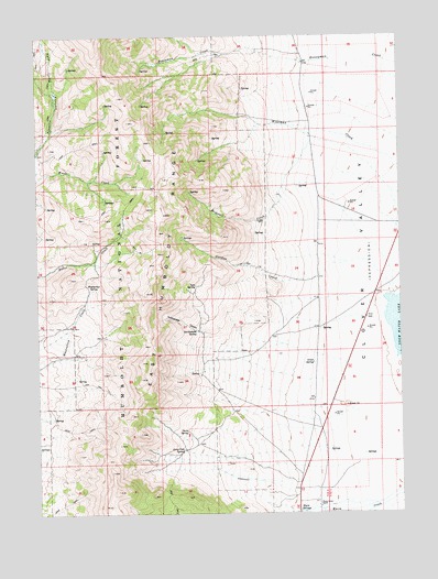
Gordon Creek, NV USGS Topographic Map
Click on map above to begin viewing in our Map Viewer.

This topographic map contains these locations and features:
Feature Name Type Latitude Longitude GNIS ID View Map
Agee SpringSpringN40.8096°W115.0709°858675View Map
Brough RanchLocaleN40.8491°W115.0314°862695View Map
Clover (historical)Populated PlaceN40.7549°W115.0392°862754View Map
Clover Valley Post Office (historical)Post OfficeN40.7549°W115.0392°864263View Map
Clover Valley Volunteer Fire DepartmentBuildingN40.8215°W115.0286°2581412View Map
Clover Valley Wildlife ReservoirReservoirN40.7649°W115.0636°862426View Map
Davis SpringSpringN40.7716°W115.0742°859463View Map
Gordon CreekStreamN40.8130°W115.0281°859859View Map
Gordon Creek Fire GuardLocaleN40.8352°W115.0437°862428View Map
Greek SpringSpringN40.7891°W115.0309°859896View Map
Jerry Crab SpringSpringN40.7669°W115.0759°860204View Map
Rattlesnake CanyonValleyN40.7921°W115.0531°861061View Map
Rattlesnake CreekStreamN40.7894°W115.0200°862427View Map
Rattlesnake SpringSpringN40.7974°W115.0709°861072View Map
Rockwall CreekStreamN40.8335°W115.0406°861157View Map
Steele RanchLocaleN40.8680°W115.0339°862713View Map
Warm Creek RanchLocaleN40.7519°W115.0295°861893View Map
Warm SpringsSpringN40.7502°W115.0362°861898View Map
Wells DivisionCivilN40.7747°W115.0058°1937485View Map
Woolverton SpringSpringN40.8085°W115.1062°862108View Map

Note: Coordinates in the location and feature list above are referenced to NAD83 datum.


Copyright (C) 2008-2024 Ryan Niemi / Sunset Dynamics ... All Rights Reserved