TopoQuest Logo
Do you find TopoQuest useful?
Help keep TopoQuest running and adding new maps/features by donating!
Bitcoin:  19c7KJd3qBynnjoSw5npx9KScwjBe4ifkT
Litecoin:  LXs6TkuXGGXo1vDsWCkWVdjQX94eUKd6ui
Home View Maps Find Maps Find Places Resources & Links


Gossville, New Hampshire Topographic Map

USGS Map Title: Gossville, NH
USGS Map MRC: 43071B3
DRG (GeoTIFF) Download: o43071b3.tif


Neighboring USGS Topographic Map Quads:


  Loudon, NH  
43071C4
 

  Pittsfield, NH  
43071C3
 

  Parker Mountain, NH  
43071C2
 

  Suncook, NH  
43071B4
 

  Gossville, NH  
43071B3
 

  Northwood, NH  
43071B2
 

  Manchester North, NH  
43071A4
 

  Candia, NH  
43071A3
 

  Mount Pawtuckaway, NH  
43071A2


Map MRC Location:

N44°
W72°
N44°
W71°
H8 H7 H6 H5 H4 H3 H2 H1
G8 G7 G6 G5 G4 G3 G2 G1
F8 F7 F6 F5 F4 F3 F2 F1
E8 E7 E6 E5 E4 E3 E2 E1
D8 D7 D6 D5 D4 D3 D2 D1
C8 C7 C6 C5 C4 C3 C2 C1
B8 B7 B6 B5 B4 B3 B2 B1
A8 A7 A6 A5 A4 A3 A2 A1
N43°
W72°
N43°
W71°

Gossville, NH USGS 1:24K Topographic Map Preview:
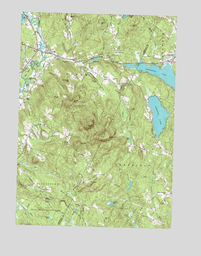
Gossville, NH USGS Topographic Map
Click on map above to begin viewing in our Map Viewer.

This topographic map contains these locations and features:
Feature Name Type Latitude Longitude GNIS ID View Map
Barton HillSummitN43.2451°W71.3106°865404View Map
Bear IslandIslandN43.2145°W71.3687°865447View Map
Bixby PondReservoirN43.2234°W71.3141°865605View Map
Bixby Pond DamDamN43.2229°W71.3170°1775800View Map
Blake BrookStreamN43.2212°W71.3270°865648View Map
Brush HillSummitN43.2006°W71.3423°865835View Map
Catamount TrailTrailN43.1442°W71.3706°866044View Map
Center School (historical)SchoolN43.2165°W71.3178°1916985View Map
Cornerstone Christian AcademySchoolN43.2031°W71.3695°2499400View Map
Dow PondLakeN43.1859°W71.2843°866623View Map
EpsomPopulated PlaceN43.2229°W71.3320°866806View Map
Epsom Baptist ChurchChurchN43.2248°W71.3453°1917047View Map
Epsom Baptist ChurchChurchN43.2234°W71.3323°1917048View Map
Epsom Central SchoolSchoolN43.2102°W71.3619°866807View Map
Epsom CirclePopulated PlaceN43.2279°W71.3603°871175View Map
Epsom Fire DepartmentBuildingN43.2250°W71.3433°2605072View Map
Epsom MountainSummitN43.2440°W71.2853°866808View Map
Epsom Post OfficePost OfficeN43.2302°W71.3605°1917049View Map
Evans CemeteryCemeteryN43.1566°W71.3699°866817View Map
Fairview CemeteryCemeteryN43.2263°W71.2552°866831View Map
Flat Meadow BrookStreamN43.2220°W71.2562°866890View Map
Fort MountainSummitN43.1842°W71.3192°866930View Map
GossvillePopulated PlaceN43.2265°W71.3509°867145View Map
Gossville CemeteryCemeteryN43.2271°W71.3523°1917089View Map
Griffin BrookStreamN43.2190°W71.2837°867257View Map
Gulf BrookStreamN43.2240°W71.3092°867280View Map
Hayes SwampReservoirN43.1417°W71.3662°1775678View Map
Hayes Swamp DamDamN43.1417°W71.3662°1775677View Map
Huckins DamDamN43.2217°W71.3645°1775880View Map
Leighton BrookStreamN43.2192°W71.3578°867988View Map
Levi HillSummitN43.1948°W71.2834°867996View Map
Little Bear BrookStreamN43.2234°W71.3012°868038View Map
Little River ReservoirReservoirN43.2217°W71.3645°1775881View Map
Little Suncook RiverStreamN43.2240°W71.3553°868097View Map
Lockes BrookStreamN43.2234°W71.3406°868118View Map
Lockes HillSummitN43.2484°W71.3353°868120View Map
Mason BrookStreamN43.2190°W71.3670°868297View Map
McClary CemeteryCemeteryN43.2179°W71.3184°868318View Map
McClary HillSummitN43.2123°W71.3001°868319View Map
McCoy MountainSummitN43.1984°W71.3306°868323View Map
Meetinghouse HillSummitN43.1454°W71.2515°868359View Map
Mount DelightSummitN43.1509°W71.3156°866541View Map
Mountain School (historical)SchoolN43.1742°W71.3359°1917188View Map
Mud PondLakeN43.1774°W71.2843°868638View Map
Narrows BrookStreamN43.2206°W71.2534°868674View Map
Nats MountainSummitN43.1742°W71.3256°868687View Map
New Orchard School (historical)SchoolN43.2415°W71.3381°1917220View Map
New RyePopulated PlaceN43.1840°W71.3634°868716View Map
New Rye Congregational ChurchChurchN43.1798°W71.3642°1917221View Map
North Road School (historical)SchoolN43.2309°W71.2998°1917229View Map
Northwood LakeLakeN43.2148°W71.2591°868831View Map
Northwood Lake DamDamN43.2201°W71.2912°1775263View Map
Nottingham MountainSummitN43.1781°W71.3026°868846View Map
Number 13 School (historical)SchoolN43.1365°W71.3159°1914444View Map
Pathfinder AcademySchoolN43.2324°W71.3621°2499502View Map
Pease BrookStreamN43.1404°W71.3367°869045View Map
Pleasant LakeReservoirN43.1919°W71.2622°869253View Map
Pleasant Lake DamDamN43.2017°W71.2712°1775080View Map
Police DeptBuildingN43.2322°W71.3607°2752864View Map
Round PondLakeN43.2088°W71.3673°869609View Map
Sandborn HillSummitN43.2106°W71.3348°869772View Map
Short FallsPopulated PlaceN43.1984°W71.3695°869913View Map
Smiths PondLakeN43.1296°W71.3470°869989View Map
Steeles FallsFallsN43.2106°W71.3128°870161View Map
Thurston PondReservoirN43.1389°W71.2980°870434View Map
Town of DeerfieldCivilN43.1381°W71.2569°873576View Map
Town of EpsomCivilN43.2149°W71.3391°873592View Map
Willow HillSummitN43.1298°W71.3037°870917View Map
WNHT-TV (Concord)TowerN43.1845°W71.3195°873521View Map

Note: Coordinates in the location and feature list above are referenced to NAD83 datum.


Copyright (C) 2008-2024 Ryan Niemi / Sunset Dynamics ... All Rights Reserved