TopoQuest Logo
Do you find TopoQuest useful?
Help keep TopoQuest running and adding new maps/features by donating!
Bitcoin:  19c7KJd3qBynnjoSw5npx9KScwjBe4ifkT
Litecoin:  LXs6TkuXGGXo1vDsWCkWVdjQX94eUKd6ui
Home View Maps Find Maps Find Places Resources & Links


Gould NW, Colorado Topographic Map

USGS Map Title: Gould NW, CO
USGS Map MRC: 40106F2
DRG (GeoTIFF) Download: o40106f2.tif


Neighboring USGS Topographic Map Quads:


  Cowdrey, CO  
40106G3
 

  Eagle Hill, CO  
40106G2
 

  Shipman Mountain, CO  
40106G1
 

  Walden, CO  
40106F3
 

  Gould NW, CO  
40106F2
 

  Johnny Moore Mountain, CO  
40106F1
 

  MacFarlane Reservoir, CO  
40106E3
 

  Owl Ridge, CO  
40106E2
 

  Gould, CO  
40106E1


Map MRC Location:

N41°
W107°
N41°
W106°
H8 H7 H6 H5 H4 H3 H2 H1
G8 G7 G6 G5 G4 G3 G2 G1
F8 F7 F6 F5 F4 F3 F2 F1
E8 E7 E6 E5 E4 E3 E2 E1
D8 D7 D6 D5 D4 D3 D2 D1
C8 C7 C6 C5 C4 C3 C2 C1
B8 B7 B6 B5 B4 B3 B2 B1
A8 A7 A6 A5 A4 A3 A2 A1
N40°
W107°
N40°
W106°

Gould NW, CO USGS 1:24K Topographic Map Preview:
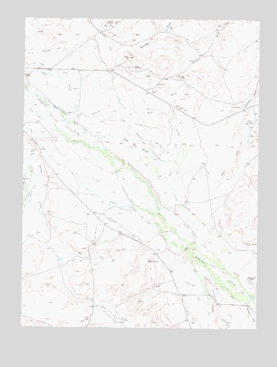
Gould NW, CO USGS Topographic Map
Click on map above to begin viewing in our Map Viewer.

This topographic map contains these locations and features:
Feature Name Type Latitude Longitude GNIS ID View Map
Bostwick DitchCanalN40.6705°W106.1589°172442View Map
Capron MineMineN40.7272°W106.1920°172435View Map
Carden Dagle DitchCanalN40.6361°W106.1561°202064View Map
Cleveland DitchCanalN40.6500°W106.1700°172444View Map
Conrad Coal MineMineN40.7144°W106.1353°172436View Map
Curtin DitchCanalN40.6772°W106.2089°202058View Map
Dike DitchCanalN40.7305°W106.2482°2711864View Map
Dry Fork Michigan RiverStreamN40.7239°W106.1659°172409View Map
Edith DitchCanalN40.6389°W106.1317°172445View Map
Hill and Crouter DitchCanalN40.6753°W106.2478°172443View Map
Hugh Griffith DitchCanalN40.7155°W106.2365°2722932View Map
Hugh Griffith Ditch Number 2CanalN40.7039°W106.2334°2722933View Map
Jakey DitchCanalN40.7105°W106.2450°202060View Map
Kimmons DrawValleyN40.6348°W106.1325°172462View Map
Lower Walden DitchCanalN40.7089°W106.2339°172439View Map
Mac Farlane Meadows DitchCanalN40.6578°W106.1624°2723362View Map
Manning Coal MinesMineN40.7472°W106.2050°172434View Map
Martin DitchCanalN40.6952°W106.2125°2723500View Map
Mathews DitchCanalN40.6723°W106.1801°2723501View Map
Mathews Eastern DitchCanalN40.6583°W106.1534°172447View Map
Meadow CreekStreamN40.6383°W106.1270°172498View Map
Meadow Creek DitchCanalN40.6706°W106.1717°2723531View Map
Michigan Association DitchCanalN40.7111°W106.2172°172441View Map
Monolith MineMineN40.7366°W106.1967°1683309View Map
Nancy Jane DitchCanalN40.7205°W106.2450°2723688View Map
Nellie E DitchCanalN40.6305°W106.2034°172448View Map
Old S C DitchCanalN40.6833°W106.2200°202059View Map
Owl CreekStreamN40.6641°W106.1778°172461View Map
Paul Ditch Number 1CanalN40.7035°W106.2311°2723991View Map
Paul Ditch Number 2CanalN40.6946°W106.2186°2723994View Map
Sage Hen CreekStreamN40.7014°W106.2136°172449View Map
Spring CreekStreamN40.6941°W106.2461°172450View Map
Sudduth Coal MineMineN40.7486°W106.1447°172433View Map
Terrell DitchCanalN40.6485°W106.1461°2631058View Map
Three Rivers RanchLocaleN40.6450°W106.1295°172437View Map
Walden DitchCanalN40.7041°W106.2256°172440View Map
Wales DitchCanalN40.7197°W106.2200°172438View Map

Note: Coordinates in the location and feature list above are referenced to NAD83 datum.


Copyright (C) 2008-2024 Ryan Niemi / Sunset Dynamics ... All Rights Reserved