TopoQuest Logo
Do you find TopoQuest useful?
Help keep TopoQuest running and adding new maps/features by donating!
Bitcoin:  19c7KJd3qBynnjoSw5npx9KScwjBe4ifkT
Litecoin:  LXs6TkuXGGXo1vDsWCkWVdjQX94eUKd6ui
Home View Maps Find Maps Find Places Resources & Links


Grace, Montana Topographic Map

USGS Map Title: Grace, MT
USGS Map MRC: 45112G3
DRG (GeoTIFF) Download: o45112g3.tif


Neighboring USGS Topographic Map Quads:


  Homestake, MT  
45112H4
 

  Delmoe Lake, MT  
45112H3
 

  Dry Mountain, MT  
45112H2
 

  Pipestone Pass, MT  
45112G4
 

  Grace, MT  
45112G3
 

  Vendome, MT  
45112G2
 

  Table Mountain, MT  
45112F4
 

  Silver Star, MT  
45112F3
 

  Waterloo, MT  
45112F2


Map MRC Location:

N46°
W113°
N46°
W112°
H8 H7 H6 H5 H4 H3 H2 H1
G8 G7 G6 G5 G4 G3 G2 G1
F8 F7 F6 F5 F4 F3 F2 F1
E8 E7 E6 E5 E4 E3 E2 E1
D8 D7 D6 D5 D4 D3 D2 D1
C8 C7 C6 C5 C4 C3 C2 C1
B8 B7 B6 B5 B4 B3 B2 B1
A8 A7 A6 A5 A4 A3 A2 A1
N45°
W113°
N45°
W112°

Grace, MT USGS 1:24K Topographic Map Preview:
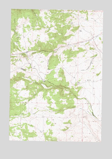
Grace, MT USGS Topographic Map
Click on map above to begin viewing in our Map Viewer.

This topographic map contains these locations and features:
Feature Name Type Latitude Longitude GNIS ID View Map
Cactus JunctionLocaleN45.8488°W112.2625°794167View Map
CedricPopulated PlaceN45.8249°W112.2664°781122View Map
Colbert CreekStreamN45.8538°W112.2514°781486View Map
Cold SpringSpringN45.8555°W112.2825°781493View Map
Friend SpringSpringN45.8624°W112.2951°783757View Map
GracePopulated PlaceN45.8066°W112.3303°784142View Map
Grace (historical)LocaleN45.8066°W112.3303°1797854View Map
Grace Post Office (historical)Post OfficeN45.8066°W112.3303°1797853View Map
Little Fish CreekStreamN45.7785°W112.2633°778816View Map
Montana State Highway Department Section HouseLocaleN45.8374°W112.3133°798897View Map
Mud SpringSpringN45.8083°W112.2714°787812View Map
Mud SpringsSpringN45.8178°W112.3250°787816View Map
Mud Springs CreekStreamN45.8352°W112.3172°787817View Map
NE SW Section 14 MineMineN45.8355°W112.3175°803569View Map
Nineteen MileLocaleN45.8341°W112.3550°788017View Map
North Fork Little Pipestone CreekStreamN45.8338°W112.3556°788201View Map
Poison SpringSpringN45.8060°W112.2845°789038View Map
Rader CreekStreamN45.8419°W112.2950°789322View Map
Rader Creek Census Designated PlaceCensusN45.8456°W112.3160°2583837View Map
Root CreekStreamN45.8266°W112.3239°789769View Map
SE SW Section 7 MineMineN45.8471°W112.2717°803568View Map
Toll Mountain CampgroundLocaleN45.8480°W112.3667°792241View Map
Two Heart CreekStreamN45.7999°W112.3244°792550View Map

Note: Coordinates in the location and feature list above are referenced to NAD83 datum.


Copyright (C) 2008-2024 Ryan Niemi / Sunset Dynamics ... All Rights Reserved