TopoQuest Logo
Do you find TopoQuest useful?
Help keep TopoQuest running and adding new maps/features by donating!
Bitcoin:  19c7KJd3qBynnjoSw5npx9KScwjBe4ifkT
Litecoin:  LXs6TkuXGGXo1vDsWCkWVdjQX94eUKd6ui
Home View Maps Find Maps Find Places Resources & Links


Grafton, North Dakota Topographic Map

USGS Map Title: Grafton, ND
USGS Map MRC: 48097D4
DRG (GeoTIFF) Download: o48097d4.tif


Neighboring USGS Topographic Map Quads:


  Crystal SE, ND  
48097E5
 

  Saint Thomas, ND  
48097E4
 

  North Salt Lake, ND  
48097E3
 

  Nash, ND  
48097D5
 

  Grafton, ND  
48097D4
 

  Oakwood, ND  
48097D3
 

  Veseleyville, ND  
48097C5
 

  Voss, ND  
48097C4
 

  Minto, ND  
48097C3


Map MRC Location:

N49°
W98°
N49°
W97°
H8 H7 H6 H5 H4 H3 H2 H1
G8 G7 G6 G5 G4 G3 G2 G1
F8 F7 F6 F5 F4 F3 F2 F1
E8 E7 E6 E5 E4 E3 E2 E1
D8 D7 D6 D5 D4 D3 D2 D1
C8 C7 C6 C5 C4 C3 C2 C1
B8 B7 B6 B5 B4 B3 B2 B1
A8 A7 A6 A5 A4 A3 A2 A1
N48°
W98°
N48°
W97°

Grafton, ND USGS 1:24K Topographic Map Preview:
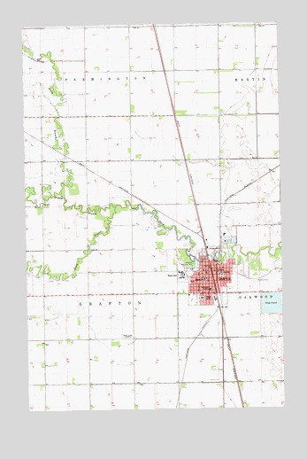
Grafton, ND USGS Topographic Map
Click on map above to begin viewing in our Map Viewer.

This topographic map contains these locations and features:
Feature Name Type Latitude Longitude GNIS ID View Map
Carnegie Regional LibraryBuildingN48.4178°W97.4123°2745460View Map
Century Elementary SchoolSchoolN48.4077°W97.4242°2747788View Map
Chase SchoolSchoolN48.4189°W97.4042°1028348View Map
City of GraftonCivilN48.4146°W97.4067°1036063View Map
Deaconess Hospital (historical)HospitalN48.4136°W97.4101°1028629View Map
GraftonPopulated PlaceN48.4122°W97.4106°1029194View Map
Grafton Central Middle SchoolSchoolN48.4072°W97.4241°1028329View Map
Grafton City CemeteryCemeteryN48.4133°W97.4015°2775782View Map
Grafton City Fire Department 2BuildingN48.4128°W97.4246°2637697View Map
Grafton City HallBuildingN48.4207°W97.4108°2744667View Map
Grafton DamDamN48.4250°W97.4087°1033074View Map
Grafton Fire Station 1BuildingN48.4209°W97.4108°2637591View Map
Grafton High SchoolSchoolN48.4072°W97.4235°2747789View Map
Grafton Lutheran CemeteryCemeteryN48.4170°W97.4205°2775781View Map
Grafton Police DepartmentBuildingN48.4177°W97.4051°2734452View Map
Grafton Post OfficePost OfficeN48.4194°W97.4123°2742022View Map
Heritage Village and Jugville MuseumBuildingN48.4142°W97.4218°2748960View Map
Historic Elmwood House MuseumBuildingN48.4221°W97.4055°2748961View Map
KXPO-AM (Grafton)TowerN48.3980°W97.4492°1033437View Map
Leistikow Memorial ParkParkN48.4225°W97.4176°1029861View Map
Lutheran Sunset HomeBuildingN48.4210°W97.4003°2748738View Map
Middle Branch Park RiverStreamN48.4408°W97.4554°1030218View Map
North Branch Park RiverStreamN48.4464°W97.4826°1030447View Map
Saint Johns Catholic CemeteryCemeteryN48.4164°W97.3890°1031164View Map
South Branch Park RiverStreamN48.4408°W97.4556°1032184View Map
Township of FarmingtonCivilN48.4995°W97.4698°1036545View Map
Township of GraftonCivilN48.4124°W97.4732°1036535View Map
Unity Medical CenterHospitalN48.4110°W97.4145°1031186View Map
Valley Ambulance and Rescue ServiceBuildingN48.4111°W97.4133°2658805View Map
Vigness DamDamN48.4250°W97.4054°1033124View Map
Walsh County CourthouseBuildingN48.4185°W97.4047°2743620View Map
Walsh County JailBuildingN48.4178°W97.4050°2734499View Map
Walsh County Sheriff's OfficeBuildingN48.4180°W97.4051°2734390View Map
Western PlazaLocaleN48.4125°W97.4256°1033399View Map

Note: Coordinates in the location and feature list above are referenced to NAD83 datum.


Copyright (C) 2008-2024 Ryan Niemi / Sunset Dynamics ... All Rights Reserved