TopoQuest Logo
Do you find TopoQuest useful?
Help keep TopoQuest running and adding new maps/features by donating!
Bitcoin:  19c7KJd3qBynnjoSw5npx9KScwjBe4ifkT
Litecoin:  LXs6TkuXGGXo1vDsWCkWVdjQX94eUKd6ui
Home View Maps Find Maps Find Places Resources & Links


Grandmother Mountain East, New Mexico Topographic Map

USGS Map Title: Grandmother Mountain East, NM
USGS Map MRC: 32108C1
DRG (GeoTIFF) Download: o32108c1.tif


Neighboring USGS Topographic Map Quads:


  Cow Springs Mountain, NM  
32108D2
 

  Antelope Hill, NM  
32108D1
 

  Spalding, NM  
32107D8
 

  Grandmother Mountain West, NM  
32108C2
 

  Grandmother Mountain East, NM  
32108C1
 

  Williams Ranch, NM  
32107C8
 

  Gage NW, NM  
32108B2
 

  Gage, NM  
32108B1
 

  Red Mountain, NM  
32107B8


Map MRC Location:

N33°
W109°
N33°
W108°
H8 H7 H6 H5 H4 H3 H2 H1
G8 G7 G6 G5 G4 G3 G2 G1
F8 F7 F6 F5 F4 F3 F2 F1
E8 E7 E6 E5 E4 E3 E2 E1
D8 D7 D6 D5 D4 D3 D2 D1
C8 C7 C6 C5 C4 C3 C2 C1
B8 B7 B6 B5 B4 B3 B2 B1
A8 A7 A6 A5 A4 A3 A2 A1
N32°
W109°
N32°
W108°

Grandmother Mountain East, NM USGS 1:24K Topographic Map Preview:
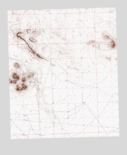
Grandmother Mountain East, NM USGS Topographic Map
Click on map above to begin viewing in our Map Viewer.

This topographic map contains these locations and features:
Feature Name Type Latitude Longitude GNIS ID View Map
01261 Water WellWellN32.3476°W108.0745°922514View Map
01366 Water WellWellN32.3245°W108.0386°922513View Map
01367 Water WellWellN32.3001°W108.0386°922512View Map
01370 Water WellWellN32.2735°W108.1074°925426View Map
01388 Water WellWellN32.2531°W108.0908°922509View Map
06037 Water WellWellN32.2993°W108.0559°925444View Map
06092 Water WellWellN32.3052°W108.0585°925446View Map
Benedict RanchLocaleN32.2731°W108.1075°886210View Map
Clabber Top HillSummitN32.3384°W108.0045°899586View Map
Davis RanchLocaleN32.2834°W108.0409°888215View Map
Dunn WindmillLocaleN32.3054°W108.0584°888579View Map
Gage WindmillLocaleN32.2529°W108.0906°889279View Map
Little Grandmother MountainSummitN32.3509°W108.1139°899724View Map
New WindmillLocaleN32.3476°W108.0742°892513View Map
North WindmillLocaleN32.3520°W108.0250°892717View Map
Number 1255 Water WellWellN32.3520°W108.0252°923256View Map
Rimrock WindmillLocaleN32.3245°W108.1064°893912View Map
Stevens WindmillLocaleN32.3734°W108.0789°895343View Map
Well 5 Water WellWellN32.2534°W108.0256°922510View Map

Note: Coordinates in the location and feature list above are referenced to NAD83 datum.


Copyright (C) 2008-2025 Ryan Niemi / Sunset Dynamics ... All Rights Reserved