TopoQuest Logo
Do you find TopoQuest useful?
Help keep TopoQuest running and adding new maps/features by donating!
Bitcoin:  19c7KJd3qBynnjoSw5npx9KScwjBe4ifkT
Litecoin:  LXs6TkuXGGXo1vDsWCkWVdjQX94eUKd6ui
Home View Maps Find Maps Find Places Resources & Links


Granite Lake, Idaho Topographic Map

USGS Map Title: Granite Lake, ID
USGS Map MRC: 45116A1
DRG (GeoTIFF) Download: o45116a1.tif


Neighboring USGS Topographic Map Quads:


  Hazard Lake, ID  
45116B2
 

  Black Tip, ID  
45116B1
 

  Victor Peak, ID  
45115B8
 

  Brundage Mountain, ID  
45116A2
 

  Granite Lake, ID  
45116A1
 

  Box Lake, ID  
45115A8
 

  Meadows, ID  
44116H2
 

  McCall, ID  
44116H1
 

  Fitsum Summit, ID  
44115H8


Map MRC Location:

N46°
W117°
N46°
W116°
H8 H7 H6 H5 H4 H3 H2 H1
G8 G7 G6 G5 G4 G3 G2 G1
F8 F7 F6 F5 F4 F3 F2 F1
E8 E7 E6 E5 E4 E3 E2 E1
D8 D7 D6 D5 D4 D3 D2 D1
C8 C7 C6 C5 C4 C3 C2 C1
B8 B7 B6 B5 B4 B3 B2 B1
A8 A7 A6 A5 A4 A3 A2 A1
N45°
W117°
N45°
W116°

Granite Lake, ID USGS 1:24K Topographic Map Preview:
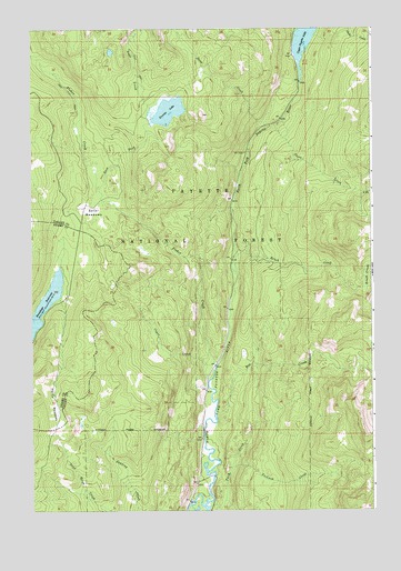
Granite Lake, ID USGS Topographic Map
Click on map above to begin viewing in our Map Viewer.

This topographic map contains these locations and features:
Feature Name Type Latitude Longitude GNIS ID View Map
Box CreekStreamN45.0241°W116.0573°378151View Map
Brundage ReservoirReservoirN45.0528°W116.1211°378315View Map
Brush CreekStreamN45.0618°W116.0504°378331View Map
Copet CreekStreamN45.0335°W116.0610°379686View Map
Deep CreekStreamN45.0993°W116.0393°380389View Map
East Fork Fisher CreekStreamN45.0835°W116.0998°381099View Map
Elip CreekStreamN45.0024°W116.0548°381319View Map
Fisher CreekStreamN45.0374°W116.0585°381777View Map
Granite LakeReservoirN45.1036°W116.0745°397758View Map
Granite Lake DamDamN45.1016°W116.0810°398845View Map
Hartly MeadowsFlatN45.0288°W116.1165°382944View Map
Lake CreekStreamN45.1043°W116.0815°384365View Map
North Fork Pearl CreekStreamN45.0824°W116.0037°387750View Map
Pearl CreekStreamN45.1007°W116.0337°388306View Map
Sater MeadowsFlatN45.0777°W116.1021°389925View Map
Twah CreekStreamN45.0010°W116.0601°392475View Map
Upper Payette Lake CampgroundLocaleN45.1227°W116.0290°394386View Map
Upper Payette Lake DamDamN45.1110°W116.0265°400197View Map
Yockwah CreekStreamN45.0113°W116.0518°393768View Map

Note: Coordinates in the location and feature list above are referenced to NAD83 datum.


Copyright (C) 2008-2025 Ryan Niemi / Sunset Dynamics ... All Rights Reserved