TopoQuest Logo
Do you find TopoQuest useful?
Help keep TopoQuest running and adding new maps/features by donating!
Bitcoin:  19c7KJd3qBynnjoSw5npx9KScwjBe4ifkT
Litecoin:  LXs6TkuXGGXo1vDsWCkWVdjQX94eUKd6ui
Home View Maps Find Maps Find Places Resources & Links


Granite Peak, Nevada Topographic Map

USGS Map Title: Granite Peak, NV
USGS Map MRC: 39119G8
DRG (GeoTIFF) Download: o39119g8.tif


Neighboring USGS Topographic Map Quads:


  Constantia, CA  
39120H1


  Beckwourth Pass, CA  
39120G1
 

  Granite Peak, NV  
39119G8
 

  Bedell Flat, NV  
39119G7
 

  Evans Canyon, CA  
39120F1
 

  Reno NW, NV  
39119F8
 

  Reno NE, NV  
39119F7


Map MRC Location:

N40°
W120°
N40°
W119°
H8 H7 H6 H5 H4 H3 H2 H1
G8 G7 G6 G5 G4 G3 G2 G1
F8 F7 F6 F5 F4 F3 F2 F1
E8 E7 E6 E5 E4 E3 E2 E1
D8 D7 D6 D5 D4 D3 D2 D1
C8 C7 C6 C5 C4 C3 C2 C1
B8 B7 B6 B5 B4 B3 B2 B1
A8 A7 A6 A5 A4 A3 A2 A1
N39°
W120°
N39°
W119°

Granite Peak, NV USGS 1:24K Topographic Map Preview:
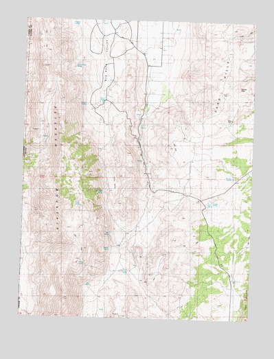
Granite Peak, NV USGS Topographic Map
Click on map above to begin viewing in our Map Viewer.

This topographic map contains these locations and features:
Feature Name Type Latitude Longitude GNIS ID View Map
August SpringSpringN39.8737°W119.9719°838530View Map
Biltz SpringSpringN39.7846°W119.9529°850647View Map
Bird SpringSpringN39.7990°W119.8995°838790View Map
Buckhorn MineMineN39.8210°W119.9994°855173View Map
Chokecherry SpringSpringN39.8513°W119.9705°839514View Map
Dickinson RanchLocaleN39.8394°W119.9571°847580View Map
French MountainsRangeN39.8096°W119.8777°848459View Map
Granite PeakSummitN39.8446°W119.8896°840752View Map
Hillside SpringSpringN39.7797°W119.9528°841007View Map
Horse SpringSpringN39.7728°W119.9661°841107View Map
Juniper SpringSpringN39.7993°W119.8974°841449View Map
Lake SpringSpringN39.7975°W119.9720°841552View Map
Little ValleyBasinN39.8069°W119.9516°850648View Map
Little Valley SpringSpringN39.8033°W119.9571°853517View Map
Middle Red Rock ValleyBasinN39.8730°W119.9274°857296View Map
Mud SpringSpringN39.7639°W119.9646°842305View Map
Pasture WellWellN39.7671°W119.8852°842744View Map
Petersen MountainRangeN39.7957°W119.9763°860927View Map
Red Rock Volunteer Fire Department Station 240BuildingN39.8699°W119.9604°2581285View Map
Sand HillsRangeN39.8513°W119.8935°849694View Map
Stateline Peak Mining DistrictCivilN39.7671°W119.9444°855174View Map
Summit SpringSpringN39.7700°W119.9424°844089View Map
Tunnel SpringSpringN39.8395°W119.9675°844456View Map
Whitney SpringSpringN39.8097°W119.8871°844835View Map

Note: Coordinates in the location and feature list above are referenced to NAD83 datum.


Copyright (C) 2008-2025 Ryan Niemi / Sunset Dynamics ... All Rights Reserved