TopoQuest Logo
Do you find TopoQuest useful?
Help keep TopoQuest running and adding new maps/features by donating!
Bitcoin:  19c7KJd3qBynnjoSw5npx9KScwjBe4ifkT
Litecoin:  LXs6TkuXGGXo1vDsWCkWVdjQX94eUKd6ui
Home View Maps Find Maps Find Places Resources & Links


Green Ridge North, Missouri Topographic Map

USGS Map Title: Green Ridge North, MO
USGS Map MRC: 38093F4
DRG (GeoTIFF) Download: o38093f4.tif


Neighboring USGS Topographic Map Quads:


  Knob Noster, MO  
38093G5
 

  La Monte, MO  
38093G4
 

  Hughesville, MO  
38093G3
 

  Burtville, MO  
38093F5
 

  Green Ridge North, MO  
38093F4
 

  Sedalia West, MO  
38093F3
 

  Windsor, MO  
38093E5
 

  Green Ridge South, MO  
38093E4
 

  Ionia, MO  
38093E3


Map MRC Location:

N39°
W94°
N39°
W93°
H8 H7 H6 H5 H4 H3 H2 H1
G8 G7 G6 G5 G4 G3 G2 G1
F8 F7 F6 F5 F4 F3 F2 F1
E8 E7 E6 E5 E4 E3 E2 E1
D8 D7 D6 D5 D4 D3 D2 D1
C8 C7 C6 C5 C4 C3 C2 C1
B8 B7 B6 B5 B4 B3 B2 B1
A8 A7 A6 A5 A4 A3 A2 A1
N38°
W94°
N38°
W93°

Green Ridge North, MO USGS 1:24K Topographic Map Preview:
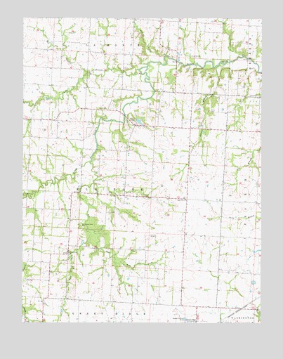
Green Ridge North, MO USGS Topographic Map
Click on map above to begin viewing in our Map Viewer.

This topographic map contains these locations and features:
Feature Name Type Latitude Longitude GNIS ID View Map
Allen School (historical)SchoolN38.7453°W93.4663°745410View Map
Bee BranchStreamN38.7275°W93.4664°713856View Map
Bethel School (historical)SchoolN38.7011°W93.4863°745416View Map
Botts CemeteryCemeteryN38.7120°W93.4021°714553View Map
Brushy CreekStreamN38.7345°W93.4258°714897View Map
Craighead CemeteryCemeteryN38.7350°W93.4127°716457View Map
Crystal Springs School (historical)SchoolN38.7200°W93.4197°745413View Map
East Elk ForkStreamN38.6508°W93.4516°717271View Map
Elk ForkStreamN38.6908°W93.4652°729733View Map
Elm ForkStreamN38.6822°W93.4630°717511View Map
Hickory Point ChurchChurchN38.6536°W93.4760°719488View Map
Hickory Point School (historical)SchoolN38.6558°W93.4758°745417View Map
Hughes Lake DamDamN38.7083°W93.4402°764493View Map
Jackson School (historical)SchoolN38.7497°W93.3827°745412View Map
Lone Elm School (historical)SchoolN38.7050°W93.4224°745414View Map
Long BranchStreamN38.7288°W93.4395°721508View Map
Old Bethel CemeteryCemeteryN38.7133°W93.4608°714030View Map
Old Hickory Point CemeteryCemeteryN38.6653°W93.4695°723756View Map
Pleasant Green School (historical)SchoolN38.7486°W93.4233°745411View Map
Prairie View ChurchChurchN38.6756°W93.4149°724893View Map
Prairie View School (historical)SchoolN38.6758°W93.4230°745415View Map
Rabourn CemeteryCemeteryN38.7075°W93.4427°725039View Map
Township of Elk ForkCivilN38.6772°W93.4511°767163View Map
Walnut BranchStreamN38.7311°W93.3949°728291View Map
West Elk ForkStreamN38.6631°W93.4669°728546View Map
Weston Lake DamDamN38.6983°W93.4052°763365View Map

Note: Coordinates in the location and feature list above are referenced to NAD83 datum.


Copyright (C) 2008-2025 Ryan Niemi / Sunset Dynamics ... All Rights Reserved