TopoQuest Logo
Do you find TopoQuest useful?
Help keep TopoQuest running and adding new maps/features by donating!
Bitcoin:  19c7KJd3qBynnjoSw5npx9KScwjBe4ifkT
Litecoin:  LXs6TkuXGGXo1vDsWCkWVdjQX94eUKd6ui
Home View Maps Find Maps Find Places Resources & Links


Green River, Wyoming Topographic Map

USGS Map Title: Green River, WY
USGS Map MRC: 41109E4
DRG (GeoTIFF) Download: o41109e4.tif


Neighboring USGS Topographic Map Quads:


  Austin Ranch, WY  
41109F5
 

  Scott Spring, WY  
41109F4
 

  Pilot Butte, WY  
41109F3
 

  Peru, WY  
41109E5
 

  Green River, WY  
41109E4
 

  Kanda, WY  
41109E3
 

  Blacks Fork Bridge, WY  
41109D5
 

  Whalen Butte, WY  
41109D4
 

  Wilkins Peak, WY  
41109D3


Map MRC Location:

N42°
W110°
N42°
W109°
H8 H7 H6 H5 H4 H3 H2 H1
G8 G7 G6 G5 G4 G3 G2 G1
F8 F7 F6 F5 F4 F3 F2 F1
E8 E7 E6 E5 E4 E3 E2 E1
D8 D7 D6 D5 D4 D3 D2 D1
C8 C7 C6 C5 C4 C3 C2 C1
B8 B7 B6 B5 B4 B3 B2 B1
A8 A7 A6 A5 A4 A3 A2 A1
N41°
W110°
N41°
W109°

Green River, WY USGS 1:24K Topographic Map Preview:
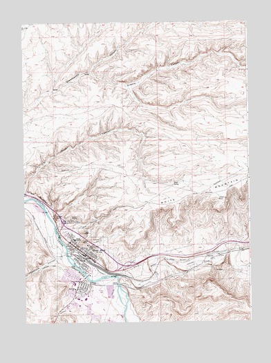
Green River, WY USGS Topographic Map
Click on map above to begin viewing in our Map Viewer.

This topographic map contains these locations and features:
Feature Name Type Latitude Longitude GNIS ID View Map
Acme PitMineN41.5189°W109.4714°1747010View Map
Bitter CreekStreamN41.5180°W109.4507°1585574View Map
Castle RockPillarN41.5339°W109.4679°1586441View Map
Castle Rock Ambulance ServicesBuildingN41.5089°W109.4789°2673660View Map
Castle Rock Convalescent CenterHospitalN41.5286°W109.4662°1794908View Map
City of Green RiverCivilN41.5124°W109.4708°2410656View Map
Eagle RockPillarN41.5339°W109.4679°1587992View Map
First SpringSpringN41.5584°W109.4167°1588491View Map
Flaming Gorge Shopping CenterLocaleN41.5286°W109.4662°1764041View Map
Giants ThumbPillarN41.5433°W109.4737°1588878View Map
Granger Volunteer Fire DepartmentBuildingN41.5266°W109.4707°2673461View Map
Green RiverPopulated PlaceN41.5286°W109.4662°1589126View Map
Green River Area MineMineN41.5277°W109.4854°1747011View Map
Green River Area MineMineN41.6144°W109.4826°1747012View Map
Green River Fire Department Station 2BuildingN41.5088°W109.4631°2673441View Map
Green River Police DepartmentBuildingN41.5298°W109.4667°2752617View Map
Green River Post OfficePost OfficeN41.5166°W109.4709°2767840View Map
Greens CanyonValleyN41.6044°W109.4635°1589132View Map
Hutton Heights Shopping CenterLocaleN41.5286°W109.4662°1764042View Map
Island ParkParkN41.5233°W109.4712°1589981View Map
KUGR-AM (Green River)TowerN41.5155°W109.4371°1608803View Map
Lincoln High SchoolSchoolN41.5344°W109.4721°1590695View Map
Old Stage StationLocaleN41.5169°W109.4643°1592405View Map
Riverview CemeteryCemeteryN41.5336°W109.4579°1593492View Map
Roosevelt SchoolSchoolN41.5141°W109.4726°1593638View Map
Sugar Bowl RockPillarN41.5427°W109.4721°1595146View Map
Sweetwater County Sheriff's OfficeBuildingN41.5298°W109.4678°2752685View Map
Teakettle RockPillarN41.5419°W109.4729°1595338View Map
Telephone CanyonValleyN41.5266°W109.4821°1603549View Map
The PalisadesCliffN41.5536°W109.4924°1595455View Map
The TowersSummitN41.5433°W109.4701°1595477View Map
Tollgate RockPillarN41.5447°W109.4826°1595614View Map
Washington SchoolSchoolN41.5314°W109.4632°1596067View Map

Note: Coordinates in the location and feature list above are referenced to NAD83 datum.


Copyright (C) 2008-2025 Ryan Niemi / Sunset Dynamics ... All Rights Reserved