TopoQuest Logo
Do you find TopoQuest useful?
Help keep TopoQuest running and adding new maps/features by donating!
Bitcoin:  19c7KJd3qBynnjoSw5npx9KScwjBe4ifkT
Litecoin:  LXs6TkuXGGXo1vDsWCkWVdjQX94eUKd6ui
Home View Maps Find Maps Find Places Resources & Links


Greenfield, Iowa Topographic Map

USGS Map Title: Greenfield, IA
USGS Map MRC: 41094C4
DRG (GeoTIFF) Download: o41094c4.tif


Neighboring USGS Topographic Map Quads:


  Canby, IA  
41094D5
 

  Rosserdale, IA  
41094D4
 

  Stuart South, IA  
41094D3
 

  Fontanelle, IA  
41094C5
 

  Greenfield, IA  
41094C4
 

  Arbor Hill, IA  
41094C3
 

  Nevinville, IA  
41094B5
 

  Orient, IA  
41094B4
 

  Zion, IA  
41094B3


Map MRC Location:

N42°
W95°
N42°
W94°
H8 H7 H6 H5 H4 H3 H2 H1
G8 G7 G6 G5 G4 G3 G2 G1
F8 F7 F6 F5 F4 F3 F2 F1
E8 E7 E6 E5 E4 E3 E2 E1
D8 D7 D6 D5 D4 D3 D2 D1
C8 C7 C6 C5 C4 C3 C2 C1
B8 B7 B6 B5 B4 B3 B2 B1
A8 A7 A6 A5 A4 A3 A2 A1
N41°
W95°
N41°
W94°

Greenfield, IA USGS 1:24K Topographic Map Preview:
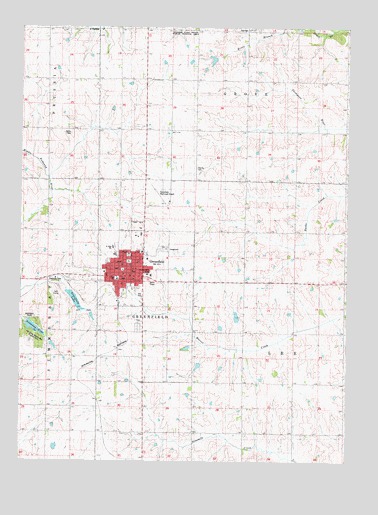
Greenfield, IA USGS Topographic Map
Click on map above to begin viewing in our Map Viewer.

This topographic map contains these locations and features:
Feature Name Type Latitude Longitude GNIS ID View Map
Adair CountyCivilN41.3307°W94.4709°465190View Map
Adair County CemeteryCemeteryN41.3344°W94.4333°463587View Map
Adair County CourthouseBuildingN41.3053°W94.4611°1970120View Map
Adair County FairgroundsLocaleN41.3111°W94.4447°1970121View Map
Adair County Historical MuseumBuildingN41.3039°W94.4811°1970122View Map
Adair County Memorial HospitalHospitalN41.3038°W94.4518°463586View Map
Adair County Sheriff's OfficeBuildingN41.3049°W94.4575°1970125View Map
City of GreenfieldCivilN41.3056°W94.4592°2394989View Map
Clara ChapelChurchN41.3378°W94.3766°455421View Map
Cornerstone Evangelical Free ChurchChurchN41.3039°W94.4608°1970138View Map
Country ClubLocaleN41.2986°W94.4864°1970118View Map
First Presbyterian ChurchChurchN41.3028°W94.4614°1970137View Map
GreenfieldPopulated PlaceN41.3053°W94.4614°457121View Map
Greenfield (historical)LocaleN41.2958°W94.4625°1970128View Map
Greenfield CemeteryCemeteryN41.2888°W94.4546°457122View Map
Greenfield Chiropractic CenterHospitalN41.3044°W94.4608°1970131View Map
Greenfield City ParkParkN41.3078°W94.4586°1970119View Map
Greenfield LakeReservoirN41.2963°W94.4793°1823191View Map
Greenfield LibraryBuildingN41.3039°W94.4614°1970124View Map
Greenfield ManorHospitalN41.3036°W94.4502°1970130View Map
Greenfield Municipal AirportAirportN41.3258°W94.4445°466803View Map
Greenfield Police DepartmentBuildingN41.3048°W94.4575°1970123View Map
Greenfield Post OfficePost OfficeN41.3044°W94.4600°1970127View Map
Greenfield Volunteer Fire DepartmentBuildingN41.3044°W94.4619°1970117View Map
Greenfield Wastewater PlantLocaleN41.2975°W94.4558°2728355View Map
Groveland Post Office (historical)Post OfficeN41.3583°W94.4333°466573View Map
Immanuel Lutheran ChurchChurchN41.3103°W94.4536°1970132View Map
Iowa Aviation Preservation CenterBuildingN41.3250°W94.4433°1970126View Map
Ken Sidey Nature AreaParkN41.2864°W94.4950°463934View Map
Lemont (historical)Populated PlaceN41.3328°W94.4697°465492View Map
Living Word Family ChurchChurchN41.3105°W94.4527°1970136View Map
Nodaway LakeReservoirN41.2883°W94.4949°459539View Map
Nodaway ParkParkN41.2892°W94.4930°459540View Map
Nodaway Valley East Elementary SchoolSchoolN41.3097°W94.4640°1970139View Map
Nodaway Valley High SchoolSchoolN41.3120°W94.4647°1970129View Map
Plymouth Brethren Gospel ChapelChurchN41.3055°W94.4558°1970133View Map
Saint Johns Catholic ChurchChurchN41.3092°W94.4580°1970134View Map
School Number 4LocaleN41.3750°W94.4536°465895View Map
Township of GreenfieldCivilN41.2945°W94.4523°467972View Map
Township of GroveCivilN41.3740°W94.4138°467980View Map
Township of LeeCivilN41.2860°W94.4063°468197View Map
United Methodist ChurchChurchN41.3044°W94.4680°1970135View Map

Note: Coordinates in the location and feature list above are referenced to NAD83 datum.


Copyright (C) 2008-2025 Ryan Niemi / Sunset Dynamics ... All Rights Reserved