TopoQuest Logo
Do you find TopoQuest useful?
Help keep TopoQuest running and adding new maps/features by donating!
Bitcoin:  19c7KJd3qBynnjoSw5npx9KScwjBe4ifkT
Litecoin:  LXs6TkuXGGXo1vDsWCkWVdjQX94eUKd6ui
Home View Maps Find Maps Find Places Resources & Links


Gretna, Virginia Topographic Map

USGS Map Title: Gretna, VA
USGS Map MRC: 36079H3
DRG (GeoTIFF) Download: o36079h3.tif


Neighboring USGS Topographic Map Quads:


  Leesville, VA  
37079A4
 

  Altavista, VA  
37079A3
 

  Straightstone, VA  
37079A2
 

  Pittsville, VA  
36079H4
 

  Gretna, VA  
36079H3
 

  Mount Airy, VA  
36079H2
 

  Chatham, VA  
36079G4
 

  Spring Garden, VA  
36079G3
 

  Java, VA  
36079G2


Map MRC Location:

N37°
W80°
N37°
W79°
H8 H7 H6 H5 H4 H3 H2 H1
G8 G7 G6 G5 G4 G3 G2 G1
F8 F7 F6 F5 F4 F3 F2 F1
E8 E7 E6 E5 E4 E3 E2 E1
D8 D7 D6 D5 D4 D3 D2 D1
C8 C7 C6 C5 C4 C3 C2 C1
B8 B7 B6 B5 B4 B3 B2 B1
A8 A7 A6 A5 A4 A3 A2 A1
N36°
W80°
N36°
W79°

Gretna, VA USGS 1:24K Topographic Map Preview:
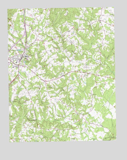
Gretna, VA USGS Topographic Map
Click on map above to begin viewing in our Map Viewer.

This topographic map contains these locations and features:
Feature Name Type Latitude Longitude GNIS ID View Map
Chalk LevelPopulated PlaceN36.9185°W79.2778°1495372View Map
Coles HillPopulated PlaceN36.8757°W79.3006°1495411View Map
Dalton School (historical)SchoolN36.9951°W79.3431°1738153View Map
Dry BranchStreamN36.8771°W79.2511°1465968View Map
Fairview CemeteryCemeteryN36.8985°W79.2878°1466403View Map
Fairview ChurchChurchN36.9004°W79.2914°1466413View Map
Faith Hope ChurchChurchN36.9099°W79.3739°1466434View Map
Galveston School (historical)SchoolN36.9210°W79.3511°1738163View Map
Georges CreekStreamN36.8776°W79.2547°1467044View Map
GreenfieldPopulated PlaceN36.9382°W79.2825°1495614View Map
Greenfield Baptist ChurchChurchN36.9368°W79.2836°1738165View Map
GretnaPopulated PlaceN36.9538°W79.3589°1467538View Map
Gretna DamDamN36.9601°W79.3597°1490566View Map
Gretna Elementary SchoolSchoolN36.9503°W79.3667°1738167View Map
Gretna First Baptist ChurchChurchN36.9574°W79.3570°1738168View Map
Gretna High SchoolSchoolN36.9455°W79.3690°1467539View Map
Gretna Industrial ParkLocaleN36.9501°W79.3739°1738169View Map
Gretna LakeReservoirN36.9612°W79.3617°1490567View Map
Gretna Middle SchoolSchoolN36.9553°W79.3540°1471664View Map
Gretna Police DepartmentBuildingN36.9536°W79.3621°2767054View Map
Gretna Police DepartmentBuildingN36.9525°W79.3622°2075248View Map
Gretna Post OfficePost OfficeN36.9516°W79.3633°2766220View Map
Gretna Rescue SquadBuildingN36.9462°W79.3616°2721138View Map
Gretna Rolling MillLocaleN36.8954°W79.3445°1467540View Map
Gretna Station (historical)LocaleN36.9501°W79.3603°1738170View Map
Gretna Town ParkParkN36.9607°W79.3595°1738171View Map
Gretna Volunteer Fire DepartmentBuildingN36.9462°W79.3607°2075271View Map
Long BranchStreamN36.8951°W79.3331°1469762View Map
Meadow School (historical)SchoolN36.9071°W79.2603°1738194View Map
Midway ChurchChurchN36.9674°W79.2989°1470433View Map
Midway School (historical)SchoolN36.9782°W79.3036°1738195View Map
Mill CreekStreamN36.8762°W79.2742°1470515View Map
Mount Nebo School (historical)SchoolN36.9626°W79.3120°1738200View Map
Mount Zion Baptist ChurchChurchN36.9376°W79.2800°1471123View Map
NatalPopulated PlaceN36.9868°W79.2672°1495994View Map
North Fork Stinking RiverStreamN36.9521°W79.2747°1471620View Map
Poplar BranchStreamN36.8801°W79.3334°1472633View Map
RayPopulated PlaceN36.9363°W79.3109°1477663View Map
Ray School (historical)SchoolN36.9232°W79.3397°1738226View Map
Rockford School (historical)SchoolN36.9518°W79.3209°1738229View Map
Shelton DamDamN36.9751°W79.3347°1490592View Map
SonansPopulated PlaceN36.8860°W79.3172°1477770View Map
Sonans SchoolSchoolN36.8854°W79.3114°1474823View Map
Springfield ChurchChurchN36.9446°W79.3628°1475018View Map
Tates Mill (historical)LocaleN36.9404°W79.2559°1738245View Map
Town of GretnaCivilN36.9492°W79.3646°2390220View Map
Vadens MillPopulated PlaceN36.9129°W79.3711°1496348View Map
West Fork Stinking RiverStreamN36.9582°W79.2989°1476489View Map
Whitethorn CemeteryCemeteryN36.8760°W79.3695°1476678View Map
Whitethorn School (historical)SchoolN36.8890°W79.3547°1738294View Map
WMNA-AM (Gretna)TowerN36.9254°W79.3303°1498938View Map
WMNA-FM (Gretna)TowerN36.9254°W79.3303°1498988View Map
Yates Tavern (historical)LocaleN36.9396°W79.3636°1738300View Map
Zion ChurchChurchN36.9010°W79.2950°1738301View Map

Note: Coordinates in the location and feature list above are referenced to NAD83 datum.


Copyright (C) 2008-2025 Ryan Niemi / Sunset Dynamics ... All Rights Reserved