TopoQuest Logo
Do you find TopoQuest useful?
Help keep TopoQuest running and adding new maps/features by donating!
Bitcoin:  19c7KJd3qBynnjoSw5npx9KScwjBe4ifkT
Litecoin:  LXs6TkuXGGXo1vDsWCkWVdjQX94eUKd6ui
Home View Maps Find Maps Find Places Resources & Links


Greyhound Mountain, Idaho Topographic Map

USGS Map Title: Greyhound Mountain, ID
USGS Map MRC: 44115E1
DRG (GeoTIFF) Download: o44115e1.tif


Neighboring USGS Topographic Map Quads:


  Artillery Dome, ID  
44115F2
 

  Little Soldier Mountain, ID  
44115F1
 

  Sliderock Ridge, ID  
44114F8
 

  Soldier Creek, ID  
44115E2
 

  Greyhound Mountain, ID  
44115E1
 

  Pinyon Peak, ID  
44114E8
 

  Cape Horn Lakes, ID  
44115D2
 

  Langer Peak, ID  
44115D1
 

  Knapp Lakes, ID  
44114D8


Map MRC Location:

N45°
W116°
N45°
W115°
H8 H7 H6 H5 H4 H3 H2 H1
G8 G7 G6 G5 G4 G3 G2 G1
F8 F7 F6 F5 F4 F3 F2 F1
E8 E7 E6 E5 E4 E3 E2 E1
D8 D7 D6 D5 D4 D3 D2 D1
C8 C7 C6 C5 C4 C3 C2 C1
B8 B7 B6 B5 B4 B3 B2 B1
A8 A7 A6 A5 A4 A3 A2 A1
N44°
W116°
N44°
W115°

Greyhound Mountain, ID USGS 1:24K Topographic Map Preview:
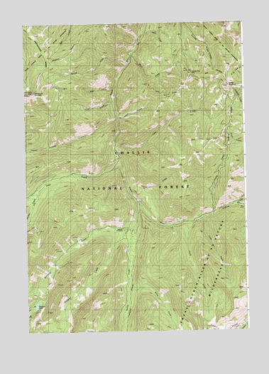
Greyhound Mountain, ID USGS Topographic Map
Click on map above to begin viewing in our Map Viewer.

This topographic map contains these locations and features:
Feature Name Type Latitude Longitude GNIS ID View Map
Aspen CreekStreamN44.6210°W115.0573°376751View Map
Baldwin CreekStreamN44.5413°W115.0676°376897View Map
Bernard CreekStreamN44.5502°W115.0087°377396View Map
Bruin CreekStreamN44.6132°W115.0645°378307View Map
Casto CreekStreamN44.5460°W115.0251°379023View Map
Drop CreekStreamN44.5560°W115.0651°380765View Map
Duffield CreekStreamN44.5474°W115.0190°380918View Map
Float CreekStreamN44.5707°W115.0723°381867View Map
Fontez CreekStreamN44.5471°W115.0193°381908View Map
Garnet CreekStreamN44.6077°W115.0673°382203View Map
Greyhound MountainSummitN44.5971°W115.1207°382673View Map
Harlan CreekStreamN44.5582°W115.1165°382912View Map
Lime CreekStreamN44.5749°W115.0757°384656View Map
Lunch CreekStreamN44.5866°W115.0726°386287View Map
Mountain King MineMineN44.6055°W115.0309°387291View Map
Opal CreekStreamN44.5932°W115.0754°387970View Map
Pearl CreekStreamN44.5980°W115.0745°388302View Map
Seafoam CreekStreamN44.5524°W115.0620°390065View Map
Seafoam Guard StationLocaleN44.5407°W115.0701°394573View Map
Seafoam LakeLakeN44.5108°W115.1200°390066View Map
Shady CreekStreamN44.5444°W115.0334°390128View Map
Sheep Mountain Recreation SiteLocaleN44.5944°W115.0051°394574View Map
Silver CreekStreamN44.5163°W115.0695°390431View Map
Sulphur CreekStreamN44.5857°W115.0734°391603View Map
Vanity CreekStreamN44.5416°W115.0648°392704View Map

Note: Coordinates in the location and feature list above are referenced to NAD83 datum.


Copyright (C) 2008-2025 Ryan Niemi / Sunset Dynamics ... All Rights Reserved