TopoQuest Logo
Do you find TopoQuest useful?
Help keep TopoQuest running and adding new maps/features by donating!
Bitcoin:  19c7KJd3qBynnjoSw5npx9KScwjBe4ifkT
Litecoin:  LXs6TkuXGGXo1vDsWCkWVdjQX94eUKd6ui
Home View Maps Find Maps Find Places Resources & Links


Grimes Point, Nevada Topographic Map

USGS Map Title: Grimes Point, NV
USGS Map MRC: 39118D6
DRG (GeoTIFF) Download: o39118d6.tif


Neighboring USGS Topographic Map Quads:


  Soda Lake East, NV  
39118E7
 

  Indian Lakes, NV  
39118E6
 

  Stillwater, NV  
39118E5
 

  Fallon, NV  
39118D7
 

  Grimes Point, NV  
39118D6
 

  Lahontan Mountains, NV  
39118D5
 

  South of Fallon, NV  
39118C7
 

  Carson Lake, NV  
39118C6
 

  Bunejug Mountains, NV  
39118C5


Map MRC Location:

N40°
W119°
N40°
W118°
H8 H7 H6 H5 H4 H3 H2 H1
G8 G7 G6 G5 G4 G3 G2 G1
F8 F7 F6 F5 F4 F3 F2 F1
E8 E7 E6 E5 E4 E3 E2 E1
D8 D7 D6 D5 D4 D3 D2 D1
C8 C7 C6 C5 C4 C3 C2 C1
B8 B7 B6 B5 B4 B3 B2 B1
A8 A7 A6 A5 A4 A3 A2 A1
N39°
W119°
N39°
W118°

Grimes Point, NV USGS 1:24K Topographic Map Preview:
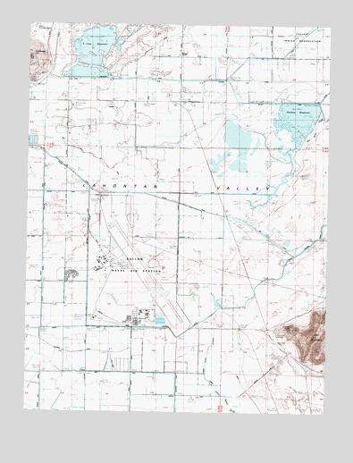
Grimes Point, NV USGS Topographic Map
Click on map above to begin viewing in our Map Viewer.

This topographic map contains these locations and features:
Feature Name Type Latitude Longitude GNIS ID View Map
Branch 5 DrainCanalN39.4994°W118.6596°850680View Map
Carson Lake DrainCanalN39.3871°W118.7468°839328View Map
D CanalCanalN39.4958°W118.7432°839906View Map
Eetz MountainSummitN39.3960°W118.6265°857979View Map
Fallon Naval Air Station (Van Voorhis Field)AirportN39.4198°W118.7061°2443866View Map
Fallon Radio Range StationLocaleN39.4327°W118.6571°840416View Map
Fallon Station Census Designated PlaceCensusN39.4159°W118.7167°2408115View Map
Grimes PointCliffN39.4019°W118.6390°848555View Map
Grimes SloughCanalN39.3833°W118.6715°850686View Map
Grimes Slough ExtensionCanalN39.3963°W118.6743°850687View Map
Harmon DrainCanalN39.4827°W118.6374°840902View Map
Harmon Number One DrainCanalN39.4896°W118.6804°858010View Map
Harmon ReservoirReservoirN39.4678°W118.6398°850679View Map
Harmon School (historical)SchoolN39.4905°W118.6882°858011View Map
Hill (historical)Populated PlaceN39.4021°W118.6629°858392View Map
Hill Post OfficePost OfficeN39.4021°W118.6629°864576View Map
L 12 CanalCanalN39.3902°W118.6615°854432View Map
L 3 DrainCanalN39.4449°W118.7443°850685View Map
L DrainCanalN39.3885°W118.7149°841530View Map
Lower Diagonal Number 1 DrainCanalN39.4313°W118.6851°845200View Map
Naval Air Station FallonMilitaryN39.3910°W118.7020°2710074View Map
Naval Air Station Fallon Fire Station 1BuildingN39.4032°W118.7244°2581251View Map
Naval Air Station Fallon Fire Station 2BuildingN39.4204°W118.7250°2581252View Map
Nevada City (historical)Populated PlaceN39.4374°W118.6713°848160View Map
Nevada Feed and CattleLocaleN39.3910°W118.7149°863206View Map
New River DrainCanalN39.4608°W118.7349°857665View Map
R Line CanalCanalN39.4902°W118.6449°850683View Map
Redmans (historical)LocaleN39.3913°W118.6601°856551View Map
S 7 CanalCanalN39.4913°W118.7021°850681View Map
S Line CanalCanalN39.4821°W118.7321°845243View Map
S Line DamDamN39.4833°W118.7177°863456View Map
S Line ReservoirReservoirN39.4842°W118.7265°858165View Map
S-One CanalCanalN39.4638°W118.7060°854606View Map
S-Two CanalCanalN39.4752°W118.6399°843416View Map
Salt Well Junction (historical)LocaleN39.3927°W118.6393°848012View Map
Wallace-Taylor RanchLocaleN39.3938°W118.7329°863205View Map

Note: Coordinates in the location and feature list above are referenced to NAD83 datum.


Copyright (C) 2008-2024 Ryan Niemi / Sunset Dynamics ... All Rights Reserved