TopoQuest Logo
Do you find TopoQuest useful?
Help keep TopoQuest running and adding new maps/features by donating!
Bitcoin:  19c7KJd3qBynnjoSw5npx9KScwjBe4ifkT
Litecoin:  LXs6TkuXGGXo1vDsWCkWVdjQX94eUKd6ui
Home View Maps Find Maps Find Places Resources & Links


Grouse Creek, Utah Topographic Map

USGS Map Title: Grouse Creek, UT
USGS Map MRC: 41113F8
DRG (GeoTIFF) Download: o41113f8.tif


Neighboring USGS Topographic Map Quads:


  Judd Mountain, UT  
41114G1
 

  Dry Canyon Mountain, UT  
41113G8
 

  Kimbell Creek, UT  
41113G7
 

  Death Creek Reservoir, UT  
41114F1
 

  Grouse Creek, UT  
41113F8
 

  Ingham Canyon, UT  
41113F7
 

  Dairy Valley, NV  
41114E1
 

  Toms Cabin Spring, UT  
41113E8
 

  Rocky Pass Peak, UT  
41113E7


Map MRC Location:

N42°
W114°
N42°
W113°
H8 H7 H6 H5 H4 H3 H2 H1
G8 G7 G6 G5 G4 G3 G2 G1
F8 F7 F6 F5 F4 F3 F2 F1
E8 E7 E6 E5 E4 E3 E2 E1
D8 D7 D6 D5 D4 D3 D2 D1
C8 C7 C6 C5 C4 C3 C2 C1
B8 B7 B6 B5 B4 B3 B2 B1
A8 A7 A6 A5 A4 A3 A2 A1
N41°
W114°
N41°
W113°

Grouse Creek, UT USGS 1:24K Topographic Map Preview:
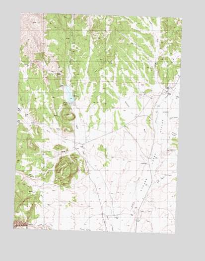
Grouse Creek, UT USGS Topographic Map
Click on map above to begin viewing in our Map Viewer.

This topographic map contains these locations and features:
Feature Name Type Latitude Longitude GNIS ID View Map
Bill Shaw CanyonValleyN41.6852°W113.8858°1425577View Map
Buckskin SpringSpringN41.7224°W113.9283°1426087View Map
Buckskin WashValleyN41.6694°W113.8978°1426088View Map
Camp CreekStreamN41.6863°W113.9983°1426306View Map
Cook CanyonValleyN41.7035°W113.8792°1437960View Map
Death CreekStreamN41.6646°W113.9686°839957View Map
Dry CanyonValleyN41.7049°W113.8903°1427521View Map
EtnaPopulated PlaceN41.6716°W113.9545°1437556View Map
Etna ReservoirReservoirN41.7033°W113.9610°1427847View Map
Etna SpringSpringN41.7149°W113.9715°1427848View Map
Grouse CreekPopulated PlaceN41.7094°W113.8833°1428419View Map
Grouse Creek AmbulanceBuildingN41.7059°W113.8902°2665417View Map
Grouse Creek CemeteryCemeteryN41.7163°W113.8768°1435630View Map
Grouse Creek Fire DepartmentBuildingN41.7060°W113.8907°2627245View Map
Grouse Creek Post OfficePost OfficeN41.7058°W113.8883°2769077View Map
Grouse Creek Secondary SchoolSchoolN41.7098°W113.8837°1435631View Map
Haystack HillSummitN41.6730°W113.8820°1428609View Map
Kimber RanchLocaleN41.7085°W113.9625°1435821View Map
Kimber Ranch BurialCemeteryN41.7330°W113.9447°1989824View Map
Mecham CreekStreamN41.6913°W113.9975°842046View Map
Morse CanyonValleyN41.7080°W113.9661°842260View Map
Paskett CanyonValleyN41.6902°W113.8856°1431125View Map
Red Butte CreekStreamN41.6502°W113.8986°1431616View Map
Straight Fork CreekStreamN41.7071°W113.9639°1433003View Map
The Church of Jesus Christ of Latter Day SaintsChurchN41.7102°W113.8836°1438053View Map
Warm CreekStreamN41.6713°W113.9500°1433952View Map
White Rock CreekStreamN41.6877°W113.9931°844793View Map

Note: Coordinates in the location and feature list above are referenced to NAD83 datum.


Copyright (C) 2008-2025 Ryan Niemi / Sunset Dynamics ... All Rights Reserved