TopoQuest Logo
Do you find TopoQuest useful?
Help keep TopoQuest running and adding new maps/features by donating!
Bitcoin:  19c7KJd3qBynnjoSw5npx9KScwjBe4ifkT
Litecoin:  LXs6TkuXGGXo1vDsWCkWVdjQX94eUKd6ui
Home View Maps Find Maps Find Places Resources & Links


Gunsight Draw SE, Texas Topographic Map

USGS Map Title: Gunsight Draw SE, TX
USGS Map MRC: 32101E3
DRG (GeoTIFF) Download: o32101e3.tif


Neighboring USGS Topographic Map Quads:


  Mushaway Peak, TX  
32101F4
 

  Gunsight Draw NE, TX  
32101F3
 

  Ira NW, TX  
32101F2
 

  Gunsight Draw, TX  
32101E4
 

  Gunsight Draw SE, TX  
32101E3
 

  Ira SW, TX  
32101E2
 

  Luther, TX  
32101D4
 

  Big Spring North NE, TX  
32101D3
 

  Vincent, TX  
32101D2


Map MRC Location:

N33°
W102°
N33°
W101°
H8 H7 H6 H5 H4 H3 H2 H1
G8 G7 G6 G5 G4 G3 G2 G1
F8 F7 F6 F5 F4 F3 F2 F1
E8 E7 E6 E5 E4 E3 E2 E1
D8 D7 D6 D5 D4 D3 D2 D1
C8 C7 C6 C5 C4 C3 C2 C1
B8 B7 B6 B5 B4 B3 B2 B1
A8 A7 A6 A5 A4 A3 A2 A1
N32°
W102°
N32°
W101°

Gunsight Draw SE, TX USGS 1:24K Topographic Map Preview:
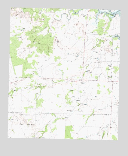
Gunsight Draw SE, TX USGS Topographic Map
Click on map above to begin viewing in our Map Viewer.

This topographic map contains these locations and features:
Feature Name Type Latitude Longitude GNIS ID View Map
Boedecker TankReservoirN32.5370°W101.2982°1330979View Map
Bull Pasture TankReservoirN32.5968°W101.3644°1331598View Map
Bush and Tiller TankReservoirN32.5270°W101.3027°1331732View Map
Cedar PointCliffN32.6140°W101.3385°1332470View Map
Creek TankReservoirN32.5335°W101.2872°1333647View Map
Double TanksReservoirN32.6037°W101.3600°1334545View Map
East Vealmoor Oil FieldOilfieldN32.5093°W101.3462°1335012View Map
Fairview CemeteryCemeteryN32.5582°W101.3604°1335629View Map
Flat TankReservoirN32.5806°W101.2977°1335925View Map
Hackberry DrawValleyN32.6149°W101.3252°1337193View Map
Hillside TankReservoirN32.5225°W101.3621°1337821View Map
Hobo Oil FieldOilfieldN32.5401°W101.2932°1337860View Map
Horseshoe TankReservoirN32.5468°W101.3061°1338137View Map
Hudson TankReservoirN32.5932°W101.3222°1338220View Map
Hullem CreekStreamN32.6209°W101.2612°1338276View Map
Little Red TankReservoirN32.5982°W101.3278°1340157View Map
Mother-in-Law TankReservoirN32.5839°W101.2755°1341994View Map
North Holley TankReservoirN32.5679°W101.2637°1342755View Map
Red BluffsCliffN32.6243°W101.3729°1375659View Map
Reineke Vincent Oil FieldOilfieldN32.5751°W101.2571°1345028View Map
Road TankReservoirN32.5540°W101.2905°1345289View Map
Round TankReservoirN32.5206°W101.3081°1345693View Map
Rutherford TankReservoirN32.5778°W101.2753°1345784View Map
Sand Rock TankReservoirN32.6187°W101.2904°1346537View Map
Sand TankReservoirN32.5914°W101.3433°1346545View Map
Simer LakeReservoirN32.6125°W101.3090°1865294View Map
Simer Lake DamDamN32.6134°W101.3087°1865293View Map
South Holley TankReservoirN32.5607°W101.2638°1347475View Map
South Pasture TanksReservoirN32.5179°W101.3711°1347507View Map
Whitaker Field TankReservoirN32.5271°W101.2962°1349923View Map
Wildcat TankReservoirN32.5655°W101.2872°1350074View Map
Wolf TankReservoirN32.5411°W101.2777°1350485View Map

Note: Coordinates in the location and feature list above are referenced to NAD83 datum.


Copyright (C) 2008-2025 Ryan Niemi / Sunset Dynamics ... All Rights Reserved