TopoQuest Logo
Do you find TopoQuest useful?
Help keep TopoQuest running and adding new maps/features by donating!
Bitcoin:  19c7KJd3qBynnjoSw5npx9KScwjBe4ifkT
Litecoin:  LXs6TkuXGGXo1vDsWCkWVdjQX94eUKd6ui
Home View Maps Find Maps Find Places Resources & Links


Guston, Kentucky Topographic Map

USGS Map Title: Guston, KY
USGS Map MRC: 37086H2
DRG (GeoTIFF) Download: o37086h2.tif


Neighboring USGS Topographic Map Quads:


  New Amsterdam, IN  
38086A3
 

  Mauckport, IN  
38086A2
 

  Laconia, IN  
38086A1
 

  Irvington, KY  
37086H3
 

  Guston, KY  
37086H2
 

  Rock Haven, KY  
37086H1
 

  Garfield, KY  
37086G3
 

  Big Spring, KY  
37086G2
 

  Flaherty, KY  
37086G1


Map MRC Location:

N38°
W87°
N38°
W86°
H8 H7 H6 H5 H4 H3 H2 H1
G8 G7 G6 G5 G4 G3 G2 G1
F8 F7 F6 F5 F4 F3 F2 F1
E8 E7 E6 E5 E4 E3 E2 E1
D8 D7 D6 D5 D4 D3 D2 D1
C8 C7 C6 C5 C4 C3 C2 C1
B8 B7 B6 B5 B4 B3 B2 B1
A8 A7 A6 A5 A4 A3 A2 A1
N37°
W87°
N37°
W86°

Guston, KY USGS 1:24K Topographic Map Preview:
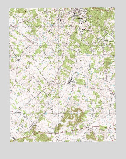
Guston, KY USGS Topographic Map
Click on map above to begin viewing in our Map Viewer.

This topographic map contains these locations and features:
Feature Name Type Latitude Longitude GNIS ID View Map
Bethel United Methodist ChurchChurchN37.9753°W86.1280°486986View Map
BrandenburgPopulated PlaceN37.9990°W86.1694°487822View Map
Brandenburg DivisionCivilN37.9535°W86.1713°1936886View Map
Brandenburg Police DepartmentBuildingN37.9987°W86.1739°2767725View Map
Brandenburg StationPopulated PlaceN37.9690°W86.1405°487823View Map
Buck GrovePopulated PlaceN37.9190°W86.1277°507604View Map
Canaanland ChurchChurchN37.9270°W86.1744°509542View Map
Cap Anderson CemeteryCemeteryN37.9956°W86.1789°509539View Map
City of BrandenburgCivilN37.9955°W86.1766°2403913View Map
City of EkronCivilN37.9302°W86.1764°2403546View Map
Doe Run Creek Historic District Historical MarkerParkN37.9492°W86.1382°2744607View Map
Eastwood HillsPopulated PlaceN37.9990°W86.1655°491526View Map
EkronPopulated PlaceN37.9292°W86.1794°491600View Map
Ekron Fire DepartmentBuildingN37.9296°W86.1759°2636764View Map
General ChurchChurchN37.9695°W86.2472°509543View Map
GustonPopulated PlaceN37.8928°W86.2219°493504View Map
Guston ChurchChurchN37.8828°W86.2011°509541View Map
Harold Pee Wee Reese Historical MarkerParkN37.9318°W86.1779°2744608View Map
HaysvillePopulated PlaceN37.9034°W86.2425°508210View Map
HillgrovePopulated PlaceN37.8792°W86.1639°508241View Map
Johnstown (historical)Populated PlaceN37.9340°W86.1273°2742588View Map
Meade CountyCivilN37.9698°W86.2172°516928View Map
Meade County Historical MarkerParkN37.9993°W86.1694°2744606View Map
Meade Olin ParkParkN37.9887°W86.1541°509540View Map
Meade Springs (historical)SpringN37.9434°W86.1660°2742589View Map
MidwayPopulated PlaceN37.9520°W86.2386°498163View Map
New Highland ChurchChurchN37.9827°W86.2462°499333View Map
Salem ChurchChurchN37.9305°W86.1976°502790View Map
Weldon ChurchChurchN37.9778°W86.1364°506365View Map
WMMG-AM (Brandenburg)TowerN37.9848°W86.1566°517777View Map
WMMG-FM (Brandenburg)TowerN37.9848°W86.1566°517925View Map

Note: Coordinates in the location and feature list above are referenced to NAD83 datum.


Copyright (C) 2008-2025 Ryan Niemi / Sunset Dynamics ... All Rights Reserved