TopoQuest Logo
Do you find TopoQuest useful?
Help keep TopoQuest running and adding new maps/features by donating!
Bitcoin:  19c7KJd3qBynnjoSw5npx9KScwjBe4ifkT
Litecoin:  LXs6TkuXGGXo1vDsWCkWVdjQX94eUKd6ui
Home View Maps Find Maps Find Places Resources & Links


Hachita Peak, New Mexico Topographic Map

USGS Map Title: Hachita Peak, NM
USGS Map MRC: 31108G4
DRG (GeoTIFF) Download: o31108g4.tif


Neighboring USGS Topographic Map Quads:


  Playas Lake North, NM  
31108H5
 

  Playas Peak, NM  
31108H4
 

  Hachita, NM  
31108H3
 

  Playas Lake South, NM  
31108G5
 

  Hachita Peak, NM  
31108G4
 

  Doyle Peak, NM  
31108G3
 

  Walnut Wells NE, NM  
31108F5
 

  Big Hatchet Peak, NM  
31108F4
 

  Hatchet Ranch, NM  
31108F3


Map MRC Location:

N32°
W109°
N32°
W108°
H8 H7 H6 H5 H4 H3 H2 H1
G8 G7 G6 G5 G4 G3 G2 G1
F8 F7 F6 F5 F4 F3 F2 F1
E8 E7 E6 E5 E4 E3 E2 E1
D8 D7 D6 D5 D4 D3 D2 D1
C8 C7 C6 C5 C4 C3 C2 C1
B8 B7 B6 B5 B4 B3 B2 B1
A8 A7 A6 A5 A4 A3 A2 A1
N31°
W109°
N31°
W108°

Hachita Peak, NM USGS 1:24K Topographic Map Preview:
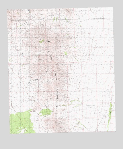
Hachita Peak, NM USGS Topographic Map
Click on map above to begin viewing in our Map Viewer.

This topographic map contains these locations and features:
Feature Name Type Latitude Longitude GNIS ID View Map
Broken Jug PassGapN31.8312°W108.4520°886754View Map
C Ranch Water WellWellN31.7776°W108.4567°921366View Map
ClemmieMineN31.8112°W108.4573°917155View Map
Copper Dick MineMineN31.8573°W108.4603°887827View Map
Corbett RanchLocaleN31.7765°W108.4575°887836View Map
Cottonwood SpringSpringN31.8340°W108.4895°887926View Map
Creeper TunnelsMineN31.8293°W108.4673°915528View Map
FaithMineN31.8418°W108.4339°915223View Map
Faria WorkingsMineN31.8557°W108.4792°915224View Map
George Winkler RanchLocaleN31.7812°W108.4300°898322View Map
Gold Hill MineMineN31.8220°W108.4531°939524View Map
Gold Hill Water WellWellN31.7765°W108.4895°921365View Map
Golden Eagle MineMineN31.8220°W108.4531°921048View Map
Granite PassGapN31.7773°W108.4445°889547View Map
Green MineMineN31.8245°W108.4575°915382View Map
Hachita PeakSummitN31.8418°W108.4525°897379View Map
Hall RanchLocaleN31.8312°W108.4809°889728View Map
Handcar VeinMineN31.8365°W108.4692°915016View Map
Howells WellsWellN31.8618°W108.4303°890229View Map
Jowell WorkingsMineN31.8426°W108.4978°915388View Map
King SolomonMineN31.8290°W108.4492°915391View Map
KinickerbockerMineN31.7834°W108.4506°915021View Map
Lalacha PeakSummitN31.8409°W108.4595°929291View Map
Little Hatchet MineMineN31.8501°W108.4756°915395View Map
Little Hatchet MountainsRangeN31.8470°W108.4570°920632View Map
Livermore SpringSpringN31.8576°W108.4789°891217View Map
RidgewoodMineN31.8195°W108.4514°915234View Map
Silver Trail TunnelMineN31.8507°W108.4809°917153View Map
Stone Cabin GulchValleyN31.8001°W108.4756°895365View Map
SylvaniteLocaleN31.8248°W108.4678°895472View Map
Sylvanite MineMineN31.8251°W108.4589°915502View Map
Sylvanite Post Office (historical)Post OfficeN31.8248°W108.4678°937276View Map
Twelvemile WellsWellN31.7662°W108.3845°895933View Map

Note: Coordinates in the location and feature list above are referenced to NAD83 datum.


Copyright (C) 2008-2025 Ryan Niemi / Sunset Dynamics ... All Rights Reserved