TopoQuest Logo
Do you find TopoQuest useful?
Help keep TopoQuest running and adding new maps/features by donating!
Bitcoin:  19c7KJd3qBynnjoSw5npx9KScwjBe4ifkT
Litecoin:  LXs6TkuXGGXo1vDsWCkWVdjQX94eUKd6ui
Home View Maps Find Maps Find Places Resources & Links


Hagerman, Idaho Topographic Map

USGS Map Title: Hagerman, ID
USGS Map MRC: 42114G8
DRG (GeoTIFF) Download: o42114g8.tif


Neighboring USGS Topographic Map Quads:


  Ticeska, ID  
42115H1
 

  Bliss, ID  
42114H8
 

  Gooding Butte, ID  
42114H7
 

  Indian Butte, ID  
42115G1
 

  Hagerman, ID  
42114G8
 

  Tuttle, ID  
42114G7
 

  Crows Nest NE, ID  
42115F1
 

  Yahoo Creek, ID  
42114F8
 

  Thousand Springs, ID  
42114F7


Map MRC Location:

N43°
W115°
N43°
W114°
H8 H7 H6 H5 H4 H3 H2 H1
G8 G7 G6 G5 G4 G3 G2 G1
F8 F7 F6 F5 F4 F3 F2 F1
E8 E7 E6 E5 E4 E3 E2 E1
D8 D7 D6 D5 D4 D3 D2 D1
C8 C7 C6 C5 C4 C3 C2 C1
B8 B7 B6 B5 B4 B3 B2 B1
A8 A7 A6 A5 A4 A3 A2 A1
N42°
W115°
N42°
W114°

Hagerman, ID USGS 1:24K Topographic Map Preview:
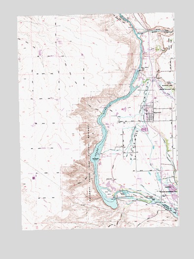
Hagerman, ID USGS Topographic Map
Click on map above to begin viewing in our Map Viewer.

This topographic map contains these locations and features:
Feature Name Type Latitude Longitude GNIS ID View Map
Bell DitchCanalN42.8093°W114.9051°371437View Map
Bell Rapids (historical)RapidsN42.7905°W114.9412°396100View Map
Bell Rapids Access AreaLocaleN42.7930°W114.9359°401220View Map
Big Bend DitchCanalN42.7849°W114.8881°371478View Map
Billingsley CreekStreamN42.8324°W114.9045°371544View Map
Billingsley Creek Wildlife Management AreaParkN42.8288°W114.8817°395712View Map
Birch CreekStreamN42.8513°W114.9017°395833View Map
Brailsford DitchCanalN42.7791°W114.8784°371682View Map
Buckeye DitchCanalN42.8043°W114.8981°371748View Map
Buckeye RanchLocaleN42.7782°W114.9276°371749View Map
City of HagermanCivilN42.8163°W114.8975°2410680View Map
Curren DitchCanalN42.7893°W114.8801°372292View Map
Devils Washbasin (historical)BasinN42.8630°W114.9026°399474View Map
Dolman IslandIslandN42.7682°W114.9073°372437View Map
Dolman RapidsRapidsN42.7706°W114.9173°372438View Map
Florence SpringSpringN42.8429°W114.8788°395740View Map
Fossil GulchValleyN42.8177°W114.9356°372761View Map
Fossil Gulch CanalCanalN42.8493°W114.9651°376405View Map
Gridley BridgeBridgeN42.7610°W114.8787°399502View Map
Gridley BridgeBridgeN42.7580°W114.8767°395746View Map
Gridley IslandIslandN42.7599°W114.8776°372928View Map
HagermanPopulated PlaceN42.8121°W114.8987°372957View Map
Hagerman City HallBuildingN42.8160°W114.8987°395747View Map
Hagerman City ParkParkN42.8191°W114.8973°395748View Map
Hagerman DivisionCivilN42.8108°W114.8833°1936725View Map
Hagerman Elementary SchoolSchoolN42.8187°W114.9007°401378View Map
Hagerman Fire Protection DistrictBuildingN42.8153°W114.8977°2619062View Map
Hagerman Fossil Beds National MonumentParkN42.7907°W114.9443°395749View Map
Hagerman Junior-Senior High SchoolSchoolN42.8180°W114.8989°401497View Map
Hagerman Post OfficePost OfficeN42.8196°W114.8988°2766818View Map
Hagerman SchoolSchoolN42.8180°W114.8996°395750View Map
Hagerman ValleyValleyN42.7916°W114.9092°395849View Map
Hagerman Wildlife Management AreaReserveN42.7727°W114.8809°401391View Map
Hagerman Wildlife Management AreaParkN42.7738°W114.8817°395751View Map
Hunt DitchCanalN42.7718°W114.9084°373180View Map
Justice GradeSlopeN42.8391°W114.8887°395765View Map
Lower Salmon FallsFallsN42.8430°W114.9042°399970View Map
Lower Salmon Falls DamDamN42.8416°W114.9076°398657View Map
Malad GorgeValleyN42.8641°W114.8917°395777View Map
Malad Gorge State ParkParkN42.8577°W114.8789°395778View Map
Malad RiverStreamN42.8624°W114.9051°376083View Map
Millet IslandIslandN42.7705°W114.9317°373957View Map
Owsley BridgeBridgeN42.7643°W114.8898°374288View Map
Owsley Bridge Access AreaLocaleN42.7568°W114.8795°401044View Map
Peters GulchValleyN42.7821°W114.9423°374374View Map
Pipeline DitchCanalN42.7721°W114.9012°395872View Map
Salmon FallsFallsN42.7666°W114.8973°399223View Map
Sands DitchCanalN42.8210°W114.9034°374900View Map
Upper Salmon FallsFallsN42.7666°W114.8973°400151View Map
Upper Salmon Falls DamDamN42.7649°W114.8959°398822View Map
Upper Salmon Falls ReservoirReservoirN42.7649°W114.8959°398823View Map
Yahoo CreekStreamN42.7668°W114.9139°376004View Map

Note: Coordinates in the location and feature list above are referenced to NAD83 datum.


Copyright (C) 2008-2024 Ryan Niemi / Sunset Dynamics ... All Rights Reserved