TopoQuest Logo
Do you find TopoQuest useful?
Help keep TopoQuest running and adding new maps/features by donating!
Bitcoin:  19c7KJd3qBynnjoSw5npx9KScwjBe4ifkT
Litecoin:  LXs6TkuXGGXo1vDsWCkWVdjQX94eUKd6ui
Home View Maps Find Maps Find Places Resources & Links


Hall Summit, Louisiana Topographic Map

USGS Map Title: Hall Summit, LA
USGS Map MRC: 32093B3
DRG (GeoTIFF) Download: o32093b3.tif


Neighboring USGS Topographic Map Quads:


  Bossier Point, LA  
32093C4
 

  Ringgold, LA  
32093C3
 

  Jamestown, LA  
32093C2
 

  East Point, LA  
32093B4
 

  Hall Summit, LA  
32093B3
 

  Roy, LA  
32093B2
 

  Harmon, LA  
32093A4
 

  Coushatta, LA  
32093A3
 

  Martin, LA  
32093A2


Map MRC Location:

N33°
W94°
N33°
W93°
H8 H7 H6 H5 H4 H3 H2 H1
G8 G7 G6 G5 G4 G3 G2 G1
F8 F7 F6 F5 F4 F3 F2 F1
E8 E7 E6 E5 E4 E3 E2 E1
D8 D7 D6 D5 D4 D3 D2 D1
C8 C7 C6 C5 C4 C3 C2 C1
B8 B7 B6 B5 B4 B3 B2 B1
A8 A7 A6 A5 A4 A3 A2 A1
N32°
W94°
N32°
W93°

Hall Summit, LA USGS 1:24K Topographic Map Preview:
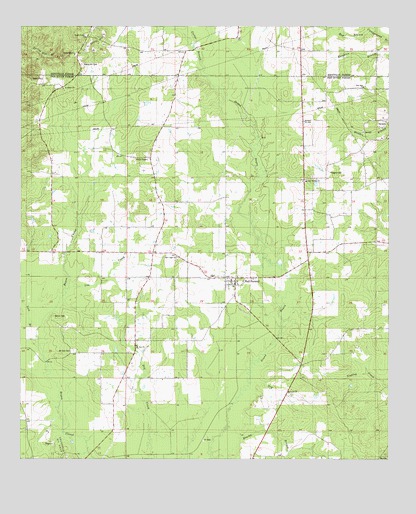
Hall Summit, LA USGS Topographic Map
Click on map above to begin viewing in our Map Viewer.

This topographic map contains these locations and features:
Feature Name Type Latitude Longitude GNIS ID View Map
Bracky BranchStreamN32.1274°W93.3107°533358View Map
Bracky Branch Oil and Gas FieldOilfieldN32.1335°W93.3241°548738View Map
Carter BranchStreamN32.2390°W93.3149°532055View Map
Dry BranchStreamN32.1471°W93.2971°534597View Map
Elizabeth Church (historical)ChurchN32.1263°W93.2874°541314View Map
Hall SummitPopulated PlaceN32.1774°W93.3024°535495View Map
Hall Summit Post OfficePost OfficeN32.1752°W93.3025°1630820View Map
Hall Summit School (historical)SchoolN32.1779°W93.3101°548747View Map
Hall Summit Volunteer Fire DepartmentBuildingN32.1668°W93.2964°2673040View Map
Huggins CemeteryCemeteryN32.2082°W93.2702°535850View Map
Lick BranchStreamN32.1590°W93.3699°536438View Map
Low CreekStreamN32.1729°W93.3596°536758View Map
Maddens Spur (historical)Populated PlaceN32.1990°W93.2938°548754View Map
Mount ZionPopulated PlaceN32.1593°W93.3363°548757View Map
Mount Zion CemeteryCemeteryN32.1565°W93.3571°537424View Map
Mount Zion ChurchChurchN32.1577°W93.3360°537444View Map
New Hope Church (historical)ChurchN32.1846°W93.3727°541313View Map
New Light ChurchChurchN32.1835°W93.3221°537601View Map
New Star ChurchChurchN32.2327°W93.2588°537633View Map
Parish Governing Authority District 3CivilN32.1772°W93.3109°1929968View Map
Red BranchStreamN32.2488°W93.2557°538519View Map
Saint Marks ChurchChurchN32.2321°W93.3610°538970View Map
Social Springs CemeteryCemeteryN32.2065°W93.2760°548765View Map
Social Springs ChurchChurchN32.2054°W93.2785°539466View Map
Spring Hill CemeteryCemeteryN32.2388°W93.3549°556118View Map
Spring Hill ChurchChurchN32.2418°W93.3571°539598View Map
Village of Hall SummitCivilN32.1768°W93.3055°2407472View Map
Ward ThreeCivilN32.1860°W93.2935°545181View Map
Watson CemeteryCemeteryN32.1663°W93.3641°540264View Map

Note: Coordinates in the location and feature list above are referenced to NAD83 datum.


Copyright (C) 2008-2025 Ryan Niemi / Sunset Dynamics ... All Rights Reserved