TopoQuest Logo
Do you find TopoQuest useful?
Help keep TopoQuest running and adding new maps/features by donating!
Bitcoin:  19c7KJd3qBynnjoSw5npx9KScwjBe4ifkT
Litecoin:  LXs6TkuXGGXo1vDsWCkWVdjQX94eUKd6ui
Home View Maps Find Maps Find Places Resources & Links


Hamby, Texas Topographic Map

USGS Map Title: Hamby, TX
USGS Map MRC: 32099E6
DRG (GeoTIFF) Download: o32099e6.tif


Neighboring USGS Topographic Map Quads:


  Hawley NE, TX  
32099F7
 

  Nugent, TX  
32099F6
 

  Smoky Draw, TX  
32099F5
 

  Hawley, TX  
32099E7
 

  Hamby, TX  
32099E6
 

  Flattop, TX  
32099E5
 

  Abilene West, TX  
32099D7
 

  Abilene East, TX  
32099D6
 

  Kirby Lake NE, TX  
32099D5


Map MRC Location:

N33°
W100°
N33°
W99°
H8 H7 H6 H5 H4 H3 H2 H1
G8 G7 G6 G5 G4 G3 G2 G1
F8 F7 F6 F5 F4 F3 F2 F1
E8 E7 E6 E5 E4 E3 E2 E1
D8 D7 D6 D5 D4 D3 D2 D1
C8 C7 C6 C5 C4 C3 C2 C1
B8 B7 B6 B5 B4 B3 B2 B1
A8 A7 A6 A5 A4 A3 A2 A1
N32°
W100°
N32°
W99°

Hamby, TX USGS 1:24K Topographic Map Preview:
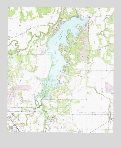
Hamby, TX USGS Topographic Map
Click on map above to begin viewing in our Map Viewer.

This topographic map contains these locations and features:
Feature Name Type Latitude Longitude GNIS ID View Map
Buck CreekStreamN32.5140°W99.7026°1372787View Map
Cedar CreekStreamN32.5287°W99.7101°1332413View Map
Clear Fork Brazos River Diversion DamDamN32.6111°W99.6921°1859141View Map
Clear Fork Diversion DamReservoirN32.6118°W99.6920°1859142View Map
Fort Phantom Hill DamDamN32.6168°W99.6687°1859145View Map
Fort Phantom Hill LakeReservoirN32.6168°W99.6687°1859146View Map
HambyPopulated PlaceN32.5187°W99.6312°1378405View Map
Hamby Baptist ChurchChurchN32.5185°W99.6334°2024739View Map
Hamby Elementary SchoolSchoolN32.5187°W99.6354°2003751View Map
Hamby Volunteer Fire DepartmentBuildingN32.5128°W99.6304°2551990View Map
KWVG-AM (Hamby)TowerN32.5151°W99.6381°1387851View Map
Lake Fort Phantom HillReservoirN32.5688°W99.6867°1336059View Map
LaniusLocaleN32.5187°W99.7445°1378559View Map
Mulberry CreekStreamN32.5829°W99.7362°1342242View Map
Rainy CreekStreamN32.5051°W99.7054°1375617View Map
Round Mound CemeteryCemeteryN32.5701°W99.6556°1345670View Map
Sayles LakeReservoirN32.5681°W99.7429°1859144View Map
Sayles Lake DamDamN32.5751°W99.7437°1859143View Map
Texas Department of Criminal Justice French Robertson UnitBuildingN32.5562°W99.6332°2738631View Map
Texas Department of Criminal Justice John Middleton Transfer FacilityBuildingN32.5563°W99.6256°2738627View Map
Texas State Veterans Cemetery at AbileneCemeteryN32.5510°W99.7169°2773412View Map
Town of ImpactCivilN32.5002°W99.7465°2412789View Map
Warren Dodson Abilene Police Training ComplexBuildingN32.5117°W99.6832°2750326View Map

Note: Coordinates in the location and feature list above are referenced to NAD83 datum.


Copyright (C) 2008-2024 Ryan Niemi / Sunset Dynamics ... All Rights Reserved