TopoQuest Logo
Do you find TopoQuest useful?
Help keep TopoQuest running and adding new maps/features by donating!
Bitcoin:  19c7KJd3qBynnjoSw5npx9KScwjBe4ifkT
Litecoin:  LXs6TkuXGGXo1vDsWCkWVdjQX94eUKd6ui
Home View Maps Find Maps Find Places Resources & Links


Hamilton West, Texas Topographic Map

USGS Map Title: Hamilton West, TX
USGS Map MRC: 31098F2
DRG (GeoTIFF) Download: o31098f2.tif


Neighboring USGS Topographic Map Quads:


  Lamkin, TX  
31098G3
 

  Gentrys Mill, TX  
31098G2
 

  Eidson Lake, TX  
31098G1
 

  Pottsville, TX  
31098F3
 

  Hamilton West, TX  
31098F2
 

  Hamilton East, TX  
31098F1
 

  Pecan Wells, TX  
31098E3
 

  Shive, TX  
31098E2
 

  Ohio, TX  
31098E1


Map MRC Location:

N32°
W99°
N32°
W98°
H8 H7 H6 H5 H4 H3 H2 H1
G8 G7 G6 G5 G4 G3 G2 G1
F8 F7 F6 F5 F4 F3 F2 F1
E8 E7 E6 E5 E4 E3 E2 E1
D8 D7 D6 D5 D4 D3 D2 D1
C8 C7 C6 C5 C4 C3 C2 C1
B8 B7 B6 B5 B4 B3 B2 B1
A8 A7 A6 A5 A4 A3 A2 A1
N31°
W99°
N31°
W98°

Hamilton West, TX USGS 1:24K Topographic Map Preview:
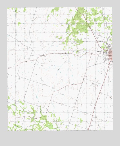
Hamilton West, TX USGS Topographic Map
Click on map above to begin viewing in our Map Viewer.

This topographic map contains these locations and features:
Feature Name Type Latitude Longitude GNIS ID View Map
Center Valley CemeteryCemeteryN31.7018°W98.2217°1332554View Map
Gholson CreekStreamN31.6338°W98.2128°1373832View Map
Hamilton City ParkParkN31.7168°W98.1309°2029178View Map
Hamilton County JailBuildingN31.6920°W98.1288°2738727View Map
Hamilton County Sheriff's OfficeBuildingN31.6920°W98.1287°2750360View Map
Hamilton DivisionCivilN31.6451°W98.1434°1938819View Map
Hamilton Elementary and Junior High SchoolSchoolN31.7013°W98.1267°2005432View Map
Hamilton High SchoolSchoolN31.7013°W98.1267°2005433View Map
Hamilton Municipal AirportAirportN31.6702°W98.1442°1386783View Map
Joseph LakeReservoirN31.7177°W98.1835°1863898View Map
Joseph Lake DamDamN31.7185°W98.1820°1863897View Map
KCLW-FM (Hamilton)TowerN31.7188°W98.1445°1385870View Map
KOES-AM (Hamilton) (historical)TowerN31.7190°W98.1445°1385577View Map
Lund Valley ChurchChurchN31.7007°W98.2075°1340740View Map
MidwayPopulated PlaceN31.7015°W98.2056°1378672View Map
Perry Country Club Golf CourseLocaleN31.7046°W98.1661°1384451View Map
Soil Conservation Service Site 2 DamDamN31.6852°W98.1320°1863012View Map
Soil Conservation Service Site 2 ReservoirReservoirN31.6855°W98.1347°1863013View Map
Soil Conservation Service Site 3 DamDamN31.6935°W98.1286°1863463View Map
Soil Conservation Service Site 3 ReservoirReservoirN31.6941°W98.1304°1863464View Map
Soil Conservation Service Site 4 DamDamN31.7002°W98.1320°1863821View Map
Soil Conservation Service Site 4 ReservoirReservoirN31.6996°W98.1333°1863822View Map
Soil Conservation Service Site 5 DamDamN31.7068°W98.1320°1863465View Map
Soil Conservation Service Site 5 ReservoirReservoirN31.7068°W98.1320°1863466View Map
Spring Branch Hiller SloughStreamN31.6271°W98.1970°1347695View Map

Note: Coordinates in the location and feature list above are referenced to NAD83 datum.


Copyright (C) 2008-2025 Ryan Niemi / Sunset Dynamics ... All Rights Reserved