TopoQuest Logo
Do you find TopoQuest useful?
Help keep TopoQuest running and adding new maps/features by donating!
Bitcoin:  19c7KJd3qBynnjoSw5npx9KScwjBe4ifkT
Litecoin:  LXs6TkuXGGXo1vDsWCkWVdjQX94eUKd6ui
Home View Maps Find Maps Find Places Resources & Links


Hammil Valley, California Topographic Map

USGS Map Title: Hammil Valley, CA
USGS Map MRC: 37118F4
DRG (GeoTIFF) Download: o37118f4.tif


Neighboring USGS Topographic Map Quads:


  Benton Hot Springs, CA  
37118G5
 

  Benton, CA  
37118G4
 

  Boundary Peak, NV  
37118G3
 

  Banner Ridge, CA  
37118F5
 

  Hammil Valley, CA  
37118F4
 

  White Mountain Peak, CA  
37118F3
 

  Casa Diablo Mountain, CA  
37118E5
 

  Chidago Canyon, CA  
37118E4
 

  Chalfant Valley, CA  
37118E3


Map MRC Location:

N38°
W119°
N38°
W118°
H8 H7 H6 H5 H4 H3 H2 H1
G8 G7 G6 G5 G4 G3 G2 G1
F8 F7 F6 F5 F4 F3 F2 F1
E8 E7 E6 E5 E4 E3 E2 E1
D8 D7 D6 D5 D4 D3 D2 D1
C8 C7 C6 C5 C4 C3 C2 C1
B8 B7 B6 B5 B4 B3 B2 B1
A8 A7 A6 A5 A4 A3 A2 A1
N37°
W119°
N37°
W118°

Hammil Valley, CA USGS 1:24K Topographic Map Preview:
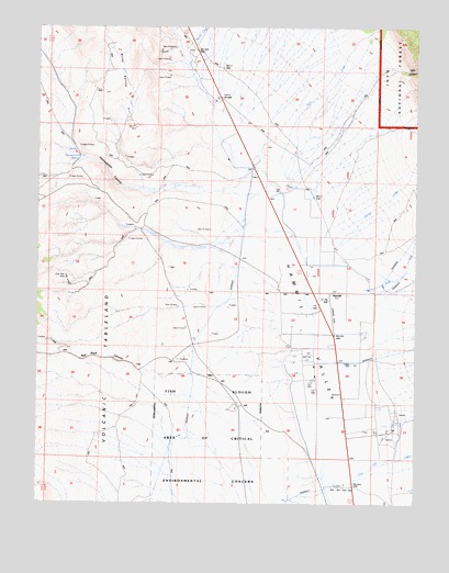
Hammil Valley, CA USGS Topographic Map
Click on map above to begin viewing in our Map Viewer.

This topographic map contains these locations and features:
Feature Name Type Latitude Longitude GNIS ID View Map
Blind Spring HillRidgeN37.7347°W118.4782°257203View Map
Cashbaugh RanchLocaleN37.6433°W118.3887°258044View Map
Cottonwood RanchLocaleN37.6435°W118.3887°275593View Map
Falls CanyonValleyN37.7383°W118.3812°260040View Map
HammilPopulated PlaceN37.6785°W118.4037°261054View Map
Harris Brothers RanchLocaleN37.6810°W118.3907°261106View Map
Lone Tree CreekStreamN37.6330°W118.3934°262814View Map
Marble CreekStreamN37.7438°W118.4523°272344View Map
Pellisier CreekStreamN37.6877°W118.4121°264630View Map
Queen Dicks CanyonValleyN37.7252°W118.4343°265107View Map
Red Canyon PetroglphsLocaleN37.6499°W118.4362°265256View Map
Red Rock CanyonValleyN37.6708°W118.4212°267171View Map
Rock CreekStreamN37.7038°W118.4165°231709View Map
Silver Reef MineMineN37.6835°W118.4918°266203View Map
Symons RanchLocaleN37.6619°W118.3993°268042View Map
Yellowjacket CanyonValleyN37.7074°W118.4637°269355View Map
Yellowjacket SpringSpringN37.7158°W118.4877°269360View Map
Zacks RanchLocaleN37.6616°W118.3976°275592View Map

Note: Coordinates in the location and feature list above are referenced to NAD83 datum.


Copyright (C) 2008-2025 Ryan Niemi / Sunset Dynamics ... All Rights Reserved